Directions to Fairhaven Convenience Store (Boston) with public transportation
The following transit lines have routes that pass near Fairhaven Convenience Store
 Bus: 211.
How to get to Fairhaven Convenience Store by bus?
Click on the bus route to see step by step directions with maps, line arrival times and updated time schedules.
From Charlton Memorial Hospital, Fall River
138 minFrom Lizzy Borden House, Fall River
107 minFrom Bristol Community College, Fall River
120 minFrom Amazon Fulfillment Bos7, Fall River
150 minFrom B.M.C. Durfee High School, Fall River
118 minFrom RMV New Bedford, New Bedford
131 minFrom Walmart Fall River Supercenter, Fall River
133 minFrom Bedford Industrial Park, New Bedford
133 minFrom Mass Maritime Academy, Buzzards Bay
133 minFrom Falmouth MA USA, Falmouth
136 min
Bus stop near Fairhaven Convenience Store in Boston
- Nb11 End Of Line Stop, 4 min walk,VIEW
Bus lines to Fairhaven Convenience Store in Boston
- 211, Fairhaven,VIEW
What are the closest stations to Fairhaven Convenience Store?
The closest stations to Fairhaven Convenience Store are:
- Nb11 End Of Line Stop is 303 yards away, 4 min walk.
Which bus line stops near Fairhaven Convenience Store?
211 (Fairhaven)
What’s the nearest bus station to Fairhaven Convenience Store in Boston?
The nearest bus station to Fairhaven Convenience Store in Boston is Nb11 End Of Line Stop. It’s a 4 min walk away.
What time is the first bus to Fairhaven Convenience Store in Boston?
The 211 is the first bus that goes to Fairhaven Convenience Store in Boston. It stops nearby at 6:38 AM.
What time is the last bus to Fairhaven Convenience Store in Boston?
The 211 is the last bus that goes to Fairhaven Convenience Store in Boston. It stops nearby at 6:15 PM.
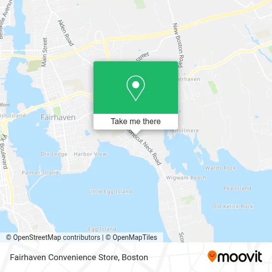
See Fairhaven Convenience Store, Boston, on the map
Public Transit to Fairhaven Convenience Store in Boston
Wondering how to get to Fairhaven Convenience Store in Boston? Moovit helps you find the best way to get to Fairhaven Convenience Store with step-by-step directions from the nearest public transit station.
Moovit provides free maps and live directions to help you navigate through your city. View schedules, routes, timetables, and find out how long does it take to get to Fairhaven Convenience Store in real time.
Looking for the nearest stop or station to Fairhaven Convenience Store? Check out this list of stops closest to your destination: Nb11 End Of Line Stop.
Bus: 211.
Want to see if there’s another route that gets you there at an earlier time? Moovit helps you find alternative routes or times. Get directions from and directions to Fairhaven Convenience Store easily from the Moovit App or Website.
We make riding to Fairhaven Convenience Store easy, which is why over 1.7 million users, including users in Boston, trust Moovit as the best app for public transit. You don’t need to download an individual bus app or train app, Moovit is your all-in-one transit app that helps you find the best bus time or train time available.
For information on prices of bus, costs and ride fares to Fairhaven Convenience Store, please check the Moovit app.
Use the app to navigate to popular places including to the airport, hospital, stadium, grocery store, mall, coffee shop, school, college, and university.
Fairhaven Convenience Store Address: 121 Sconticut Neck Rd street in Boston
- Bradford and Company Construction,
- Active Day of Fairhaven,
- Coinstar,
- Fairhaven Plaza,
- Coinstar - Bitcoin ATM,
- Town of Fairhaven,
- Dom Corey Upholstery & Antique Auto Restoration,
- Behavioral Connections,
- Gallagher Promotional Advertising,
- CB Foods,
- Shred Nations,
- Meilert Financial Services,
- Gallagher Promotional Advg,
- Care Free Homes,
- CFH Builders,
- Flour Girls Baking,
- FedEx,
- BMO Harris Bank,
- WESTERN UNION,
- TD Bank
Places Near Fairhaven Convenience Store (Boston)
- Prudential Center, Boston,
- Wilbur Theatre, Boston,
- Mgm Music Hall, Boston,
- North End, Boston,
- Td Garden, Boston,
- Boston Children's Hospital, Boston,
- Seaport District, Boston,
- Cheers, Boston,
- Castle Island, Boston,
- Boston Convention & Exhibition Center, Boston,
- Massachusetts General Hospital, Boston,
- House Of Blues, Boston,
- Isabella Stewart Gardner Museum, Boston,
- Boston Common, Boston,
- Wang Theater, Boston,
- Boston Medical Center, Boston,
- Leader Bank Pavilion (Leader Bank Pavillion), Boston,
- Faneuil Hall, Boston,
- Museum Of Science, Boston,
- Quincy Market, Boston
How to get to popular places in Boston with public transit
Get around Boston by public transit!
Traveling around Boston has never been so easy. See step by step directions as you travel to any attraction, street or major public transit station. View bus and train schedules, arrival times, service alerts and detailed routes on a map, so you know exactly how to get to anywhere in Boston.
When traveling to any destination around Boston use Moovit's Live Directions with Get Off Notifications to know exactly where and how far to walk, how long to wait for your line, and how many stops are left. Moovit will alert you when it's time to get off — no need to constantly re-check whether yours is the next stop.
Wondering how to use public transit in Boston or how to pay for public transit in Boston? Moovit public transit app can help you navigate your way with public transit easily, and at minimum cost. It includes public transit fees, ticket prices, and costs. Looking for a map of Boston public transit lines? Moovit public transit app shows all public transit maps in Boston with all Bus, Train, Subway and Ferry routes and stops on an interactive map.
Boston has 4 transit type(s), including: Bus, Train, Subway and Ferry, operated by several transit agencies, including MBTA, Southeastern Regional Transit Authority, MetroWest Regional Transit Authority, Rhode Island Public Transit Authority, WRTA, Lowell Regional Transit Authority, Merrimack Valley Transit, Montachusett Regional Transit Authority, Cape Cod Regional Transit Authority, Brockton Area Transit Authority, Martha's Vineyard Transit Authority, the WAVE - Nantucket Regional Transit Authority, GATRA, Cape Ann Transportation Authority and Massport