See Falkoner Alle 7, Frederiksberg, on the map
Directions to Falkoner Alle 7 (Frederiksberg) with public transportation
The following transit lines have routes that pass near Falkoner Alle 7
 Bus:
Bus: - Train:
- Metro:
How to get to Falkoner Alle 7 by bus?
Click on the bus route to see step by step directions with maps, line arrival times and updated time schedules.
How to get to Falkoner Alle 7 by train?
Click on the train route to see step by step directions with maps, line arrival times and updated time schedules.
How to get to Falkoner Alle 7 by metro?
Click on the metro route to see step by step directions with maps, line arrival times and updated time schedules.
Bus stations near Falkoner Alle 7 in Frederiksberg
- Fasanvej St. (Metro),13 min walk,
Bus lines to Falkoner Alle 7 in Frederiksberg
- M1,Vestamager St. (Metro),
- M2,Vanløse St. (Metro),
What are the closest stations to Falkoner Alle 7?
The closest stations to Falkoner Alle 7 are:
- Fasanvej St. (Metro) is 915 meters away, 13 min walk.
Which bus lines stop near Falkoner Alle 7?
These bus lines stop near Falkoner Alle 7: 8A, 9A.
Which train lines stop near Falkoner Alle 7?
These train lines stop near Falkoner Alle 7: A, B, C, F.
Which metro line stops near Falkoner Alle 7?
M1
What’s the nearest bus stop to Falkoner Alle 7 in Frederiksberg?
The nearest bus stop to Falkoner Alle 7 in Frederiksberg is Fasanvej St. (Metro). It’s a 13 min walk away.
See Falkoner Alle 7, Frederiksberg, on the map
Public Transit to Falkoner Alle 7 in Frederiksberg
Wondering how to get to Falkoner Alle 7 in Frederiksberg, Denmark? Moovit helps you find the best way to get to Falkoner Alle 7 with step-by-step directions from the nearest public transit station.
Moovit provides free maps and live directions to help you navigate through your city. View schedules, routes, timetables, and find out how long does it take to get to Falkoner Alle 7 in real time.
Looking for the nearest stop or station to Falkoner Alle 7? Check out this list of stops closest to your destination: Fasanvej St. (Metro).
Bus:Train:Metro:
Want to see if there’s another route that gets you there at an earlier time? Moovit helps you find alternative routes or times. Get directions from and directions to Falkoner Alle 7 easily from the Moovit App or Website.
We make riding to Falkoner Alle 7 easy, which is why over 1.5 million users, including users in Frederiksberg, trust Moovit as the best app for public transit. You don’t need to download an individual bus app or train app, Moovit is your all-in-one transit app that helps you find the best bus time or train time available.
For information on prices of bus, train and metro, costs and ride fares to Falkoner Alle 7, please check the Moovit app.
Use the app to navigate to popular places including to the airport, hospital, stadium, grocery store, mall, coffee shop, school, college, and university.
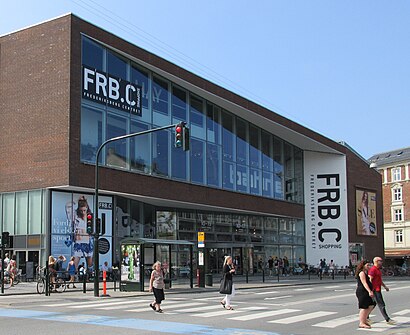
Falkoner Alle 7 Address: Falkoner Alle 7, 2000 Frederiksberg, Danmark street in Frederiksberg
Attractions near Falkoner Alle 7
Forex,Falkoner Scenen,italiano a2 trin 3,Tandlægerne Falkonercentret,Falconer Salen,Radisson Falconer,San Marco,Forex - Falkoner Alle,Vesterkopi,Frederiksberg Kontorforsyning,Howitzvej 6,Adecco,Hay,Netto,rialto advokaterne,Aldi,Louis Nielsen,CBS, Grundtvigsvej 37,CBS IT,8 km. Piskeben How to get to popular attractions in Frederiksberg with public transit
Scandic Hotel Aarhus, Århus,Ingerslev Marked, Århus,Roskilde Dyrskueplads, Roskilde,Greve Station, Greve,Ceres Arena, Århus,Jersie st., Solrød,Rasteplads Lillebælt, Middelfart,Munkebjerg Hotel & Casino, Vejle,Middelfart, Middelfart,Åmarken Station, Hvidovre,Hvidovre Hospital Busstop, Hvidovre,Regionaltog (Østerport st - Ringsted st), Roskilde,Struer, Struer,Bus 400 / 400S (Hundige St. - Lyngby St.), Ishøj,Høje Taastrup Station, Busholdepladsen, Høje Taastrup,Aalborg Vestby Station, Aalborg,Silvan Skejby, Århus,Bus 10 (Rådhuspladsen - Brønshøj Torv), Frederiksberg,Meny, Aalborg,Sæby, FrederikshavnGet around Frederiksberg by public transit!
Traveling around Frederiksberg has never been so easy. See step by step directions as you travel to any attraction, street or major public transit station. View bus and train schedules, arrival times, service alerts and detailed routes on a map, so you know exactly how to get to anywhere in Frederiksberg.
When traveling to any destination around Frederiksberg use Moovit's Live Directions with Get Off Notifications to know exactly where and how far to walk, how long to wait for your line, and how many stops are left. Moovit will alert you when it's time to get off — no need to constantly re-check whether yours is the next stop.
Wondering how to use public transit in Frederiksberg or how to pay for public transit in Frederiksberg? Moovit public transit app can help you navigate your way with public transit easily, and at minimum cost. It includes public transit fees, ticket prices, and costs. Looking for a map of Frederiksberg public transit lines? Moovit public transit app shows all public transit maps in Frederiksberg with all bus, train or metro routes and stops on an interactive map.
Frederiksberg has 3 transit type(s), including: bus, train or metro, operated by several transit agencies, including Metroselskabet, DSB S-tog, Lokaltog A/S, DSB S-tog, Midttrafik, Odense Letbane, DSB, NT, GoCollective, Midttrafik, Skånetrafiken, Metroselskabet, Movia, NT and Midttrafik