How to get to Fall River Stay by bus?
Click on the bus route to see step by step directions with maps, line arrival times and updated time schedules.
How to get to Fall River Stay by train?
Click on the train route to see step by step directions with maps, line arrival times and updated time schedules.
Bus stops near Fall River Stay
Train station near Fall River Stay
- Fall River Depot, 57 min walk,VIEW
What are the closest stations to Fall River Stay?
The closest stations to Fall River Stay are:
- S Main St And Bradford Ave is 377 yards away, 5 min walk.
- S Main St And Cottage St is 401 yards away, 5 min walk.
- Rodman St And S Main St is 454 yards away, 6 min walk.
- Fall River Depot is 4870 yards away, 57 min walk.
Which bus lines stop near Fall River Stay?
These bus lines stop near Fall River Stay: 102, 24L, 9, PETER PAN.
Which train line stops near Fall River Stay?
FALL RIVER/NEW BEDFORD (#1909 | Fall River)
What’s the nearest bus station to Fall River Stay?
The nearest bus stations to Fall River Stay are S Main St And Bradford Ave and S Main St And Cottage St. The closest one is a 5 min walk away.
What time is the first train to Fall River Stay?
The FALL RIVER/NEW BEDFORD is the first train that goes to Fall River Stay. It stops nearby at 5:00 AM.
What time is the last train to Fall River Stay?
The FALL RIVER/NEW BEDFORD is the last train that goes to Fall River Stay. It stops nearby at 12:14 AM.
What time is the first bus to Fall River Stay?
The 101 is the first bus that goes to Fall River Stay. It stops nearby at 6:10 AM.
What time is the last bus to Fall River Stay?
The 101 is the last bus that goes to Fall River Stay. It stops nearby at 8:43 PM.
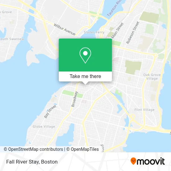
See Fall River Stay on the map
Public Transportation to Fall River Stay
Wondering how to get to Fall River Stay? Moovit helps you find the best way to get to Fall River Stay with step-by-step directions from the nearest public transit station.
Moovit provides free maps and live directions to help you navigate through your city. View schedules, routes, timetables, and find out how long does it take to get to Fall River Stay in real time.
Looking for the nearest stop or station to Fall River Stay? Check out this list of stops closest to your destination: S Main St And Bradford Ave; S Main St And Cottage St; Rodman St And S Main St; Fall River Depot.
Bus: 102, 24L, 9, PETER PAN, 101, 103, 107.Train: FALL RIVER/NEW BEDFORD.
Want to see if there’s another route that gets you there at an earlier time? Moovit helps you find alternative routes or times. Get directions from and directions to Fall River Stay easily from the Moovit App or Website.
We make riding to Fall River Stay easy, which is why over 1.7 million users, including users in Fall River, trust Moovit as the best app for public transit. You don’t need to download an individual bus app or train app, Moovit is your all-in-one transit app that helps you find the best bus time or train time available.
For information on prices of bus and train, costs and ride fares to Fall River Stay, please check the Moovit app.
Use the app to navigate to popular places including to the airport, hospital, stadium, grocery store, mall, coffee shop, school, college, and university.
Fall River Stay Address: 243 Columbia St street in Fall River
- Libertyx Bitcoin ATM,
- 253 Columbia Fashion,
- Changed Locks Plus Locks Locksmith,
- Our Lady of the Immaculate Conception,
- Cceenails,
- Swedish Massage Swedish Massage,
- Autocare Brake Services Auto Repair,
- Manny Sousa Construction,
- Black Label Guns,
- YMCA,
- Joseph Vasconcellos, Realtor,
- Centro de Ajuda Fall River,
- Gana, Sheldon J,
- Smokevapeconvenience,
- Prosper at Fall River,
- Gems Artistry,
- Nails & Beauty,
- Elite Constable Services,
- Total by Verizon,
- Psychic Boutique
Places Near Fall River Stay
- Boston Children's Hospital, Boston,
- Boston Common, Boston,
- Td Garden, Boston,
- Castle Island, Boston,
- Museum Of Science, Boston,
- North End, Boston,
- Leader Bank Pavilion (Leader Bank Pavillion), Boston,
- Boston Medical Center, Boston,
- Wilbur Theatre, Boston,
- Prudential Center, Boston,
- Wang Theater, Boston,
- Boston Convention & Exhibition Center, Boston,
- Massachusetts General Hospital, Boston,
- House Of Blues, Boston,
- Seaport District, Boston,
- Faneuil Hall, Boston,
- Quincy Market, Boston,
- Cheers, Boston,
- Isabella Stewart Gardner Museum, Boston,
- Mgm Music Hall, Boston
How to get to popular places in Boston with public transit
Get around Fall River by public transit!
Traveling around Fall River has never been so easy. See step by step directions as you travel to any attraction, street or major public transit station. View bus and train schedules, arrival times, service alerts and detailed routes on a map, so you know exactly how to get to anywhere in Fall River.
When traveling to any destination around Fall River use Moovit's Live Directions with Get Off Notifications to know exactly where and how far to walk, how long to wait for your line, and how many stops are left. Moovit will alert you when it's time to get off — no need to constantly re-check whether yours is the next stop.
Wondering how to use public transit in Fall River or how to pay for public transit in Fall River? Moovit public transit app can help you navigate your way with public transit easily, and at minimum cost. It includes public transit fees, ticket prices, and costs. Looking for a map of Fall River public transit lines? Moovit public transit app shows all public transit maps in Fall River with all Bus, Train, Subway and Ferry routes and stops on an interactive map.
Boston has 4 transit type(s), including: Bus, Train, Subway and Ferry, operated by several transit agencies, including MBTA, Southeastern Regional Transit Authority, MetroWest Regional Transit Authority, Rhode Island Public Transit Authority, WRTA, Lowell Regional Transit Authority, Merrimack Valley Transit, Montachusett Regional Transit Authority, Cape Cod Regional Transit Authority, Brockton Area Transit Authority, Martha's Vineyard Transit Authority, the WAVE - Nantucket Regional Transit Authority, GATRA, Cape Ann Transportation Authority and Massport