Directions to Fall River Waterfront Cultural District with public transportation
The following transit lines have routes that pass near Fall River Waterfront Cultural District
 Bus: 102, 108, 9, PETER PAN.
- Train: FALL RIVER/NEW BEDFORD.
How to get to Fall River Waterfront Cultural District by bus?
Click on the bus route to see step by step directions with maps, line arrival times and updated time schedules.
How to get to Fall River Waterfront Cultural District by train?
Click on the train route to see step by step directions with maps, line arrival times and updated time schedules.
Bus stops near Fall River Waterfront Cultural District
Train station near Fall River Waterfront Cultural District
- Fall River Depot, 43 min walk,VIEW
Bus lines to Fall River Waterfront Cultural District
What are the closest stations to Fall River Waterfront Cultural District?
The closest stations to Fall River Waterfront Cultural District are:
- High St And Locust St is 105 yards away, 2 min walk.
- N Main St And Locust St is 270 yards away, 4 min walk.
- Fall River Depot is 3631 yards away, 43 min walk.
Which bus lines stop near Fall River Waterfront Cultural District?
These bus lines stop near Fall River Waterfront Cultural District: 102, 108, 9, PETER PAN.
Which train line stops near Fall River Waterfront Cultural District?
FALL RIVER/NEW BEDFORD (#1909 | Fall River)
What’s the nearest bus station to Fall River Waterfront Cultural District?
The nearest bus station to Fall River Waterfront Cultural District is High St And Locust St. It’s a 2 min walk away.
What time is the first train to Fall River Waterfront Cultural District?
The FALL RIVER/NEW BEDFORD is the first train that goes to Fall River Waterfront Cultural District. It stops nearby at 5:00 AM.
What time is the last train to Fall River Waterfront Cultural District?
The FALL RIVER/NEW BEDFORD is the last train that goes to Fall River Waterfront Cultural District. It stops nearby at 12:14 AM.
What time is the first bus to Fall River Waterfront Cultural District?
The 102 is the first bus that goes to Fall River Waterfront Cultural District. It stops nearby at 6:02 AM.
What time is the last bus to Fall River Waterfront Cultural District?
The 102 is the last bus that goes to Fall River Waterfront Cultural District. It stops nearby at 8:33 PM.
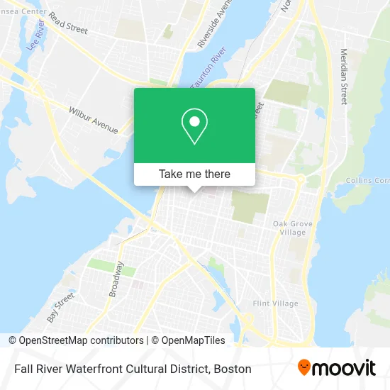
See Fall River Waterfront Cultural District on the map
Public Transportation to Fall River Waterfront Cultural District
Wondering how to get to Fall River Waterfront Cultural District? Moovit helps you find the best way to get to Fall River Waterfront Cultural District with step-by-step directions from the nearest public transit station.
Moovit provides free maps and live directions to help you navigate through your city. View schedules, routes, timetables, and find out how long does it take to get to Fall River Waterfront Cultural District in real time.
Looking for the nearest stop or station to Fall River Waterfront Cultural District? Check out this list of stops closest to your destination: High St And Locust St; N Main St And Locust St; Fall River Depot.
Bus: 102, 108, 9, PETER PAN.Train: FALL RIVER/NEW BEDFORD.
Want to see if there’s another route that gets you there at an earlier time? Moovit helps you find alternative routes or times. Get directions from and directions to Fall River Waterfront Cultural District easily from the Moovit App or Website.
We make riding to Fall River Waterfront Cultural District easy, which is why over 1.7 million users, including users in Fall River, trust Moovit as the best app for public transit. You don’t need to download an individual bus app or train app, Moovit is your all-in-one transit app that helps you find the best bus time or train time available.
For information on prices of bus and train, costs and ride fares to Fall River Waterfront Cultural District, please check the Moovit app.
Use the app to navigate to popular places including to the airport, hospital, stadium, grocery store, mall, coffee shop, school, college, and university.
Fall River Waterfront Cultural District Address: 132 Highland Ave street in Fall River
- Fall River Democrats,
- Philomena A Barboza at,
- Gilbane Building Company,
- Fall River Historical Societyeaston Tea Room,
- Lajoie Richard D, DDS,
- Carousel of Fall River,
- River To Recovery Center,
- Access Podiatry,
- People, Incorporated Preschool,
- Soul Sista S Reiki,
- Sonia M Seng,
- Southcoast Centers For Cancer Care,
- Bousquet Arthur R,
- John Mendes Constable Service and Remolding We do It All,
- Amaral,
- Dr John C Corrigan Mental Health Center,
- Maplehill Mobile Home Park,
- Southcoast Laboratory Services - Charlton Memorial Hospital,
- Dr John C. Quatromoni, MD,
- Webster Bank
Places Near Fall River Waterfront Cultural District
- Wilbur Theatre, Boston,
- Cheers, Boston,
- Isabella Stewart Gardner Museum, Boston,
- Seaport District, Boston,
- Mgm Music Hall, Boston,
- Quincy Market, Boston,
- Wang Theater, Boston,
- Leader Bank Pavilion (Leader Bank Pavillion), Boston,
- Td Garden, Boston,
- Boston Medical Center, Boston,
- House Of Blues, Boston,
- Boston Children's Hospital, Boston,
- Faneuil Hall, Boston,
- Museum Of Science, Boston,
- Boston Common, Boston,
- Boston Convention & Exhibition Center, Boston,
- Castle Island, Boston,
- North End, Boston,
- Prudential Center, Boston,
- Massachusetts General Hospital, Boston
How to get to popular places in Boston with public transit
Get around Fall River by public transit!
Traveling around Fall River has never been so easy. See step by step directions as you travel to any attraction, street or major public transit station. View bus and train schedules, arrival times, service alerts and detailed routes on a map, so you know exactly how to get to anywhere in Fall River.
When traveling to any destination around Fall River use Moovit's Live Directions with Get Off Notifications to know exactly where and how far to walk, how long to wait for your line, and how many stops are left. Moovit will alert you when it's time to get off — no need to constantly re-check whether yours is the next stop.
Wondering how to use public transit in Fall River or how to pay for public transit in Fall River? Moovit public transit app can help you navigate your way with public transit easily, and at minimum cost. It includes public transit fees, ticket prices, and costs. Looking for a map of Fall River public transit lines? Moovit public transit app shows all public transit maps in Fall River with all Bus, Train, Subway and Ferry routes and stops on an interactive map.
Boston has 4 transit type(s), including: Bus, Train, Subway and Ferry, operated by several transit agencies, including MBTA, Southeastern Regional Transit Authority, MetroWest Regional Transit Authority, Rhode Island Public Transit Authority, WRTA, Lowell Regional Transit Authority, Merrimack Valley Transit, Montachusett Regional Transit Authority, Cape Cod Regional Transit Authority, Brockton Area Transit Authority, Martha's Vineyard Transit Authority, the WAVE - Nantucket Regional Transit Authority, GATRA, Cape Ann Transportation Authority and Massport