How to get to Fallon Clinic-Optical Center by bus?
Click on the bus route to see step by step directions with maps, line arrival times and updated time schedules.
From St Vincent Hospital TH Medical, Worcester
52 minFrom Umass Memorial Medical Center - University Campus, Worcester
74 minFrom Quinsigamond Community College, Worcester
82 minFrom Polar Park, Worcester
49 minFrom Registry Of Motor Vehicles (Rmv) Branch Office, Worcester
40 minFrom Palladium, Worcester
48 minFrom South High Community School, Worcester
66 min
Bus stop near Fallon Clinic-Optical Center in Boston
- Auburn Mall, 17 min walk,VIEW
Bus lines to Fallon Clinic-Optical Center in Boston
What are the closest stations to Fallon Clinic-Optical Center?
The closest stations to Fallon Clinic-Optical Center are:
- Auburn Mall is 1448 yards away, 17 min walk.
Which bus lines stop near Fallon Clinic-Optical Center?
These bus lines stop near Fallon Clinic-Optical Center: 27, 42.
What time is the first bus to Fallon Clinic-Optical Center in Boston?
The 27 is the first bus that goes to Fallon Clinic-Optical Center in Boston. It stops nearby at 5:32 AM.
What time is the last bus to Fallon Clinic-Optical Center in Boston?
The 27 is the last bus that goes to Fallon Clinic-Optical Center in Boston. It stops nearby at 9:50 PM.
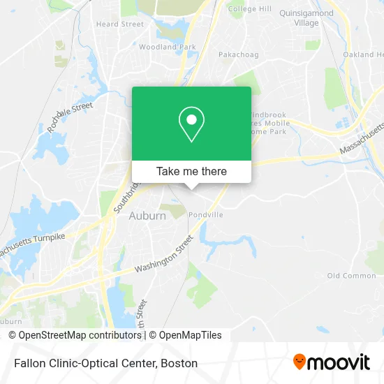
See Fallon Clinic-Optical Center, Boston, on the map
Public Transit to Fallon Clinic-Optical Center in Boston
Wondering how to get to Fallon Clinic-Optical Center in Boston? Moovit helps you find the best way to get to Fallon Clinic-Optical Center with step-by-step directions from the nearest public transit station.
Moovit provides free maps and live directions to help you navigate through your city. View schedules, routes, timetables, and find out how long does it take to get to Fallon Clinic-Optical Center in real time.
Looking for the nearest stop or station to Fallon Clinic-Optical Center? Check out this list of stops closest to your destination: Auburn Mall.
Bus: 27, 42, 29.
Want to see if there’s another route that gets you there at an earlier time? Moovit helps you find alternative routes or times. Get directions from and directions to Fallon Clinic-Optical Center easily from the Moovit App or Website.
We make riding to Fallon Clinic-Optical Center easy, which is why over 1.7 million users, including users in Boston, trust Moovit as the best app for public transit. You don’t need to download an individual bus app or train app, Moovit is your all-in-one transit app that helps you find the best bus time or train time available.
For information on prices of bus, costs and ride fares to Fallon Clinic-Optical Center, please check the Moovit app.
Use the app to navigate to popular places including to the airport, hospital, stadium, grocery store, mall, coffee shop, school, college, and university.
Fallon Clinic-Optical Center Address: 35 Millbury St street in Boston
- Ryder Truck Rental and Leasing,
- O'Connell & O'Connell, PC Attorneys at Law,
- R.H. White Companies, Inc.,
- Law Office of David P. Cortese,
- Roche & Wrenn, P.C.,
- Business,
- AmpUp,
- Alternative Unlimited,
- Tesla,
- Capitol Gutter Service,
- Sadie Greens Jewelry,
- Zhu Relaxation,
- William Jumbo Donuts,
- Liang Gang Chen,
- Electrify America,
- The North Face,
- Five Below,
- Talk & Fix,
- The Children's Place Outlet,
- Pacific Sunwear Stores
Places Near Fallon Clinic-Optical Center (Boston)
- Wang Theater, Boston,
- Museum Of Science, Boston,
- Massachusetts General Hospital, Boston,
- Isabella Stewart Gardner Museum, Boston,
- Seaport District, Boston,
- Boston Common, Boston,
- Wilbur Theatre, Boston,
- Boston Medical Center, Boston,
- Td Garden, Boston,
- House Of Blues, Boston,
- Boston Convention & Exhibition Center, Boston,
- Leader Bank Pavilion (Leader Bank Pavillion), Boston,
- North End, Boston,
- Castle Island, Boston,
- Cheers, Boston,
- Prudential Center, Boston,
- Mgm Music Hall, Boston,
- Faneuil Hall, Boston,
- Quincy Market, Boston,
- Boston Children's Hospital, Boston
How to get to popular places in Boston with public transit
Get around Boston by public transit!
Traveling around Boston has never been so easy. See step by step directions as you travel to any attraction, street or major public transit station. View bus and train schedules, arrival times, service alerts and detailed routes on a map, so you know exactly how to get to anywhere in Boston.
When traveling to any destination around Boston use Moovit's Live Directions with Get Off Notifications to know exactly where and how far to walk, how long to wait for your line, and how many stops are left. Moovit will alert you when it's time to get off — no need to constantly re-check whether yours is the next stop.
Wondering how to use public transit in Boston or how to pay for public transit in Boston? Moovit public transit app can help you navigate your way with public transit easily, and at minimum cost. It includes public transit fees, ticket prices, and costs. Looking for a map of Boston public transit lines? Moovit public transit app shows all public transit maps in Boston with all Bus, Train, Subway and Ferry routes and stops on an interactive map.
Boston has 4 transit type(s), including: Bus, Train, Subway and Ferry, operated by several transit agencies, including MBTA, Southeastern Regional Transit Authority, MetroWest Regional Transit Authority, Rhode Island Public Transit Authority, WRTA, Lowell Regional Transit Authority, Merrimack Valley Transit, Montachusett Regional Transit Authority, Cape Cod Regional Transit Authority, Brockton Area Transit Authority, Martha's Vineyard Transit Authority, the WAVE - Nantucket Regional Transit Authority, GATRA, Cape Ann Transportation Authority and Massport