Directions to Falls Church High School (West Falls Church) with public transportation
The following transit lines have routes that pass near Falls Church High School
How to get to Falls Church High School by bus?
Click on the bus route to see step by step directions with maps, line arrival times and updated time schedules.
How to get to Falls Church High School by metro?
Click on the metro route to see step by step directions with maps, line arrival times and updated time schedules.
Bus stops near Falls Church High School in West Falls Church
- Gallows Rd And Hemlock Dr, 25 min walk,
- Gallows Rd And Thor Dr, 31 min walk,
Bus lines to Falls Church High School in West Falls Church
- 401, 401 Tysons West Park,
- 402, 402 Franconia- Springfield,
What are the closest stations to Falls Church High School?
The closest stations to Falls Church High School are:
- Gallows Rd And Hemlock Dr is 1998 yards away, 25 min walk.
- Gallows Rd And Thor Dr is 2496 yards away, 31 min walk.
Which bus lines stop near Falls Church High School?
These bus lines stop near Falls Church High School: 1A, 1B.
Which metro line stops near Falls Church High School?
METRORAIL ORANGE LINE
See Falls Church High School, West Falls Church, on the map
Public Transit to Falls Church High School in West Falls Church
Wondering how to get to Falls Church High School in West Falls Church, United States? Moovit helps you find the best way to get to Falls Church High School with step-by-step directions from the nearest public transit station.
Moovit provides free maps and live directions to help you navigate through your city. View schedules, routes, timetables, and find out how long does it take to get to Falls Church High School in real time.
Looking for the nearest stop or station to Falls Church High School? Check out this list of stops closest to your destination: Gallows Rd And Hemlock Dr; Gallows Rd And Thor Dr.
Bus: 1A, 1B, 401, 402.Metro: METRORAIL ORANGE LINE.
Want to see if there’s another route that gets you there at an earlier time? Moovit helps you find alternative routes or times. Get directions from and directions to Falls Church High School easily from the Moovit App or Website.
We make riding to Falls Church High School easy, which is why over 1.5 million users, including users in West Falls Church, trust Moovit as the best app for public transit. You don’t need to download an individual bus app or train app, Moovit is your all-in-one transit app that helps you find the best bus time or train time available.
For information on prices of bus and metro, costs and ride fares to Falls Church High School, please check the Moovit app.
Use the app to navigate to popular places including to the airport, hospital, stadium, grocery store, mall, coffee shop, school, college, and university.
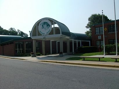
Falls Church High School Address: Marc Drive street in West Falls Church
Attractions near Falls Church High School
Marc Dr,Marc Lakeside,Holly Carol Ln,Marc Holly,Magnetic WP,Trail Creek Wood Ct,Curve Driving School,Arlington Blvd Black Dr,Arlington Blvd & Black Hickory Dr,Willow Point Condominium,St. Philip Catholic Church,Highway 50,RT-50,Freeway 50,Arlington Cedar,Arlington Cedar Hill Rd,7420 Marc Dr,Paola Giorello Bakes,7523 Saint Philips Ct,3315 Crest Haven CtHow to get to popular attractions in West Falls Church with public transit
Cherry Hill Light Rail Station, Baltimore,Rome Building - Johns Hopkins SAIS, Washington,MARC/Amtrak Shuttle, Anne Arundel County,Wilde Lake High School, Howard County,Burleith, Washington,Harvest Fare, Baltimore,Soundcheck, Washington,Homewood Suites by Hilton Baltimore-BWI Airport, Anne Arundel County,Crispus Attucks Park, Washington,I-95 Exit 55 (Key Hwy), Baltimore,Logistics Management Institute (LMI), Fairfax County,Fannie Mae, Fairfax County,Seneca Valley High School, Montgomery County,Broken Land Park & Ride, Howard County,Hybla Valley, Fairfax County,Hillendale Shopping Center, Baltimore County,Edgewood, Washington,Edmondson High School, Baltimore,I-695 @ Exit 26 (York Rd / MD 45), Baltimore County,Freddie Mac, Fairfax CountyGet around Washington, D.C. - Baltimore, MD by public transit!
Traveling around Washington, D.C. - Baltimore, MD has never been so easy. See step by step directions as you travel to any attraction, street or major public transit station. View bus and train schedules, arrival times, service alerts and detailed routes on a map, so you know exactly how to get to anywhere in Washington, D.C. - Baltimore, MD.
When traveling to any destination around Washington, D.C. - Baltimore, MD use Moovit's Live Directions with Get Off Notifications to know exactly where and how far to walk, how long to wait for your line, and how many stops are left. Moovit will alert you when it's time to get off — no need to constantly re-check whether yours is the next stop.
Wondering how to use public transit in Washington, D.C. - Baltimore, MD or how to pay for public transit in Washington, D.C. - Baltimore, MD? Moovit public transit app can help you navigate your way with public transit easily, and at minimum cost. It includes public transit fees, ticket prices, and costs. Looking for a map of Washington, D.C. - Baltimore, MD public transit lines? Moovit public transit app shows all public transit maps in Washington, D.C. - Baltimore, MD with all Bus, Train, Metro, Light Rail and Ferry routes and stops on an interactive map.
Washington, D.C. - Baltimore, MD has 5 transit type(s), including: Bus, Train, Metro, Light Rail and Ferry, operated by several transit agencies, including WMATA, Montgomery County Ride On, Montgomery County MD Ride On, Fairfax Connector, TheBus, PRTC, DC Circulator, DASH - Alexandria, Arlington Transit (ART), DC Streetcar, RTA of Central Maryland, FRED, MDOT MTA, Marc, Virginia Railway Express (VRE)