Directions to Family (Newton) with public transportation
The following transit lines have routes that pass near Family
 Bus: 57, 86, GREEN LINE B SHUTTLE, SHUTTLE, GREEN LINE B SHUTTLE.
- Subway: GREEN LINE B, GREEN LINE D.
How to get to Family by bus?
Click on the bus route to see step by step directions with maps, line arrival times and updated time schedules.
From South Boston, Boston
77 minFrom Massachusetts General Hospital/Harvard Medical School, Boston
71 minFrom Cambria Hotel, Boston
72 minFrom Mike's Pastry, Boston
76 minFrom Haymarket Square, Boston
74 minFrom Dedham District Court, Dedham
98 minFrom Registry of Motor Vehicles Haymarket (Boston), Boston
72 minFrom 110 Francis Street Garage, Boston
45 minFrom Carmelina's, Boston
76 minFrom James Hook & Co, Boston
61 min
How to get to Family by subway?
Click on the subway route to see step by step directions with maps, line arrival times and updated time schedules.
From South Boston, Boston
76 minFrom Massachusetts General Hospital/Harvard Medical School, Boston
64 minFrom Cambria Hotel, Boston
65 minFrom Mike's Pastry, Boston
66 minFrom Haymarket Square, Boston
58 minFrom Registry of Motor Vehicles Haymarket (Boston), Boston
61 minFrom 110 Francis Street Garage, Boston
44 minFrom Carmelina's, Boston
65 minFrom James Hook & Co, Boston
68 min
Bus stops near Family in Newton
Bus lines to Family in Newton
- GREEN LINE B SHUTTLE, Back Bay (Shuttle),VIEW
- SHUTTLE, Kenmore (Shuttle),VIEW
- GREEN LINE B SHUTTLE, Boston College - Blandford Street,VIEW
- GREEN LINE B SHUTTLE, Boston College - Babcock Street,VIEW
- GREEN LINE B SHUTTLE, Boston College - Washington Street,VIEW
- GREEN LINE B SHUTTLE, Boston College - Packard's Corner,VIEW
What are the closest stations to Family?
The closest stations to Family are:
- Boston College - Commonwealth Ave @ St Thomas More Rd is 423 yards away, 6 min walk.
- Boston College - Commonwealth Ave @ Lake St is 430 yards away, 6 min walk.
- Chestnut Hill is 937 yards away, 11 min walk.
- South Street is 1076 yards away, 13 min walk.
Which bus lines stop near Family?
These bus lines stop near Family: 57, 86.
Which subway line stops near Family?
GREEN LINE B (Boston College)
What’s the nearest subway station to Family in Newton?
The nearest subway station to Family in Newton is Chestnut Hill. It’s a 11 min walk away.
What’s the nearest bus station to Family in Newton?
The nearest bus stations to Family in Newton are Boston College - Commonwealth Ave @ St Thomas More Rd and Boston College - Commonwealth Ave @ Lake St. The closest one is a 6 min walk away.
What time is the first subway to Family in Newton?
The GREEN LINE D is the first subway that goes to Family in Newton. It stops nearby at 4:57 AM.
What time is the last subway to Family in Newton?
The GREEN LINE B is the last subway that goes to Family in Newton. It stops nearby at 2:39 AM.
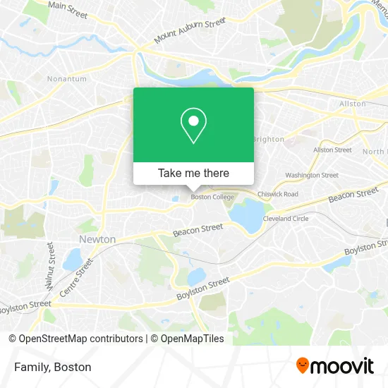
See Family, Newton, on the map
Public Transit to Family in Newton
Wondering how to get to Family in Newton? Moovit helps you find the best way to get to Family with step-by-step directions from the nearest public transit station.
Moovit provides free maps and live directions to help you navigate through your city. View schedules, routes, timetables, and find out how long does it take to get to Family in real time.
Looking for the nearest stop or station to Family? Check out this list of stops closest to your destination: Boston College - Commonwealth Ave @ St Thomas More Rd; Boston College - Commonwealth Ave @ Lake St; Chestnut Hill; South Street.
Bus: 57, 86, GREEN LINE B SHUTTLE, SHUTTLE, GREEN LINE B SHUTTLE, GREEN LINE B SHUTTLE, GREEN LINE B SHUTTLE, GREEN LINE B SHUTTLE.Subway: GREEN LINE B, GREEN LINE D.
Want to see if there’s another route that gets you there at an earlier time? Moovit helps you find alternative routes or times. Get directions from and directions to Family easily from the Moovit App or Website.
We make riding to Family easy, which is why over 1.7 million users, including users in Newton, trust Moovit as the best app for public transit. You don’t need to download an individual bus app or train app, Moovit is your all-in-one transit app that helps you find the best bus time or train time available.
For information on prices of subway and bus, costs and ride fares to Family, please check the Moovit app.
Use the app to navigate to popular places including to the airport, hospital, stadium, grocery store, mall, coffee shop, school, college, and university.
Family Address: 80 Waban Hill Rd street in Newton
- Automobile Shop,
- USPS,
- Asher Nichols & Craftsmen,
- St Mary's Chapel,
- Robsham Theater,
- Boston Liturgical Dance Ense,
- Corcoran Commons (Lower Dining Hall),
- ChargePoint,
- Auto Locksmith,
- Little Village Greek Yogurt & Honey,
- Boston College Police Department,
- Vera Bradley,
- Boston College,
- Playa Bowls,
- Shred Nations,
- Executive It Strategies,
- Brighton Movers,
- Follett,
- The Mods (Modulars),
- Ellen M Gifford Cat Shelter
Places Near Family (Newton)
- Boston Children's Hospital, Boston,
- Castle Island, Boston,
- House Of Blues, Boston,
- North End, Boston,
- Seaport District, Boston,
- Faneuil Hall, Boston,
- Leader Bank Pavilion (Leader Bank Pavillion), Boston,
- Wang Theater, Boston,
- Boston Convention & Exhibition Center, Boston,
- Boston Common, Boston,
- Massachusetts General Hospital, Boston,
- Boston Medical Center, Boston,
- Prudential Center, Boston,
- Cheers, Boston,
- Td Garden, Boston,
- Mgm Music Hall, Boston,
- Quincy Market, Boston,
- Wilbur Theatre, Boston,
- Museum Of Science, Boston,
- Isabella Stewart Gardner Museum, Boston
How to get to popular places in Boston with public transit
Get around Newton by public transit!
Traveling around Newton has never been so easy. See step by step directions as you travel to any attraction, street or major public transit station. View bus and train schedules, arrival times, service alerts and detailed routes on a map, so you know exactly how to get to anywhere in Newton.
When traveling to any destination around Newton use Moovit's Live Directions with Get Off Notifications to know exactly where and how far to walk, how long to wait for your line, and how many stops are left. Moovit will alert you when it's time to get off — no need to constantly re-check whether yours is the next stop.
Wondering how to use public transit in Newton or how to pay for public transit in Newton? Moovit public transit app can help you navigate your way with public transit easily, and at minimum cost. It includes public transit fees, ticket prices, and costs. Looking for a map of Newton public transit lines? Moovit public transit app shows all public transit maps in Newton with all Bus, Train, Subway and Ferry routes and stops on an interactive map.
Boston has 4 transit type(s), including: Bus, Train, Subway and Ferry, operated by several transit agencies, including MBTA, Southeastern Regional Transit Authority, MetroWest Regional Transit Authority, Rhode Island Public Transit Authority, WRTA, Lowell Regional Transit Authority, Merrimack Valley Transit, Montachusett Regional Transit Authority, Cape Cod Regional Transit Authority, Brockton Area Transit Authority, Martha's Vineyard Transit Authority, the WAVE - Nantucket Regional Transit Authority, GATRA, Cape Ann Transportation Authority and Massport