Directions to Fancy Schmancy (Boston) with public transportation
The following transit lines have routes that pass near Fancy Schmancy
 Bus: 39, 41, 35, 38, ORANGE LINE SHUTTLE.
- Train: NEEDHAM, FRANKLIN/FOXBORO, PROVIDENCE/STOUGHTON.
- Subway: ORANGE LINE, GREEN LINE E.
How to get to Fancy Schmancy by bus?
Click on the bus route to see step by step directions with maps, line arrival times and updated time schedules.
From Colonial Theatre, Boston
35 minFrom Costco, Everett
113 minFrom The Lawn on D, Boston
63 minFrom Spaulding Rehabilitation Hospital, Boston
73 minFrom Target, Everett
98 minFrom Granite Links Golf Club at Quarry Hills, Quincy
76 minFrom Gateway Center, Everett
98 minFrom Wellington Station, Medford
93 minFrom Chelsea District Court, Chelsea
81 minFrom Wollaston Beach, Quincy
122 min
How to get to Fancy Schmancy by train?
Click on the train route to see step by step directions with maps, line arrival times and updated time schedules.
How to get to Fancy Schmancy by subway?
Click on the subway route to see step by step directions with maps, line arrival times and updated time schedules.
Bus stops near Fancy Schmancy in Boston
Subway stations near Fancy Schmancy in Boston
Train station near Fancy Schmancy in Boston
- Forest Hills, 36 min walk,VIEW
Bus lines to Fancy Schmancy in Boston
- 35, Avenue Louis Pasteur,VIEW
- 39, Haymarket Via Forest Hills,VIEW
- 41, Jfk/Umass,VIEW
- 38, Forest Hills,VIEW
- ORANGE LINE SHUTTLE, Forest Hills - Jackson Square (Shuttle),VIEW
- ORANGE LINE SHUTTLE, Forest Hills - Back Bay via Copley (Shuttle),VIEW
- ORANGE LINE SHUTTLE, Forest Hills - Ruggles,VIEW
- ORANGE LINE SHUTTLE, Forest Hills - Jackson Square,VIEW
- ORANGE LINE SHUTTLE, Forest Hills - Back Bay (Shuttle),VIEW
- ORANGE LINE SHUTTLE, Forest Hills - Copley,VIEW
- ORANGE LINE SHUTTLE, Forest Hills - Back Bay via Ruggles Busway (Shuttle),VIEW
What are the closest stations to Fancy Schmancy?
The closest stations to Fancy Schmancy are:
- Centre St @ Seaverns Ave is 25 yards away, 1 min walk.
- Stony Brook is 340 yards away, 5 min walk.
- Centre St @ Eliot St is 359 yards away, 5 min walk.
- Green Street - Amory St @ Green St is 483 yards away, 6 min walk.
- Heath Street is 1818 yards away, 22 min walk.
- Forest Hills is 3079 yards away, 36 min walk.
Which bus lines stop near Fancy Schmancy?
These bus lines stop near Fancy Schmancy: 39, 41.
Which train line stops near Fancy Schmancy?
NEEDHAM (#625 | Needham Heights)
Which subway line stops near Fancy Schmancy?
ORANGE LINE (Forest Hills)
What’s the nearest subway station to Fancy Schmancy in Boston?
The nearest subway station to Fancy Schmancy in Boston is Stony Brook. It’s a 5 min walk away.
What’s the nearest bus station to Fancy Schmancy in Boston?
The nearest bus station to Fancy Schmancy in Boston is Centre St @ Seaverns Ave. It’s a 1 min walk away.
What time is the first subway to Fancy Schmancy in Boston?
The ORANGE LINE is the first subway that goes to Fancy Schmancy in Boston. It stops nearby at 5:15 AM.
What time is the last subway to Fancy Schmancy in Boston?
The GREEN LINE E is the last subway that goes to Fancy Schmancy in Boston. It stops nearby at 2:00 AM.
What time is the first train to Fancy Schmancy in Boston?
The NEEDHAM is the first train that goes to Fancy Schmancy in Boston. It stops nearby at 7:34 AM.
What time is the last train to Fancy Schmancy in Boston?
The PROVIDENCE/STOUGHTON is the last train that goes to Fancy Schmancy in Boston. It stops nearby at 12:08 AM.
What time is the first bus to Fancy Schmancy in Boston?
The 39 is the first bus that goes to Fancy Schmancy in Boston. It stops nearby at 4:40 AM.
What time is the last bus to Fancy Schmancy in Boston?
The 39 is the last bus that goes to Fancy Schmancy in Boston. It stops nearby at 1:30 AM.
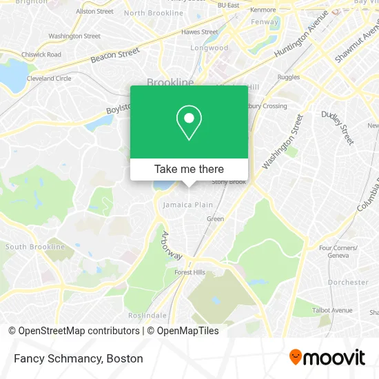
See Fancy Schmancy, Boston, on the map
Public Transit to Fancy Schmancy in Boston
Wondering how to get to Fancy Schmancy in Boston? Moovit helps you find the best way to get to Fancy Schmancy with step-by-step directions from the nearest public transit station.
Moovit provides free maps and live directions to help you navigate through your city. View schedules, routes, timetables, and find out how long does it take to get to Fancy Schmancy in real time.
Looking for the nearest stop or station to Fancy Schmancy? Check out this list of stops closest to your destination: Centre St @ Seaverns Ave; Stony Brook; Centre St @ Eliot St; Green Street - Amory St @ Green St; Heath Street; Forest Hills.
Bus: 39, 41, 35, 38, ORANGE LINE SHUTTLE, ORANGE LINE SHUTTLE, ORANGE LINE SHUTTLE, ORANGE LINE SHUTTLE, ORANGE LINE SHUTTLE.Train: NEEDHAM, FRANKLIN/FOXBORO, PROVIDENCE/STOUGHTON.Subway: ORANGE LINE, GREEN LINE E.
Want to see if there’s another route that gets you there at an earlier time? Moovit helps you find alternative routes or times. Get directions from and directions to Fancy Schmancy easily from the Moovit App or Website.
We make riding to Fancy Schmancy easy, which is why over 1.7 million users, including users in Boston, trust Moovit as the best app for public transit. You don’t need to download an individual bus app or train app, Moovit is your all-in-one transit app that helps you find the best bus time or train time available.
For information on prices of bus, subway and train, costs and ride fares to Fancy Schmancy, please check the Moovit app.
Use the app to navigate to popular places including to the airport, hospital, stadium, grocery store, mall, coffee shop, school, college, and university.
Fancy Schmancy Address: 610 Centre St street in Boston
- JC Fruit Shop and More,
- Luria, David M,
- Metro Environmental & Construction,
- Shea Butter Smoothies,
- Air Conditioning Company,
- Cafe Siete,
- Joint,
- A Butter,
- Casabe Kitchen,
- NU Fudge,
- Centre St Gibbs,
- USPS Collection Box - Blue Box,
- Handy Hands Company,
- CITGO,
- American Medical Response,
- Unimpeachable Auto Glass,
- One Day Boston,
- Myrtle Street Laundromat,
- Nehar Shalom Community Synagogue,
- Papercuts J.P. (Papercuts JP)
Places Near Fancy Schmancy (Boston)
- Boston Convention & Exhibition Center, Boston,
- Wilbur Theatre, Boston,
- House Of Blues, Boston,
- North End, Boston,
- Isabella Stewart Gardner Museum, Boston,
- Mgm Music Hall, Boston,
- Boston Medical Center, Boston,
- Castle Island, Boston,
- Td Garden, Boston,
- Quincy Market, Boston,
- Leader Bank Pavilion (Leader Bank Pavillion), Boston,
- Museum Of Science, Boston,
- Prudential Center, Boston,
- Boston Children's Hospital, Boston,
- Faneuil Hall, Boston,
- Massachusetts General Hospital, Boston,
- Wang Theater, Boston,
- Seaport District, Boston,
- Boston Common, Boston,
- Cheers, Boston
How to get to popular places in Boston with public transit
Get around Boston by public transit!
Traveling around Boston has never been so easy. See step by step directions as you travel to any attraction, street or major public transit station. View bus and train schedules, arrival times, service alerts and detailed routes on a map, so you know exactly how to get to anywhere in Boston.
When traveling to any destination around Boston use Moovit's Live Directions with Get Off Notifications to know exactly where and how far to walk, how long to wait for your line, and how many stops are left. Moovit will alert you when it's time to get off — no need to constantly re-check whether yours is the next stop.
Wondering how to use public transit in Boston or how to pay for public transit in Boston? Moovit public transit app can help you navigate your way with public transit easily, and at minimum cost. It includes public transit fees, ticket prices, and costs. Looking for a map of Boston public transit lines? Moovit public transit app shows all public transit maps in Boston with all Bus, Train, Subway and Ferry routes and stops on an interactive map.
Boston has 4 transit type(s), including: Bus, Train, Subway and Ferry, operated by several transit agencies, including MBTA, Southeastern Regional Transit Authority, MetroWest Regional Transit Authority, Rhode Island Public Transit Authority, WRTA, Lowell Regional Transit Authority, Merrimack Valley Transit, Montachusett Regional Transit Authority, Cape Cod Regional Transit Authority, Brockton Area Transit Authority, Martha's Vineyard Transit Authority, the WAVE - Nantucket Regional Transit Authority, GATRA, Cape Ann Transportation Authority and Massport