Directions to Farma Line (Hugo Lange) with public transportation
The following transit lines have routes that pass near Farma Line
How to get to Farma Line by bus?
Click on the bus route to see step by step directions with maps, line arrival times and updated time schedules.
From Rua Affife Mansur, Novo Mundo
58 minFrom Parque Tanguá, Taboão
52 minFrom Avenida República Argentina, Portão
48 minFrom Rua Paulo Setúbal, Boqueirão
72 minFrom Rua Almirante Tamandaré, Almirante Tamandaré
63 minFrom São Gabriel, Colombo
66 minFrom Rua Doutor Bley Zornig, Boqueirão
56 minFrom Faculdades Santa Cruz, Novo Mundo
64 minFrom Rua Deputado Heitor Alencar Furtado, Mossunguê
49 minFrom Rua João Reffo, Santa Felicidade
59 min
Bus stops near Farma Line in Hugo Lange
Bus lines to Farma Line in Hugo Lange
- 020 INTERBAIRROS II (HORÁRIO), Cabral → Capão da Imbuia,VIEW
- 365 JARDIM SOCIAL / BATEL, Batel → Estação Fagundes Varela,VIEW
- 366 ITUPAVA / HOSPITAL MILITAR, Hospital Militar → Itupava,VIEW
- 021 INTERBAIRROS II (ANTI-HORÁRIO), Capão da Imbuia → Cabral,VIEW
- 022 INTER 2 (HORÁRIO), Cabral → Capão da Imbuia,VIEW
- 023 INTER 2 (ANTI-HORÁRIO), Capão da Imbuia → Cabral,VIEW
- 307 BAIRRO ALTO / SANTA FELICIDADE, Terminal Santa Felicidade → Terminal Bairro Alto,VIEW
- B03 GUARAITUBA / ALTO DA XV (VIA MARACANÃ), Terminal Guaraituba ↺ Jardim Social / Alto da Rua XV (Circular),VIEW
- 361 AUGUSTO STRESSER, Praça Santos Andrade → Estação Solar,VIEW
- 374 HUGO LANGE, Praça Santos Andrade → Terminal Bairro Alto,VIEW
What are the closest stations to Farma Line?
The closest stations to Farma Line are:
- Av. Nossa Senhora da Luz, 2256 is 144 meters away, 3 min walk.
- R. Itupava, 2000 is 177 meters away, 3 min walk.
- Av. Nossa Senhora da Luz, 2329 is 247 meters away, 4 min walk.
- Praça das Nações is 473 meters away, 7 min walk.
- R. Augusto Stresser, 2000 is 627 meters away, 9 min walk.
Which bus lines stop near Farma Line?
These bus lines stop near Farma Line: 020 INTERBAIRROS II (HORÁRIO), 307 BAIRRO ALTO / SANTA FELICIDADE, 365 JARDIM SOCIAL / BATEL, C03 PINHAIS / GUADALUPE.
What’s the nearest bus station to Farma Line in Hugo Lange?
The nearest bus stations to Farma Line in Hugo Lange are Av. Nossa Senhora da Luz, 2256 and R. Itupava, 2000. The closest one is a 3 min walk away.
What time is the first bus to Farma Line in Hugo Lange?
The 020 INTERBAIRROS II (HORÁRIO) is the first bus that goes to Farma Line in Hugo Lange. It stops nearby at 5:20 AM.
What time is the last bus to Farma Line in Hugo Lange?
The 020 INTERBAIRROS II (HORÁRIO) is the last bus that goes to Farma Line in Hugo Lange. It stops nearby at 12:25 AM.
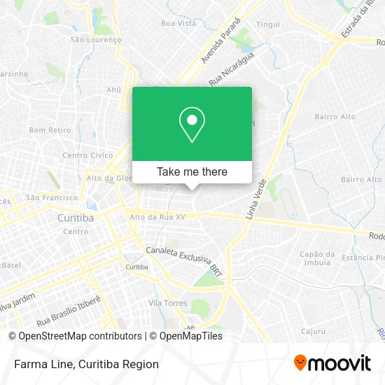
See Farma Line, Hugo Lange, on the map
Public Transit to Farma Line in Hugo Lange
Wondering how to get to Farma Line in Hugo Lange? Moovit helps you find the best way to get to Farma Line with step-by-step directions from the nearest public transit station.
Moovit provides free maps and live directions to help you navigate through your city. View schedules, routes, timetables, and find out how long does it take to get to Farma Line in real time.
Looking for the nearest stop or station to Farma Line? Check out this list of stops closest to your destination: Av. Nossa Senhora da Luz; R. Itupava; Av. Nossa Senhora da Luz; Praça das Nações; R. Augusto Stresser.
Bus: 020 INTERBAIRROS II (HORÁRIO), 307 BAIRRO ALTO / SANTA FELICIDADE, 365 JARDIM SOCIAL / BATEL, C03 PINHAIS / GUADALUPE, 366 ITUPAVA / HOSPITAL MILITAR, 021 INTERBAIRROS II (ANTI-HORÁRIO), 022 INTER 2 (HORÁRIO), 023 INTER 2 (ANTI-HORÁRIO), B03 GUARAITUBA / ALTO DA XV (VIA MARACANÃ), 361 AUGUSTO STRESSER, 374 HUGO LANGE.
Want to see if there’s another route that gets you there at an earlier time? Moovit helps you find alternative routes or times. Get directions from and directions to Farma Line easily from the Moovit App or Website.
We make riding to Farma Line easy, which is why over 1.5 million users, including users in Hugo Lange, trust Moovit as the best app for public transit. You don’t need to download an individual bus app or train app, Moovit is your all-in-one transit app that helps you find the best bus time or train time available.
For information on prices of bus, costs and ride fares to Farma Line, please check the Moovit app.
Use the app to navigate to popular places including to the airport, hospital, stadium, grocery store, mall, coffee shop, school, college, and university.
Farma Line Address: R. Prof. Duílio A. Calderari, 336 street in Hugo Lange
- Flávio Cabeleireiro,
- CDI Centro De Diagnostico Por Imagem,
- Rua Itupava 1665,
- Auto Escola Itupava,
- Panvel,
- Clinica Santa Gianna,
- Av. Nossa Sra. da Luz, 2271 - Hugo Lange,
- CEEFA - Centro de Estudos Espíritas Francisco de Assis,
- Família Farinha,
- Avenida N. Senhora da Luz 2345,
- Rua Conselheiro Carrão 1719,
- Agora - Arquitetura e Servicos de Construcao Civil,
- Escola Municipal Dom Manuel da Silveira D'Elboux,
- SETRANSP - Sindicato das Empresas de Onibus de Curitiba e Reg. Metropolitana,
- Restaurante Madero,
- MADERO,
- Clinica De Arritmia Cardíaca E Síncope,
- Rua Presidente Rodrigo Otávio 1190,
- Lotérica Alto da XV,
- Avenida Nossa Senhora Da Luz
Places Near Farma Line (Hugo Lange)
- Campo Largo, Campo,
- Hospital Angelina Caron, Campina Grande Do Sul,
- Shopping Palladium, Portão,
- Shopping Estação, Rebouças,
- Hhhhh, Fazendinha,
- Rua Martim Afonso 558, Mercês,
- Hospital Da Cruz Vermelha, Batel,
- Arena Da Baixada - Curitiba,
- Hospital Nossa Senhora Das Graças, Mercês,
- Hospital Universitário Evangélico de Curitiba, Bigorrilho,
- Jockey Plaza Shopping Center, Tarumã,
- Hospital do Rocio, Campo,
- Hospital Madalena Sofia, Bairro Alto,
- Pontifícia Universidade Católica do Paraná (PUCPR), Prado Velho,
- Hospital de Clínicas (HC - UFPR), Centro,
- Rua General Mário Tourinho, Campina Do Siqueira,
- Jardim Botânico de Curitiba PR, Centro,
- Parque Barigui, Mercês,
- Hospital Erasto Gaertner, Jardim Das Américas,
- Park Shopping Barigüi, Mossunguê
How to get to popular places in Curitiba Region with public transit
Get around Hugo Lange by public transit!
Traveling around Hugo Lange has never been so easy. See step by step directions as you travel to any attraction, street or major public transit station. View bus and train schedules, arrival times, service alerts and detailed routes on a map, so you know exactly how to get to anywhere in Hugo Lange.
When traveling to any destination around Hugo Lange use Moovit's Live Directions with Get Off Notifications to know exactly where and how far to walk, how long to wait for your line, and how many stops are left. Moovit will alert you when it's time to get off — no need to constantly re-check whether yours is the next stop.
Wondering how to use public transit in Hugo Lange or how to pay for public transit in Hugo Lange? Moovit public transit app can help you navigate your way with public transit easily, and at minimum cost. It includes public transit fees, ticket prices, and costs. Looking for a map of Hugo Lange public transit lines? Moovit public transit app shows all public transit maps in Hugo Lange with all Bus and Cable Car routes and stops on an interactive map.
Curitiba Region has 2 transit type(s), including: Bus and Cable Car, operated by several transit agencies, including Sistema Integrado de Mobilidade (URBS), Sistema Integrado de Mobilidade (AMEP), URBS (Cartões bancários e Dinheiro), URBS (Cartões bancários / Cartão URBS), AMEP (Cartões bancários / Cartão MetroCard), AMEP (Cartões bancários / Cartão MetroCard / Dinheiro), Viação Colombo (Dinheiro), TRIAR (Cartão TRIAR / Dinheiro), Empresa Curitiba Cerro Azul (Dinheiro), Expresso Nossa Senhora da Penha (Dinheiro), Empresa Campo Alto Tijucas (Dinheiro), Auto Viação São José (Cartão VEM / Dinheiro), BRT S/A (Cartão VEM / Dinheiro), TransPiedade (Cartão Cidadão / Dinheiro) and Oceânica Sul (Cartão Transporte / Dinheiro)