Directions to Farol News (Boston) with public transportation
The following transit lines have routes that pass near Farol News
 Bus: 354, SL1, SL2, SL3, 4.
- Train: FAIRMOUNT, FRAMINGHAM/WORCESTER, COMMUTER RAIL SHUTTLE, FAIRMOUNT LINE SHUTTLE, FRANKLIN LINE SHUTTLE.
- Subway: ORANGE LINE, RED LINE.
- Ferry: HINGHAM FERRY, FAST FERRY.
How to get to Farol News by bus?
Click on the bus route to see step by step directions with maps, line arrival times and updated time schedules.
From Boston College (BC), Boston
72 minFrom AC Hotel Boston Cambridge, Cambridge
79 minFrom Boston College, Boston
71 minFrom Franklin Park Zoo, Boston
63 minFrom Conte Forum, Boston
74 minFrom Massachusetts, Boston
68 minFrom Raising Cane's, Boston
68 minFrom Simmons College, Boston
59 minFrom 110 Francis Street Garage, Boston
60 minFrom Alumni Stadium, Boston
72 min
How to get to Farol News by train?
Click on the train route to see step by step directions with maps, line arrival times and updated time schedules.
How to get to Farol News by subway?
Click on the subway route to see step by step directions with maps, line arrival times and updated time schedules.
From Boston College (BC), Boston
75 minFrom AC Hotel Boston Cambridge, Cambridge
51 minFrom Boston College, Boston
74 minFrom Franklin Park Zoo, Boston
60 minFrom Conte Forum, Boston
76 minFrom Massachusetts, Boston
73 minFrom Raising Cane's, Boston
51 minFrom Simmons College, Boston
50 minFrom 110 Francis Street Garage, Boston
50 minFrom Alumni Stadium, Boston
75 min
Bus stops near Farol News in Boston
Train station near Farol News in Boston
- South Station, 6 min walk,VIEW
Ferry stations near Farol News in Boston
Bus lines to Farol News in Boston
What are the closest stations to Farol News?
The closest stations to Farol News are:
- Atlantic Ave @ Seaport Blvd. is 299 yards away, 4 min walk.
- A St @ Necco St is 379 yards away, 5 min walk.
- South Station is 437 yards away, 6 min walk.
- Rowes Wharf is 476 yards away, 7 min walk.
- Summer St Opp Melcher St is 772 yards away, 10 min walk.
- World Trade Center Pier, Boston, MA is 858 yards away, 11 min walk.
- Seaport (Fan Pier) is 1358 yards away, 17 min walk.
Which bus lines stop near Farol News?
These bus lines stop near Farol News: 354, SL1, SL2, SL3.
Which train lines stop near Farol News?
These train lines stop near Farol News: FAIRMOUNT, FRAMINGHAM/WORCESTER.
Which subway lines stop near Farol News?
These subway lines stop near Farol News: ORANGE LINE, RED LINE.
What’s the nearest train station to Farol News in Boston?
The nearest train station to Farol News in Boston is South Station. It’s a 6 min walk away.
What’s the nearest bus station to Farol News in Boston?
The nearest bus station to Farol News in Boston is Atlantic Ave @ Seaport Blvd.. It’s a 4 min walk away.
What’s the nearest ferry station to Farol News in Boston?
The nearest ferry station to Farol News in Boston is Rowes Wharf. It’s a 7 min walk away.
What time is the first subway to Farol News in Boston?
The RED LINE is the first subway that goes to Farol News in Boston. It stops nearby at 5:30 AM.
What time is the last subway to Farol News in Boston?
The RED LINE is the last subway that goes to Farol News in Boston. It stops nearby at 1:49 AM.
What time is the first train to Farol News in Boston?
The PROVIDENCE/STOUGHTON is the first train that goes to Farol News in Boston. It stops nearby at 4:20 AM.
What time is the last train to Farol News in Boston?
The LAKE SHORE LIMITED is the last train that goes to Farol News in Boston. It stops nearby at 8:32 PM.
What time is the first bus to Farol News in Boston?
The SLW is the first bus that goes to Farol News in Boston. It stops nearby at 4:14 AM.
What time is the last bus to Farol News in Boston?
The SL1 is the last bus that goes to Farol News in Boston. It stops nearby at 1:26 AM.
What time is the first ferry to Farol News in Boston?
The EAST is the first ferry that goes to Farol News in Boston. It stops nearby at 6:01 AM.
What time is the last ferry to Farol News in Boston?
The FAST FERRY is the last ferry that goes to Farol News in Boston. It stops nearby at 9:05 PM.
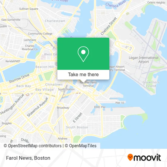
See Farol News, Boston, on the map
Public Transit to Farol News in Boston
Wondering how to get to Farol News in Boston? Moovit helps you find the best way to get to Farol News with step-by-step directions from the nearest public transit station.
Moovit provides free maps and live directions to help you navigate through your city. View schedules, routes, timetables, and find out how long does it take to get to Farol News in real time.
Looking for the nearest stop or station to Farol News? Check out this list of stops closest to your destination: Atlantic Ave @ Seaport Blvd.; A St @ Necco St; South Station; Rowes Wharf; Summer St Opp Melcher St; World Trade Center Pier; Seaport (Fan Pier).
Bus: 354, SL1, SL2, SL3, 4, 11, 7.Train: FAIRMOUNT, FRAMINGHAM/WORCESTER, COMMUTER RAIL SHUTTLE, FAIRMOUNT LINE SHUTTLE, FRANKLIN LINE SHUTTLE, KINGSTON LINE SHUTTLE, SL1.Subway: ORANGE LINE, RED LINE.Ferry: HINGHAM FERRY, FAST FERRY.
Want to see if there’s another route that gets you there at an earlier time? Moovit helps you find alternative routes or times. Get directions from and directions to Farol News easily from the Moovit App or Website.
We make riding to Farol News easy, which is why over 1.7 million users, including users in Boston, trust Moovit as the best app for public transit. You don’t need to download an individual bus app or train app, Moovit is your all-in-one transit app that helps you find the best bus time or train time available.
For information on prices of subway, bus and train, costs and ride fares to Farol News, please check the Moovit app.
Use the app to navigate to popular places including to the airport, hospital, stadium, grocery store, mall, coffee shop, school, college, and university.
Farol News Address: 89 Seaport Blvd street in Boston
- PwC,
- Seaport Common,
- Shake Shack,
- District Hall,
- L.L.Bean,
- Scorpion Bar,
- Kings Dining & Entertainment,
- Thomson Reuters at 44 Thomson Place,
- Tuscan Kitchen Seaport,
- Snowport Winter Village,
- YOTEL Boston,
- Yotel Boston,
- Caffè Nero,
- Trader Joe's,
- Marina Park Dr & Northern Ave,
- Our Lady Of Good Voyage,
- MBTA Courthouse Station,
- Seaport Holiday Farmers Market,
- Ember,
- Grace Loves Lace
Places Near Farol News (Boston)
- Seaport District, Boston,
- House Of Blues, Boston,
- North End, Boston,
- Boston Medical Center, Boston,
- Boston Children's Hospital, Boston,
- Prudential Center, Boston,
- Cheers, Boston,
- Td Garden, Boston,
- Quincy Market, Boston,
- Boston Convention & Exhibition Center, Boston,
- Wilbur Theatre, Boston,
- Boston Common, Boston,
- Leader Bank Pavilion (Leader Bank Pavillion), Boston,
- Museum Of Science, Boston,
- Faneuil Hall, Boston,
- Wang Theater, Boston,
- Isabella Stewart Gardner Museum, Boston,
- Mgm Music Hall, Boston,
- Castle Island, Boston,
- Massachusetts General Hospital, Boston
How to get to popular places in Boston with public transit
Get around Boston by public transit!
Traveling around Boston has never been so easy. See step by step directions as you travel to any attraction, street or major public transit station. View bus and train schedules, arrival times, service alerts and detailed routes on a map, so you know exactly how to get to anywhere in Boston.
When traveling to any destination around Boston use Moovit's Live Directions with Get Off Notifications to know exactly where and how far to walk, how long to wait for your line, and how many stops are left. Moovit will alert you when it's time to get off — no need to constantly re-check whether yours is the next stop.
Wondering how to use public transit in Boston or how to pay for public transit in Boston? Moovit public transit app can help you navigate your way with public transit easily, and at minimum cost. It includes public transit fees, ticket prices, and costs. Looking for a map of Boston public transit lines? Moovit public transit app shows all public transit maps in Boston with all Bus, Train, Subway and Ferry routes and stops on an interactive map.
Boston has 4 transit type(s), including: Bus, Train, Subway and Ferry, operated by several transit agencies, including MBTA, Southeastern Regional Transit Authority, MetroWest Regional Transit Authority, Rhode Island Public Transit Authority, WRTA, Lowell Regional Transit Authority, Merrimack Valley Transit, Montachusett Regional Transit Authority, Cape Cod Regional Transit Authority, Brockton Area Transit Authority, Martha's Vineyard Transit Authority, the WAVE - Nantucket Regional Transit Authority, GATRA, Cape Ann Transportation Authority and Massport