Directions to Fast And Furious Motors (Everett) with public transportation
The following transit lines have routes that pass near Fast And Furious Motors
 Bus: 104, 109, 110, 112, 97.
- Train: NEWBURYPORT/ROCKPORT.
- Subway: ORANGE LINE.
How to get to Fast And Furious Motors by bus?
Click on the bus route to see step by step directions with maps, line arrival times and updated time schedules.
From Boston Medical Center / Shapiro Center, Boston
81 minFrom Centre St, Boston
102 minFrom Dubliner, Boston
37 minFrom KNL, Cambridge
56 minFrom St. Elizabeth's Medical Center, Boston
71 minFrom JFK Library, Boston
116 minFrom The Strand Theater, Boston
100 minFrom Hotel Commonwealth, Boston
59 minFrom Trader Joe's, Boston
59 minFrom John F. Kennedy Presidential Library And Museum, Boston
116 min
How to get to Fast And Furious Motors by train?
Click on the train route to see step by step directions with maps, line arrival times and updated time schedules.
How to get to Fast And Furious Motors by subway?
Click on the subway route to see step by step directions with maps, line arrival times and updated time schedules.
From Boston Medical Center / Shapiro Center, Boston
68 minFrom Centre St, Boston
60 minFrom Dubliner, Boston
45 minFrom KNL, Cambridge
64 minFrom St. Elizabeth's Medical Center, Boston
95 minFrom JFK Library, Boston
79 minFrom The Strand Theater, Boston
78 minFrom Hotel Commonwealth, Boston
64 minFrom Trader Joe's, Boston
60 minFrom John F. Kennedy Presidential Library And Museum, Boston
80 min
Bus stops near Fast And Furious Motors in Everett
Subway station near Fast And Furious Motors in Everett
- Sullivan Square, 25 min walk,VIEW
Train station near Fast And Furious Motors in Everett
- Chelsea, 54 min walk,VIEW
Bus lines to Fast And Furious Motors in Everett
What are the closest stations to Fast And Furious Motors?
The closest stations to Fast And Furious Motors are:
- Broadway @ Norwood St is 59 yards away, 1 min walk.
- Anthem/Greystar is 1551 yards away, 19 min walk.
- Sullivan Square is 2064 yards away, 25 min walk.
- Chelsea is 4310 yards away, 54 min walk.
Which bus lines stop near Fast And Furious Motors?
These bus lines stop near Fast And Furious Motors: 104, 109, 110, 112.
Which train line stops near Fast And Furious Motors?
NEWBURYPORT/ROCKPORT (#125 | Newburyport)
Which subway line stops near Fast And Furious Motors?
ORANGE LINE (Oak Grove)
What’s the nearest subway station to Fast And Furious Motors in Everett?
The nearest subway station to Fast And Furious Motors in Everett is Sullivan Square. It’s a 25 min walk away.
What’s the nearest bus station to Fast And Furious Motors in Everett?
The nearest bus station to Fast And Furious Motors in Everett is Broadway @ Norwood St. It’s a 1 min walk away.
What time is the first subway to Fast And Furious Motors in Everett?
The ORANGE LINE is the first subway that goes to Fast And Furious Motors in Everett. It stops nearby at 5:19 AM.
What time is the last subway to Fast And Furious Motors in Everett?
The ORANGE LINE is the last subway that goes to Fast And Furious Motors in Everett. It stops nearby at 1:53 AM.
What time is the first train to Fast And Furious Motors in Everett?
The NEWBURYPORT/ROCKPORT is the first train that goes to Fast And Furious Motors in Everett. It stops nearby at 5:40 AM.
What time is the last train to Fast And Furious Motors in Everett?
The NEWBURYPORT/ROCKPORT is the last train that goes to Fast And Furious Motors in Everett. It stops nearby at 12:06 AM.
What time is the first bus to Fast And Furious Motors in Everett?
The 104 is the first bus that goes to Fast And Furious Motors in Everett. It stops nearby at 4:36 AM.
What time is the last bus to Fast And Furious Motors in Everett?
The 110 is the last bus that goes to Fast And Furious Motors in Everett. It stops nearby at 2:09 AM.
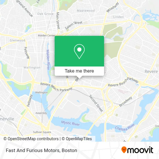
See Fast And Furious Motors, Everett, on the map
Public Transit to Fast And Furious Motors in Everett
Wondering how to get to Fast And Furious Motors in Everett? Moovit helps you find the best way to get to Fast And Furious Motors with step-by-step directions from the nearest public transit station.
Moovit provides free maps and live directions to help you navigate through your city. View schedules, routes, timetables, and find out how long does it take to get to Fast And Furious Motors in real time.
Looking for the nearest stop or station to Fast And Furious Motors? Check out this list of stops closest to your destination: Broadway @ Norwood St; Anthem/Greystar; Sullivan Square; Chelsea.
Bus: 104, 109, 110, 112, 97, LOWER MYSTIC LINK.Train: NEWBURYPORT/ROCKPORT.Subway: ORANGE LINE.
Want to see if there’s another route that gets you there at an earlier time? Moovit helps you find alternative routes or times. Get directions from and directions to Fast And Furious Motors easily from the Moovit App or Website.
We make riding to Fast And Furious Motors easy, which is why over 1.7 million users, including users in Everett, trust Moovit as the best app for public transit. You don’t need to download an individual bus app or train app, Moovit is your all-in-one transit app that helps you find the best bus time or train time available.
For information on prices of bus, subway and train, costs and ride fares to Fast And Furious Motors, please check the Moovit app.
Use the app to navigate to popular places including to the airport, hospital, stadium, grocery store, mall, coffee shop, school, college, and university.
Fast And Furious Motors Address: 153 Ferry St street in Everett
- Patricia Alvarez,
- So Express Moving,
- Goldilocks His N Hers Hair Styling,
- Dreamstar Studios,
- High Class Mobile Detail,
- MD Cleaning Service,
- Finest Bathtub Reglazing,
- Prosquad Roofing,
- Super Team Cleaning,
- Marj Media,
- Krispy Rice,
- Lyvia Vargas Cleaning Services,
- Light Touch,
- Muller Cleaning Service,
- Lolanda Cleaning,
- Shine & Clean,
- Ecolimp,
- Pet Medic Response,
- Analux Aesthetics,
- Brothers Tile & Masonry
Places Near Fast And Furious Motors (Everett)
- Mgm Music Hall, Boston,
- Td Garden, Boston,
- Prudential Center, Boston,
- Castle Island, Boston,
- Seaport District, Boston,
- Boston Common, Boston,
- Cheers, Boston,
- House Of Blues, Boston,
- Wang Theater, Boston,
- Leader Bank Pavilion (Leader Bank Pavillion), Boston,
- Boston Children's Hospital, Boston,
- Museum Of Science, Boston,
- Massachusetts General Hospital, Boston,
- Wilbur Theatre, Boston,
- Faneuil Hall, Boston,
- Boston Convention & Exhibition Center, Boston,
- Quincy Market, Boston,
- Isabella Stewart Gardner Museum, Boston,
- Boston Medical Center, Boston,
- North End, Boston
How to get to popular places in Boston with public transit
Get around Everett by public transit!
Traveling around Everett has never been so easy. See step by step directions as you travel to any attraction, street or major public transit station. View bus and train schedules, arrival times, service alerts and detailed routes on a map, so you know exactly how to get to anywhere in Everett.
When traveling to any destination around Everett use Moovit's Live Directions with Get Off Notifications to know exactly where and how far to walk, how long to wait for your line, and how many stops are left. Moovit will alert you when it's time to get off — no need to constantly re-check whether yours is the next stop.
Wondering how to use public transit in Everett or how to pay for public transit in Everett? Moovit public transit app can help you navigate your way with public transit easily, and at minimum cost. It includes public transit fees, ticket prices, and costs. Looking for a map of Everett public transit lines? Moovit public transit app shows all public transit maps in Everett with all Bus, Train, Subway and Ferry routes and stops on an interactive map.
Boston has 4 transit type(s), including: Bus, Train, Subway and Ferry, operated by several transit agencies, including MBTA, Southeastern Regional Transit Authority, MetroWest Regional Transit Authority, Rhode Island Public Transit Authority, WRTA, Lowell Regional Transit Authority, Merrimack Valley Transit, Montachusett Regional Transit Authority, Cape Cod Regional Transit Authority, Brockton Area Transit Authority, Martha's Vineyard Transit Authority, the WAVE - Nantucket Regional Transit Authority, GATRA, Cape Ann Transportation Authority and Massport