How to get to Fast Phone Fix by bus?
Click on the bus route to see step by step directions with maps, line arrival times and updated time schedules.
From B.M.C. Durfee High School, Fall River
57 minFrom Charlton Memorial Hospital, Fall River
77 minFrom Lizzy Borden House, Fall River
64 minFrom Amazon Fulfillment Bos7, Fall River
107 minFrom RMV New Bedford, New Bedford
63 minFrom Bedford Industrial Park, New Bedford
66 minFrom Walmart Fall River Supercenter, Fall River
72 minFrom Bristol Community College, Fall River
59 minFrom Mass Maritime Academy, Buzzards Bay
116 minFrom Falmouth MA USA, Falmouth
91 min
How to get to Fast Phone Fix by train?
Click on the train route to see step by step directions with maps, line arrival times and updated time schedules.
Bus stops near Fast Phone Fix in New Bedford
Ferry stations near Fast Phone Fix in New Bedford
Train station near Fast Phone Fix in New Bedford
- Church Street, 41 min walk,VIEW
Bus lines to Fast Phone Fix in New Bedford
- 201, Fort Rodman,VIEW
- 205, South Central,VIEW
- 203, Terminal,VIEW
- 299, Keith South,VIEW
- WNB, SRTA,VIEW
- 9, SRTA New Bedford Terminal - SRTA Fall River Terminal,VIEW
- 202, SRTA New Bedford Terminal - Lund's Corner,VIEW
- 204, SRTA New Bedford Terminal - Theodore H. Rice Blvd,VIEW
- 206, Rockway St and Carriage Dr - SRTA New Bedford Terminal,VIEW
- 208, SRTA New Bedford Terminal - King's Highway Stop & Shop,VIEW
- 210, Ann & Hope Plaza - SRTA New Bedford Terminal,VIEW
- 211, SRTA New Bedford Terminal - NB11 End of Line Stop,VIEW
- WARE, Cranberry Plaza - SRTA New Bedford Terminal,VIEW
- PETER PAN, CAPE COD - PROVIDENCE - NEW YORK,VIEW
- PETER PAN, NEW YORK - PROVIDENCE - CAPE COD,VIEW
What are the closest stations to Fast Phone Fix?
The closest stations to Fast Phone Fix are:
- Pleasant St And Mason St is 187 yards away, 3 min walk.
- Pleasant St And Spring St is 289 yards away, 4 min walk.
- Union St And Orchard St is 481 yards away, 6 min walk.
- Union St And Cottage St is 562 yards away, 7 min walk.
- SRTA is 600 yards away, 7 min walk.
- SRTA Terminal New Bedford is 600 yards away, 7 min walk.
- New Bedford, MA is 3369 yards away, 40 min walk.
- Church Street is 3483 yards away, 41 min walk.
- Cuttyhunk Ferry Pier, New Bedford, MA is 3563 yards away, 42 min walk.
Which bus lines stop near Fast Phone Fix?
These bus lines stop near Fast Phone Fix: 208, 9, PETER PAN, WNB.
Which train line stops near Fast Phone Fix?
FALL RIVER/NEW BEDFORD (#2011 | New Bedford)
What’s the nearest bus station to Fast Phone Fix in New Bedford?
The nearest bus station to Fast Phone Fix in New Bedford is Pleasant St And Mason St. It’s a 3 min walk away.
What time is the first train to Fast Phone Fix in New Bedford?
The FALL RIVER/NEW BEDFORD is the first train that goes to Fast Phone Fix in New Bedford. It stops nearby at 4:16 AM.
What time is the last train to Fast Phone Fix in New Bedford?
The FALL RIVER/NEW BEDFORD is the last train that goes to Fast Phone Fix in New Bedford. It stops nearby at 1:38 AM.
What time is the first bus to Fast Phone Fix in New Bedford?
The 202 is the first bus that goes to Fast Phone Fix in New Bedford. It stops nearby at 5:20 AM.
What time is the last bus to Fast Phone Fix in New Bedford?
The 9 is the last bus that goes to Fast Phone Fix in New Bedford. It stops nearby at 10:10 PM.
What time is the first ferry to Fast Phone Fix in New Bedford?
The SEASTREAK is the first ferry that goes to Fast Phone Fix in New Bedford. It stops nearby at 8:20 AM.
What time is the last ferry to Fast Phone Fix in New Bedford?
The SEASTREAK is the last ferry that goes to Fast Phone Fix in New Bedford. It stops nearby at 8:40 PM.
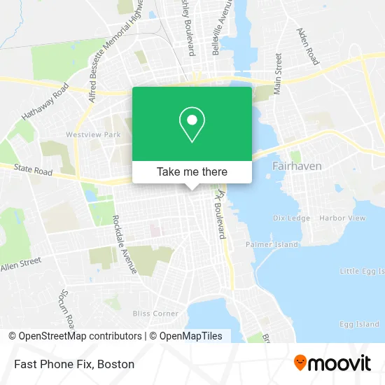
See Fast Phone Fix, New Bedford, on the map
Public Transit to Fast Phone Fix in New Bedford
Wondering how to get to Fast Phone Fix in New Bedford? Moovit helps you find the best way to get to Fast Phone Fix with step-by-step directions from the nearest public transit station.
Moovit provides free maps and live directions to help you navigate through your city. View schedules, routes, timetables, and find out how long does it take to get to Fast Phone Fix in real time.
Looking for the nearest stop or station to Fast Phone Fix? Check out this list of stops closest to your destination: Pleasant St And Mason St; Pleasant St And Spring St; Union St And Orchard St; Union St And Cottage St; SRTA; SRTA Terminal New Bedford; New Bedford, MA; Church Street; Cuttyhunk Ferry Pier.
Bus: 208, 9, PETER PAN, WNB, 201, 205, 203, 299.Train: FALL RIVER/NEW BEDFORD.Ferry: SEASTREAK, SEASTREAK.
Want to see if there’s another route that gets you there at an earlier time? Moovit helps you find alternative routes or times. Get directions from and directions to Fast Phone Fix easily from the Moovit App or Website.
We make riding to Fast Phone Fix easy, which is why over 1.7 million users, including users in New Bedford, trust Moovit as the best app for public transit. You don’t need to download an individual bus app or train app, Moovit is your all-in-one transit app that helps you find the best bus time or train time available.
For information on prices of bus and train, costs and ride fares to Fast Phone Fix, please check the Moovit app.
Use the app to navigate to popular places including to the airport, hospital, stadium, grocery store, mall, coffee shop, school, college, and university.
Fast Phone Fix Address: 283 Union St street in New Bedford
- Spot Restaurant,
- Labaron Hairdressing Academy,
- Ground O Barbershop,
- TRC Staffing Svc,
- Full Steam Staffing,
- Faria Walter P,
- Kevin Attorney Medeiros at Law,
- Smola Peter Atty,
- Regal Reatly Group,
- Millennium Realty Firm LLC,
- World Insurance,
- Mary's Restaurant,
- Fortuna Grill,
- WNB One Radio,
- Law Offices of William P. Orlacchio,
- Coveney & McNamara, PC,
- Face&Body by Liz,
- Tammi Meehan, LMHC,
- Umass Dartmouth,
- Crowley-Weaver Insurance Agency
Places Near Fast Phone Fix (New Bedford)
- North End, Boston,
- Quincy Market, Boston,
- Wilbur Theatre, Boston,
- Massachusetts General Hospital, Boston,
- Boston Convention & Exhibition Center, Boston,
- Wang Theater, Boston,
- Isabella Stewart Gardner Museum, Boston,
- Td Garden, Boston,
- Boston Medical Center, Boston,
- House Of Blues, Boston,
- Leader Bank Pavilion (Leader Bank Pavillion), Boston,
- Seaport District, Boston,
- Cheers, Boston,
- Boston Common, Boston,
- Faneuil Hall, Boston,
- Museum Of Science, Boston,
- Castle Island, Boston,
- Prudential Center, Boston,
- Boston Children's Hospital, Boston,
- Mgm Music Hall, Boston
How to get to popular places in Boston with public transit
Get around New Bedford by public transit!
Traveling around New Bedford has never been so easy. See step by step directions as you travel to any attraction, street or major public transit station. View bus and train schedules, arrival times, service alerts and detailed routes on a map, so you know exactly how to get to anywhere in New Bedford.
When traveling to any destination around New Bedford use Moovit's Live Directions with Get Off Notifications to know exactly where and how far to walk, how long to wait for your line, and how many stops are left. Moovit will alert you when it's time to get off — no need to constantly re-check whether yours is the next stop.
Wondering how to use public transit in New Bedford or how to pay for public transit in New Bedford? Moovit public transit app can help you navigate your way with public transit easily, and at minimum cost. It includes public transit fees, ticket prices, and costs. Looking for a map of New Bedford public transit lines? Moovit public transit app shows all public transit maps in New Bedford with all Bus, Train, Subway and Ferry routes and stops on an interactive map.
Boston has 4 transit type(s), including: Bus, Train, Subway and Ferry, operated by several transit agencies, including MBTA, Southeastern Regional Transit Authority, MetroWest Regional Transit Authority, Rhode Island Public Transit Authority, WRTA, Lowell Regional Transit Authority, Merrimack Valley Transit, Montachusett Regional Transit Authority, Cape Cod Regional Transit Authority, Brockton Area Transit Authority, Martha's Vineyard Transit Authority, the WAVE - Nantucket Regional Transit Authority, GATRA, Cape Ann Transportation Authority and Massport