Directions to Fb Financial Group (Framingham) with public transportation
The following transit lines have routes that pass near Fb Financial Group
 Bus: 04N, 05, 07, 04S, NCS.
- Train: FRAMINGHAM/WORCESTER, LAKE SHORE LIMITED.
How to get to Fb Financial Group by bus?
Click on the bus route to see step by step directions with maps, line arrival times and updated time schedules.
From Boston Marriott Newton, Newton
112 minFrom Wellesley, MA, Wellesley
84 minFrom Hopkinton, MA, Hopkinton
49 minFrom Newton Wellesley Hospital Green Building, Newton
90 minFrom Babson College, Wellesley
81 minFrom Bose Corp, Framingham
66 minFrom I-95 / Route 128 & Route 16 Interchange (Exit 21), Newton
86 minFrom Staples Corporate HQ, Framingham
73 min
How to get to Fb Financial Group by train?
Click on the train route to see step by step directions with maps, line arrival times and updated time schedules.
Bus stops near Fb Financial Group in Framingham
Train stations near Fb Financial Group in Framingham
Bus lines to Fb Financial Group in Framingham
What are the closest stations to Fb Financial Group?
The closest stations to Fb Financial Group are:
- Waverly St. at N 1 Cyclery is 1357 yards away, 16 min walk.
- West Natick Mbta Station is 1696 yards away, 20 min walk.
- Second St at Rec Center is 2866 yards away, 34 min walk.
- West Natick is 4183 yards away, 49 min walk.
- Framingham Amtrak is 5246 yards away, 62 min walk.
Which bus lines stop near Fb Financial Group?
These bus lines stop near Fb Financial Group: 04N, 05, 07.
Which train line stops near Fb Financial Group?
FRAMINGHAM/WORCESTER (#521 | Worcester)
What time is the first train to Fb Financial Group in Framingham?
The FRAMINGHAM/WORCESTER is the first train that goes to Fb Financial Group in Framingham. It stops nearby at 4:54 AM.
What time is the last train to Fb Financial Group in Framingham?
The LAKE SHORE LIMITED is the last train that goes to Fb Financial Group in Framingham. It stops nearby at 8:00 PM.
What time is the first bus to Fb Financial Group in Framingham?
The 04S is the first bus that goes to Fb Financial Group in Framingham. It stops nearby at 6:14 AM.
What time is the last bus to Fb Financial Group in Framingham?
The 04S is the last bus that goes to Fb Financial Group in Framingham. It stops nearby at 9:42 PM.
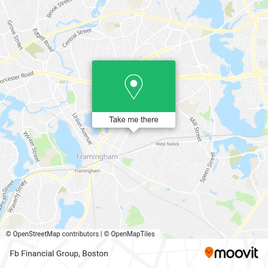
See Fb Financial Group, Framingham, on the map
Public Transit to Fb Financial Group in Framingham
Wondering how to get to Fb Financial Group in Framingham? Moovit helps you find the best way to get to Fb Financial Group with step-by-step directions from the nearest public transit station.
Moovit provides free maps and live directions to help you navigate through your city. View schedules, routes, timetables, and find out how long does it take to get to Fb Financial Group in real time.
Looking for the nearest stop or station to Fb Financial Group? Check out this list of stops closest to your destination: Waverly St. at N 1 Cyclery; West Natick Mbta Station; Second St at Rec Center; West Natick; Framingham Amtrak.
Bus: 04N, 05, 07, 04S, NCS, 10, 11.Train: FRAMINGHAM/WORCESTER, LAKE SHORE LIMITED.
Want to see if there’s another route that gets you there at an earlier time? Moovit helps you find alternative routes or times. Get directions from and directions to Fb Financial Group easily from the Moovit App or Website.
We make riding to Fb Financial Group easy, which is why over 1.7 million users, including users in Framingham, trust Moovit as the best app for public transit. You don’t need to download an individual bus app or train app, Moovit is your all-in-one transit app that helps you find the best bus time or train time available.
For information on prices of bus and train, costs and ride fares to Fb Financial Group, please check the Moovit app.
Use the app to navigate to popular places including to the airport, hospital, stadium, grocery store, mall, coffee shop, school, college, and university.
Fb Financial Group Address: 166 Arthur St street in Framingham
- Keep Natick Beautiful,
- MWRTA Central Hub,
- Caswell Plumbing and Heating,
- Dr Danielle Brook MD,
- Physical Therapy TMD Rehabilitation,
- Renewed Baptist Church,
- Msa Transport,
- The Groomery,
- Carby's Lumber,
- Andina Cafe,
- Tint,
- 2nd St / Beaver Terrace Cir,
- Plumbers Financing Plans,
- Abacus Financial Planning Solutions,
- Lillys Painting,
- MBTA Commuter Rail #508,
- Boston Pro Builders,
- Dennison Triangle,
- MBTA West Natick Station,
- Family Worship Center
Places Near Fb Financial Group (Framingham)
- Castle Island, Boston,
- Wang Theater, Boston,
- Museum Of Science, Boston,
- Wilbur Theatre, Boston,
- Massachusetts General Hospital, Boston,
- Boston Medical Center, Boston,
- Cheers, Boston,
- Mgm Music Hall, Boston,
- Boston Children's Hospital, Boston,
- Td Garden, Boston,
- House Of Blues, Boston,
- Faneuil Hall, Boston,
- Leader Bank Pavilion (Leader Bank Pavillion), Boston,
- Boston Convention & Exhibition Center, Boston,
- Seaport District, Boston,
- Quincy Market, Boston,
- Prudential Center, Boston,
- North End, Boston,
- Isabella Stewart Gardner Museum, Boston,
- Boston Common, Boston
How to get to popular places in Boston with public transit
Get around Framingham by public transit!
Traveling around Framingham has never been so easy. See step by step directions as you travel to any attraction, street or major public transit station. View bus and train schedules, arrival times, service alerts and detailed routes on a map, so you know exactly how to get to anywhere in Framingham.
When traveling to any destination around Framingham use Moovit's Live Directions with Get Off Notifications to know exactly where and how far to walk, how long to wait for your line, and how many stops are left. Moovit will alert you when it's time to get off — no need to constantly re-check whether yours is the next stop.
Wondering how to use public transit in Framingham or how to pay for public transit in Framingham? Moovit public transit app can help you navigate your way with public transit easily, and at minimum cost. It includes public transit fees, ticket prices, and costs. Looking for a map of Framingham public transit lines? Moovit public transit app shows all public transit maps in Framingham with all Bus, Train, Subway and Ferry routes and stops on an interactive map.
Boston has 4 transit type(s), including: Bus, Train, Subway and Ferry, operated by several transit agencies, including MBTA, Southeastern Regional Transit Authority, MetroWest Regional Transit Authority, Rhode Island Public Transit Authority, WRTA, Lowell Regional Transit Authority, Merrimack Valley Transit, Montachusett Regional Transit Authority, Cape Cod Regional Transit Authority, Brockton Area Transit Authority, Martha's Vineyard Transit Authority, the WAVE - Nantucket Regional Transit Authority, GATRA, Cape Ann Transportation Authority and Massport