How to get to Fbi - Boston by bus?
Click on the bus route to see step by step directions with maps, line arrival times and updated time schedules.
From The Lawn on D, Boston
34 minFrom Sonia, Boston
92 minFrom Legal Sea Foods, Boston
58 minFrom Whole Foods Market, Boston
57 minFrom Hotel Hilton Boston/Woburn, Boston
77 minFrom Staypineapple, Boston
57 minFrom Warren St, Boston
79 minFrom MSPCA Angell Animal Medical Center, Boston
79 minFrom Belmont, MA, Belmont
75 minFrom Le Meridien Cambridge-Mit, Cambridge
74 min
How to get to Fbi - Boston by subway?
Click on the subway route to see step by step directions with maps, line arrival times and updated time schedules.
From The Lawn on D, Boston
84 minFrom Sonia, Boston
106 minFrom Legal Sea Foods, Boston
69 minFrom Whole Foods Market, Boston
63 minFrom Hotel Hilton Boston/Woburn, Boston
73 minFrom Staypineapple, Boston
63 minFrom Warren St, Boston
94 minFrom MSPCA Angell Animal Medical Center, Boston
82 minFrom Le Meridien Cambridge-Mit, Cambridge
72 min
Bus stops near Fbi - Boston in Chelsea
Train station near Fbi - Boston in Chelsea
- Chelsea, 13 min walk,VIEW
Subway station near Fbi - Boston in Chelsea
- Wood Island, 44 min walk,VIEW
Bus lines to Fbi - Boston in Chelsea
What are the closest stations to Fbi - Boston?
The closest stations to Fbi - Boston are:
- Spruce St @ Everett Ave is 48 yards away, 1 min walk.
- Bellingham Square is 107 yards away, 2 min walk.
- Market Basket/Chelsea Station is 445 yards away, 6 min walk.
- Chelsea is 1043 yards away, 13 min walk.
- Wood Island is 3707 yards away, 44 min walk.
Which bus lines stop near Fbi - Boston?
These bus lines stop near Fbi - Boston: 104, 111, 112, SL3.
Which train line stops near Fbi - Boston?
NEWBURYPORT/ROCKPORT (#125 | Newburyport)
Which subway line stops near Fbi - Boston?
BLUE LINE (Wonderland)
What’s the nearest train station to Fbi - Boston in Chelsea?
The nearest train station to Fbi - Boston in Chelsea is Chelsea. It’s a 13 min walk away.
What’s the nearest bus station to Fbi - Boston in Chelsea?
The nearest bus station to Fbi - Boston in Chelsea is Spruce St @ Everett Ave. It’s a 1 min walk away.
What time is the first subway to Fbi - Boston in Chelsea?
The BLUE LINE is the first subway that goes to Fbi - Boston in Chelsea. It stops nearby at 5:10 AM.
What time is the last subway to Fbi - Boston in Chelsea?
The BLUE LINE is the last subway that goes to Fbi - Boston in Chelsea. It stops nearby at 2:01 AM.
What time is the first train to Fbi - Boston in Chelsea?
The NEWBURYPORT/ROCKPORT is the first train that goes to Fbi - Boston in Chelsea. It stops nearby at 5:40 AM.
What time is the last train to Fbi - Boston in Chelsea?
The NEWBURYPORT/ROCKPORT is the last train that goes to Fbi - Boston in Chelsea. It stops nearby at 12:06 AM.
What time is the first bus to Fbi - Boston in Chelsea?
The 104 is the first bus that goes to Fbi - Boston in Chelsea. It stops nearby at 4:35 AM.
What time is the last bus to Fbi - Boston in Chelsea?
The 104 is the last bus that goes to Fbi - Boston in Chelsea. It stops nearby at 1:23 AM.
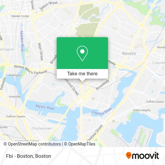
See Fbi - Boston, Chelsea, on the map
Public Transit to Fbi - Boston in Chelsea
Wondering how to get to Fbi - Boston in Chelsea? Moovit helps you find the best way to get to Fbi - Boston with step-by-step directions from the nearest public transit station.
Moovit provides free maps and live directions to help you navigate through your city. View schedules, routes, timetables, and find out how long does it take to get to Fbi - Boston in real time.
Looking for the nearest stop or station to Fbi - Boston? Check out this list of stops closest to your destination: Spruce St @ Everett Ave; Bellingham Square; Market Basket/Chelsea Station; Chelsea; Wood Island.
Bus: 104, 111, 112, SL3, 114, LOWER MYSTIC LINK.Train: NEWBURYPORT/ROCKPORT.Subway: BLUE LINE.
Want to see if there’s another route that gets you there at an earlier time? Moovit helps you find alternative routes or times. Get directions from and directions to Fbi - Boston easily from the Moovit App or Website.
We make riding to Fbi - Boston easy, which is why over 1.7 million users, including users in Chelsea, trust Moovit as the best app for public transit. You don’t need to download an individual bus app or train app, Moovit is your all-in-one transit app that helps you find the best bus time or train time available.
For information on prices of bus, subway and train, costs and ride fares to Fbi - Boston, please check the Moovit app.
Use the app to navigate to popular places including to the airport, hospital, stadium, grocery store, mall, coffee shop, school, college, and university.
Fbi - Boston Address: 201 Maple St street in Chelsea
- Residence Inn by Marriott Boston Logan Airport Chelsea,
- Fairfield Inn & Suites by Marriott Boston Logan Airport / Chelsea,
- Fairfield Inn & Suites-Boston Logan,
- Massachusetts General Hospital, Chelsea HealthCare Center,
- DoubleTree by Hilton Boston Logan Airport Chelsea,
- Everett Ave / MBTA Silver Line,
- MGH Chelsea Healthcare Center,
- Covid-19 Testing Site: MGH Chelsea Healthcare Center,
- MGH Chelsea Healthcare Center (Connolly Mary R NP-Chelsea Healthcare Center),
- Atm Market Basket,
- The Children's Place Outlet,
- Nelson Alvarado,
- Homewood Suites by Hilton Boston Logan Airport Chelsea,
- Joseph B Gimbel Podiatrist,
- Extensiones Massachusetts,
- Boston Orthopaedic PC,
- Quick Heating & Cooling Repair,
- HomeGoods (Home Goods),
- Chelsea, MA,
- Information Technology Div
Places Near Fbi - Boston (Chelsea)
- Boston Medical Center, Boston,
- Leader Bank Pavilion (Leader Bank Pavillion), Boston,
- House Of Blues, Boston,
- Mgm Music Hall, Boston,
- Museum Of Science, Boston,
- Castle Island, Boston,
- Boston Convention & Exhibition Center, Boston,
- Isabella Stewart Gardner Museum, Boston,
- Td Garden, Boston,
- Wang Theater, Boston,
- Massachusetts General Hospital, Boston,
- Quincy Market, Boston,
- Boston Common, Boston,
- North End, Boston,
- Wilbur Theatre, Boston,
- Seaport District, Boston,
- Cheers, Boston,
- Faneuil Hall, Boston,
- Boston Children's Hospital, Boston,
- Prudential Center, Boston
How to get to popular places in Boston with public transit
Get around Chelsea by public transit!
Traveling around Chelsea has never been so easy. See step by step directions as you travel to any attraction, street or major public transit station. View bus and train schedules, arrival times, service alerts and detailed routes on a map, so you know exactly how to get to anywhere in Chelsea.
When traveling to any destination around Chelsea use Moovit's Live Directions with Get Off Notifications to know exactly where and how far to walk, how long to wait for your line, and how many stops are left. Moovit will alert you when it's time to get off — no need to constantly re-check whether yours is the next stop.
Wondering how to use public transit in Chelsea or how to pay for public transit in Chelsea? Moovit public transit app can help you navigate your way with public transit easily, and at minimum cost. It includes public transit fees, ticket prices, and costs. Looking for a map of Chelsea public transit lines? Moovit public transit app shows all public transit maps in Chelsea with all Bus, Train, Subway and Ferry routes and stops on an interactive map.
Boston has 4 transit type(s), including: Bus, Train, Subway and Ferry, operated by several transit agencies, including MBTA, Southeastern Regional Transit Authority, MetroWest Regional Transit Authority, Rhode Island Public Transit Authority, WRTA, Lowell Regional Transit Authority, Merrimack Valley Transit, Montachusett Regional Transit Authority, Cape Cod Regional Transit Authority, Brockton Area Transit Authority, Martha's Vineyard Transit Authority, the WAVE - Nantucket Regional Transit Authority, GATRA, Cape Ann Transportation Authority and Massport