Directions to Fdo (Boston) with public transportation
The following transit lines have routes that pass near Fdo
 Bus: 10, 4, 9, SL2, 7.
- Train: FRAMINGHAM/WORCESTER, NEEDHAM, PROVIDENCE/STOUGHTON.
- Subway: ORANGE LINE, RED LINE.
- Ferry: FAST FERRY, QUINCY FERRY, WINTHROP FERRY, WINTHROP/QUINCY FERRY, EAST.
How to get to Fdo by bus?
Click on the bus route to see step by step directions with maps, line arrival times and updated time schedules.
From Fresh Pond Mall, Cambridge
98 minFrom Mount Auburn, Cambridge
69 minFrom MGM Music Hall at Fenway, Boston
57 minFrom Brighton District Court, Boston
62 minFrom Museum Of Fine Arts MBTA Station, Boston
57 minFrom Apple Cinemas, Cambridge
112 minFrom Brigham and Women's Faulkner Hospital, Boston
87 minFrom Revere, MA, Revere
49 minFrom Medford Square, Medford
55 minFrom Sweet Cheeks Q, Boston
67 min
How to get to Fdo by train?
Click on the train route to see step by step directions with maps, line arrival times and updated time schedules.
How to get to Fdo by subway?
Click on the subway route to see step by step directions with maps, line arrival times and updated time schedules.
From Fresh Pond Mall, Cambridge
65 minFrom MGM Music Hall at Fenway, Boston
60 minFrom Brighton District Court, Boston
92 minFrom Museum Of Fine Arts MBTA Station, Boston
59 minFrom Apple Cinemas, Cambridge
64 minFrom Brigham and Women's Faulkner Hospital, Boston
75 minFrom Medford Square, Medford
86 minFrom Sweet Cheeks Q, Boston
65 min
Bus stops near Fdo in Boston
Ferry stations near Fdo in Boston
Bus lines to Fdo in Boston
What are the closest stations to Fdo?
The closest stations to Fdo are:
- Northern Ave @ D St is 122 yards away, 2 min walk.
- Northern Ave @ Tide St is 132 yards away, 3 min walk.
- Summer St @ Drydock Ave is 589 yards away, 8 min walk.
- Silver Line Way is 876 yards away, 11 min walk.
- World Trade Center Pier, Boston, MA is 1364 yards away, 17 min walk.
- Seaport (Fan Pier) is 1864 yards away, 23 min walk.
Which bus lines stop near Fdo?
These bus lines stop near Fdo: 10, 4, 9, SL2.
Which train lines stop near Fdo?
These train lines stop near Fdo: FRAMINGHAM/WORCESTER, NEEDHAM, PROVIDENCE/STOUGHTON.
Which subway lines stop near Fdo?
These subway lines stop near Fdo: ORANGE LINE, RED LINE.
What’s the nearest bus station to Fdo in Boston?
The nearest bus station to Fdo in Boston is Northern Ave @ D St. It’s a 2 min walk away.
What’s the nearest ferry station to Fdo in Boston?
The nearest ferry station to Fdo in Boston is World Trade Center Pier, Boston, MA. It’s a 17 min walk away.
What time is the first bus to Fdo in Boston?
The SLW is the first bus that goes to Fdo in Boston. It stops nearby at 4:14 AM.
What time is the last bus to Fdo in Boston?
The SL1 is the last bus that goes to Fdo in Boston. It stops nearby at 1:29 AM.
What time is the first ferry to Fdo in Boston?
The EAST is the first ferry that goes to Fdo in Boston. It stops nearby at 6:01 AM.
What time is the last ferry to Fdo in Boston?
The FAST FERRY is the last ferry that goes to Fdo in Boston. It stops nearby at 9:05 PM.
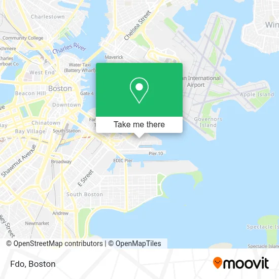
See Fdo, Boston, on the map
Public Transit to Fdo in Boston
Wondering how to get to Fdo in Boston? Moovit helps you find the best way to get to Fdo with step-by-step directions from the nearest public transit station.
Moovit provides free maps and live directions to help you navigate through your city. View schedules, routes, timetables, and find out how long does it take to get to Fdo in real time.
Looking for the nearest stop or station to Fdo? Check out this list of stops closest to your destination: Northern Ave @ D St; Northern Ave @ Tide St; Summer St @ Drydock Ave; Silver Line Way; World Trade Center Pier; Seaport (Fan Pier).
Bus: 10, 4, 9, SL2, 7, SL1, SL3, SLW.Train: FRAMINGHAM/WORCESTER, NEEDHAM, PROVIDENCE/STOUGHTON.Subway: ORANGE LINE, RED LINE.Ferry: FAST FERRY, QUINCY FERRY, WINTHROP FERRY, WINTHROP/QUINCY FERRY, EAST, LOVEJOY - FAN PIER - PIER 10.
Want to see if there’s another route that gets you there at an earlier time? Moovit helps you find alternative routes or times. Get directions from and directions to Fdo easily from the Moovit App or Website.
We make riding to Fdo easy, which is why over 1.7 million users, including users in Boston, trust Moovit as the best app for public transit. You don’t need to download an individual bus app or train app, Moovit is your all-in-one transit app that helps you find the best bus time or train time available.
For information on prices of bus, subway and train, costs and ride fares to Fdo, please check the Moovit app.
Use the app to navigate to popular places including to the airport, hospital, stadium, grocery store, mall, coffee shop, school, college, and university.
Fdo Address: 1 Design Center Pl Ste 129 street in Boston
- Isq Phase II,
- Cirque du Soleil,
- Boston Sword & Tuna,
- Araho Transfer,
- Harpoon Brewery,
- Harpoon Brewery (Harpoon St Patty's Fest),
- Harpoon Brewery Tour,
- 21 Dry Dock Avenue,
- Jubali,
- Autodesk,
- Cowtan & Tout,
- Black Falcon Cruise Terminal,
- Merida,
- New England Chpter Member Services,
- Stark Carpet,
- Sail Boston,
- Jules Place,
- Flour Bakery,
- Drydock Ave Parking,
- Raymond L. Flynn Black Falcon Cruise Terminal
Places Near Fdo (Boston)
- Boston Medical Center, Boston,
- Seaport District, Boston,
- Faneuil Hall, Boston,
- Castle Island, Boston,
- Boston Convention & Exhibition Center, Boston,
- Museum Of Science, Boston,
- Massachusetts General Hospital, Boston,
- Cheers, Boston,
- Mgm Music Hall, Boston,
- Isabella Stewart Gardner Museum, Boston,
- House Of Blues, Boston,
- Boston Common, Boston,
- Leader Bank Pavilion (Leader Bank Pavillion), Boston,
- North End, Boston,
- Quincy Market, Boston,
- Boston Children's Hospital, Boston,
- Wang Theater, Boston,
- Prudential Center, Boston,
- Td Garden, Boston,
- Wilbur Theatre, Boston
How to get to popular places in Boston with public transit
Get around Boston by public transit!
Traveling around Boston has never been so easy. See step by step directions as you travel to any attraction, street or major public transit station. View bus and train schedules, arrival times, service alerts and detailed routes on a map, so you know exactly how to get to anywhere in Boston.
When traveling to any destination around Boston use Moovit's Live Directions with Get Off Notifications to know exactly where and how far to walk, how long to wait for your line, and how many stops are left. Moovit will alert you when it's time to get off — no need to constantly re-check whether yours is the next stop.
Wondering how to use public transit in Boston or how to pay for public transit in Boston? Moovit public transit app can help you navigate your way with public transit easily, and at minimum cost. It includes public transit fees, ticket prices, and costs. Looking for a map of Boston public transit lines? Moovit public transit app shows all public transit maps in Boston with all Bus, Train, Subway and Ferry routes and stops on an interactive map.
Boston has 4 transit type(s), including: Bus, Train, Subway and Ferry, operated by several transit agencies, including MBTA, Southeastern Regional Transit Authority, MetroWest Regional Transit Authority, Rhode Island Public Transit Authority, WRTA, Lowell Regional Transit Authority, Merrimack Valley Transit, Montachusett Regional Transit Authority, Cape Cod Regional Transit Authority, Brockton Area Transit Authority, Martha's Vineyard Transit Authority, the WAVE - Nantucket Regional Transit Authority, GATRA, Cape Ann Transportation Authority and Massport