Directions to Feast & Fettle Fridge (Newton) with public transportation
The following transit lines have routes that pass near Feast & Fettle Fridge
 Bus: 504, 553, 554, 556, 59.
- Train: FRAMINGHAM/WORCESTER.
- Subway: GREEN LINE D, GREEN LINE B.
How to get to Feast & Fettle Fridge by bus?
Click on the bus route to see step by step directions with maps, line arrival times and updated time schedules.
From Winter Hill, Somerville
104 minFrom Charles River Esplanade, Boston
46 minFrom Harvard Stadium, Boston
40 minFrom O'Bryant High School, Boston
51 minFrom Inman Sq, Cambridge
53 minFrom Terrace Room, Paige Hall, Medford
82 minFrom Trader Joe's, Boston
35 minFrom Brattle St / Harvard Sq, Cambridge
39 minFrom Rochambeau, Boston
37 minFrom Massachusetts College of Art and Design, Boston
45 min
How to get to Feast & Fettle Fridge by train?
Click on the train route to see step by step directions with maps, line arrival times and updated time schedules.
How to get to Feast & Fettle Fridge by subway?
Click on the subway route to see step by step directions with maps, line arrival times and updated time schedules.
From Winter Hill, Somerville
114 minFrom Charles River Esplanade, Boston
89 minFrom Harvard Stadium, Boston
111 minFrom O'Bryant High School, Boston
99 minFrom Inman Sq, Cambridge
109 minFrom Terrace Room, Paige Hall, Medford
110 minFrom Trader Joe's, Boston
75 minFrom Brattle St / Harvard Sq, Cambridge
96 minFrom Rochambeau, Boston
77 minFrom Massachusetts College of Art and Design, Boston
88 min
Bus stops near Feast & Fettle Fridge in Newton
Train station near Feast & Fettle Fridge in Newton
- West Newton, 20 min walk,VIEW
Subway stations near Feast & Fettle Fridge in Newton
Bus lines to Feast & Fettle Fridge in Newton
What are the closest stations to Feast & Fettle Fridge?
The closest stations to Feast & Fettle Fridge are:
- Walnut St @ Austin St is 254 yards away, 4 min walk.
- Walnut St @ Watertown St is 372 yards away, 5 min walk.
- Washington St @ Walnut St is 379 yards away, 5 min walk.
- West Newton is 1631 yards away, 20 min walk.
- Boston College is 2925 yards away, 35 min walk.
- Newton Centre is 3175 yards away, 38 min walk.
Which bus lines stop near Feast & Fettle Fridge?
These bus lines stop near Feast & Fettle Fridge: 504, 553, 554, 556, 59.
Which train line stops near Feast & Fettle Fridge?
FRAMINGHAM/WORCESTER (#521 | Worcester)
Which subway line stops near Feast & Fettle Fridge?
GREEN LINE D (Riverside)
What’s the nearest train station to Feast & Fettle Fridge in Newton?
The nearest train station to Feast & Fettle Fridge in Newton is West Newton. It’s a 20 min walk away.
What’s the nearest bus station to Feast & Fettle Fridge in Newton?
The nearest bus station to Feast & Fettle Fridge in Newton is Walnut St @ Austin St. It’s a 4 min walk away.
What time is the first subway to Feast & Fettle Fridge in Newton?
The GREEN LINE D is the first subway that goes to Feast & Fettle Fridge in Newton. It stops nearby at 4:52 AM.
What time is the last subway to Feast & Fettle Fridge in Newton?
The GREEN LINE D is the last subway that goes to Feast & Fettle Fridge in Newton. It stops nearby at 2:39 AM.
What time is the first train to Feast & Fettle Fridge in Newton?
The FRAMINGHAM/WORCESTER is the first train that goes to Feast & Fettle Fridge in Newton. It stops nearby at 5:22 AM.
What time is the last train to Feast & Fettle Fridge in Newton?
The FRAMINGHAM/WORCESTER is the last train that goes to Feast & Fettle Fridge in Newton. It stops nearby at 12:20 AM.
What time is the first bus to Feast & Fettle Fridge in Newton?
The 554 is the first bus that goes to Feast & Fettle Fridge in Newton. It stops nearby at 6:02 AM.
What time is the last bus to Feast & Fettle Fridge in Newton?
The 553 is the last bus that goes to Feast & Fettle Fridge in Newton. It stops nearby at 9:07 PM.
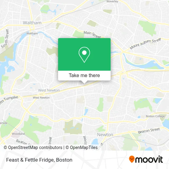
See Feast & Fettle Fridge, Newton, on the map
Public Transit to Feast & Fettle Fridge in Newton
Wondering how to get to Feast & Fettle Fridge in Newton? Moovit helps you find the best way to get to Feast & Fettle Fridge with step-by-step directions from the nearest public transit station.
Moovit provides free maps and live directions to help you navigate through your city. View schedules, routes, timetables, and find out how long does it take to get to Feast & Fettle Fridge in real time.
Looking for the nearest stop or station to Feast & Fettle Fridge? Check out this list of stops closest to your destination: Walnut St @ Austin St; Walnut St @ Watertown St; Washington St @ Walnut St; West Newton; Boston College; Newton Centre.
Bus: 504, 553, 554, 556, 59.Train: FRAMINGHAM/WORCESTER.Subway: GREEN LINE D, GREEN LINE B.
Want to see if there’s another route that gets you there at an earlier time? Moovit helps you find alternative routes or times. Get directions from and directions to Feast & Fettle Fridge easily from the Moovit App or Website.
We make riding to Feast & Fettle Fridge easy, which is why over 1.7 million users, including users in Newton, trust Moovit as the best app for public transit. You don’t need to download an individual bus app or train app, Moovit is your all-in-one transit app that helps you find the best bus time or train time available.
For information on prices of bus, subway and train, costs and ride fares to Feast & Fettle Fridge, please check the Moovit app.
Use the app to navigate to popular places including to the airport, hospital, stadium, grocery store, mall, coffee shop, school, college, and university.
Feast & Fettle Fridge Address: 811 Washington St street in Newton
- Laura Pelton-Sweet, Counselor,
- Cellular Solutions,
- VIP Skin Lab,
- Massachusetts Health Council,
- Healing Center,
- Selin Kepkep, Psychologist,
- Building Blocks,
- Lumaé Skin & Bodyworks,
- Emily Lapolice, Licsw, Ryt,
- Mida - Newton,
- Dogish,
- Plant Parenthood,
- Power Appliance Services,
- Roadstone Masonry and Building,
- Children Dsylexia Center,
- Waltham Triad Lodge af & am,
- RE/MAX,
- Newtonville 25 Commercial Locksmith,
- Ankfit,
- Newtonville, Massachusetts
Places Near Feast & Fettle Fridge (Newton)
- Wilbur Theatre, Boston,
- Boston Convention & Exhibition Center, Boston,
- Castle Island, Boston,
- Cheers, Boston,
- Boston Common, Boston,
- Isabella Stewart Gardner Museum, Boston,
- Museum Of Science, Boston,
- Td Garden, Boston,
- House Of Blues, Boston,
- Boston Medical Center, Boston,
- North End, Boston,
- Quincy Market, Boston,
- Faneuil Hall, Boston,
- Prudential Center, Boston,
- Mgm Music Hall, Boston,
- Seaport District, Boston,
- Boston Children's Hospital, Boston,
- Wang Theater, Boston,
- Massachusetts General Hospital, Boston,
- Leader Bank Pavilion (Leader Bank Pavillion), Boston
How to get to popular places in Boston with public transit
Get around Newton by public transit!
Traveling around Newton has never been so easy. See step by step directions as you travel to any attraction, street or major public transit station. View bus and train schedules, arrival times, service alerts and detailed routes on a map, so you know exactly how to get to anywhere in Newton.
When traveling to any destination around Newton use Moovit's Live Directions with Get Off Notifications to know exactly where and how far to walk, how long to wait for your line, and how many stops are left. Moovit will alert you when it's time to get off — no need to constantly re-check whether yours is the next stop.
Wondering how to use public transit in Newton or how to pay for public transit in Newton? Moovit public transit app can help you navigate your way with public transit easily, and at minimum cost. It includes public transit fees, ticket prices, and costs. Looking for a map of Newton public transit lines? Moovit public transit app shows all public transit maps in Newton with all Bus, Train, Subway and Ferry routes and stops on an interactive map.
Boston has 4 transit type(s), including: Bus, Train, Subway and Ferry, operated by several transit agencies, including MBTA, Southeastern Regional Transit Authority, MetroWest Regional Transit Authority, Rhode Island Public Transit Authority, WRTA, Lowell Regional Transit Authority, Merrimack Valley Transit, Montachusett Regional Transit Authority, Cape Cod Regional Transit Authority, Brockton Area Transit Authority, Martha's Vineyard Transit Authority, the WAVE - Nantucket Regional Transit Authority, GATRA, Cape Ann Transportation Authority and Massport