How to get to FedEx by bus?
Click on the bus route to see step by step directions with maps, line arrival times and updated time schedules.
From AFPA à Le Mans, Le Mans
55 minFrom Guetteloup - Pôle Santé Sud, Le Mans
50 minFrom École Maternelle Pauline Kergomard, Champagné
70 minFrom But, Mulsanne
76 minFrom Gymnase Des Bruyères, Le Mans
39 minFrom McDonald's, Mulsanne
75 minFrom GiFi, Mulsanne
76 minFrom Lycée Funay, Le Mans
39 minFrom La Pincenardière, Mulsanne
74 minFrom Rue Guy Bouriat, Le Mans
57 min
Bus stops near FedEx in Saint-Pavace
Bus lines to FedEx in Saint-Pavace
What are the closest stations to FedEx?
The closest stations to FedEx are:
- Lausanne is 207 meters away, 3 min walk.
- Hendaye is 492 meters away, 7 min walk.
- Jean Cocteau is 657 meters away, 9 min walk.
- Sables is 868 meters away, 12 min walk.
- Lafayette is 979 meters away, 13 min walk.
- Collège La Madeleine is 1343 meters away, 18 min walk.
Which bus lines stop near FedEx?
These bus lines stop near FedEx: 11, 15, 4.
What’s the nearest bus station to FedEx in Saint-Pavace?
The nearest bus station to FedEx in Saint-Pavace is Lausanne. It’s a 3 min walk away.
What time is the first light rail to FedEx in Saint-Pavace?
The T1 is the first light rail that goes to FedEx in Saint-Pavace. It stops nearby at 5:24 AM.
What time is the last light rail to FedEx in Saint-Pavace?
The T1 is the last light rail that goes to FedEx in Saint-Pavace. It stops nearby at 1:03 AM.
What time is the first bus to FedEx in Saint-Pavace?
The 4 is the first bus that goes to FedEx in Saint-Pavace. It stops nearby at 5:50 AM.
What time is the last bus to FedEx in Saint-Pavace?
The 4 is the last bus that goes to FedEx in Saint-Pavace. It stops nearby at 11:57 PM.
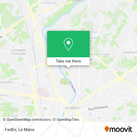
See FedEx, Saint-Pavace, on the map
Public Transit to FedEx in Saint-Pavace
Wondering how to get to FedEx in Saint-Pavace? Moovit helps you find the best way to get to FedEx with step-by-step directions from the nearest public transit station.
Moovit provides free maps and live directions to help you navigate through your city. View schedules, routes, timetables, and find out how long does it take to get to FedEx in real time.
Looking for the nearest stop or station to FedEx? Check out this list of stops closest to your destination: Lausanne; Hendaye; Jean Cocteau; Sables; Lafayette; Collège La Madeleine.
Bus: 11, 15, 4, 17, 131, 30, 7, 16, 20, T1, 102.
Want to see if there’s another route that gets you there at an earlier time? Moovit helps you find alternative routes or times. Get directions from and directions to FedEx easily from the Moovit App or Website.
We make riding to FedEx easy, which is why over 1.7 million users, including users in Saint-Pavace, trust Moovit as the best app for public transit. You don’t need to download an individual bus app or train app, Moovit is your all-in-one transit app that helps you find the best bus time or train time available.
For information on prices of bus and light rail, costs and ride fares to FedEx, please check the Moovit app.
Use the app to navigate to popular places including to the airport, hospital, stadium, grocery store, mall, coffee shop, school, college, and university.
FedEx Address: 1 Avenue du Maine 72190 Saint-Pavace street in Saint-Pavace
- Retif Sas à Saint-Pavace,
- Brasserie Bizarre,
- Bis le Mans,
- Rue de Belle Île 7,
- Au Service de l'Arbre,
- Intercaves,
- Beurdouche Denis,
- Charles Daubenton,
- Saffa Pizza,
- Gymnase De La Madeleine,
- Biogroup,
- Police Nationale,
- Rue de Carnac 17,
- L'Herberie,
- Demulder Éric,
- Fleurs Ô Naturel,
- Inalta,
- Parc François Mitterrand,
- Z.I. Champ Fleuri,
- Centre d'Animation l'Herberie
Places Near FedEx (Saint-Pavace)
- Saint-Saturnin, Saint-Saturnin,
- Hôpital, Le Mans,
- Auchan le Mans, La Chapelle-Saint-Aubin,
- Centre Hospitalier Du Mans, Le Mans,
- Gare SNCF du Mans, Le Mans,
- Maison D'Arrêt Le Mans - Les Croisettes, Coulaines,
- Clinique Pôle Santé Sud, Le Mans,
- Camp du 2e RIMa, Champagné,
- Pôle Santé Sud-Elsan, Le Mans,
- Family Village, Ruaudin,
- Clinique Du Pré, Le Mans,
- Coulaines, Coulaines,
- La Chapelle-Saint-Aubin, La Chapelle-Saint-Aubin,
- Université, Le Mans,
- Changé, Changé,
- E.Leclerc, Le Mans,
- Circuit des 24 Heures du Mans, Le Mans,
- Place des Jacobins (le Mans), Le Mans,
- Parc Des Expositions, Le Mans,
- Avenue Bollée, Le Mans
How to get to popular places in Le Mans with public transit
Get around Saint-Pavace by public transit!
Traveling around Saint-Pavace has never been so easy. See step by step directions as you travel to any attraction, street or major public transit station. View bus and train schedules, arrival times, service alerts and detailed routes on a map, so you know exactly how to get to anywhere in Saint-Pavace.
When traveling to any destination around Saint-Pavace use Moovit's Live Directions with Get Off Notifications to know exactly where and how far to walk, how long to wait for your line, and how many stops are left. Moovit will alert you when it's time to get off — no need to constantly re-check whether yours is the next stop.
Wondering how to use public transit in Saint-Pavace or how to pay for public transit in Saint-Pavace? Moovit public transit app can help you navigate your way with public transit easily, and at minimum cost. It includes public transit fees, ticket prices, and costs. Looking for a map of Saint-Pavace public transit lines? Moovit public transit app shows all public transit maps in Saint-Pavace with all Bus and Light Rail routes and stops on an interactive map.
Le Mans has 2 transit type(s), including: Bus and Light Rail, operated by several transit agencies, including SETRAM