How to get to FedEx by bus?
Click on the bus route to see step by step directions with maps, line arrival times and updated time schedules.
From 5454 Wisconsin, Montgomery County
72 minFrom Festival Grounds at RFK Campus, Washington
100 minFrom New New Hampshire Ave N, Washington
50 minFrom The Catholic University of America (CUA), Washington
121 minFrom Alexandria, VA, Alexandria
68 minFrom Glover Park Hotel Georgetown, Washington
50 minFrom Washington Yu Ying Public Charter School, Washington
99 minFrom Washington Convention Center (Walter E. Washington Convention Center), Washington
65 minFrom Avalon Theatre, Washington
94 minFrom The National Press Club, Washington
62 min
How to get to FedEx by metro?
Click on the metro route to see step by step directions with maps, line arrival times and updated time schedules.
From 5454 Wisconsin, Montgomery County
67 minFrom Festival Grounds at RFK Campus, Washington
69 minFrom New New Hampshire Ave N, Washington
51 minFrom The Catholic University of America (CUA), Washington
64 minFrom Alexandria, VA, Alexandria
68 minFrom Washington Yu Ying Public Charter School, Washington
77 minFrom Washington Convention Center (Walter E. Washington Convention Center), Washington
54 minFrom Avalon Theatre, Washington
77 minFrom The National Press Club, Washington
50 min
Bus stops near FedEx in Arlington County
Metro stations near FedEx in Arlington County
Bus lines to FedEx in Arlington County
What are the closest stations to FedEx?
The closest stations to FedEx are:
- S Uhle St Sb @ S Walter Reed Dr FS is 19 yards away, 1 min walk.
- S Courthouse Rd+2 St S is 242 yards away, 4 min walk.
- 2 St S+S Fillmore St is 612 yards away, 8 min walk.
- Clarendon is 623 yards away, 8 min walk.
- Arlington Cemetery is 4185 yards away, 50 min walk.
Which bus lines stop near FedEx?
These bus lines stop near FedEx: 42, 45, 77.
Which metro lines stop near FedEx?
These metro lines stop near FedEx: ORANGE, SILVER.
What’s the nearest metro station to FedEx in Arlington County?
The nearest metro station to FedEx in Arlington County is Clarendon. It’s a 8 min walk away.
What’s the nearest bus station to FedEx in Arlington County?
The nearest bus station to FedEx in Arlington County is S Uhle St Sb @ S Walter Reed Dr FS. It’s a 1 min walk away.
What time is the first metro to FedEx in Arlington County?
The YELLOW is the first metro that goes to FedEx in Arlington County. It stops nearby at 5:15 AM.
What time is the last metro to FedEx in Arlington County?
The BLUE is the last metro that goes to FedEx in Arlington County. It stops nearby at 12:18 AM.
What time is the first bus to FedEx in Arlington County?
The A12 is the first bus that goes to FedEx in Arlington County. It stops nearby at 6:00 AM.
What time is the last bus to FedEx in Arlington County?
The A12 is the last bus that goes to FedEx in Arlington County. It stops nearby at 12:10 AM.
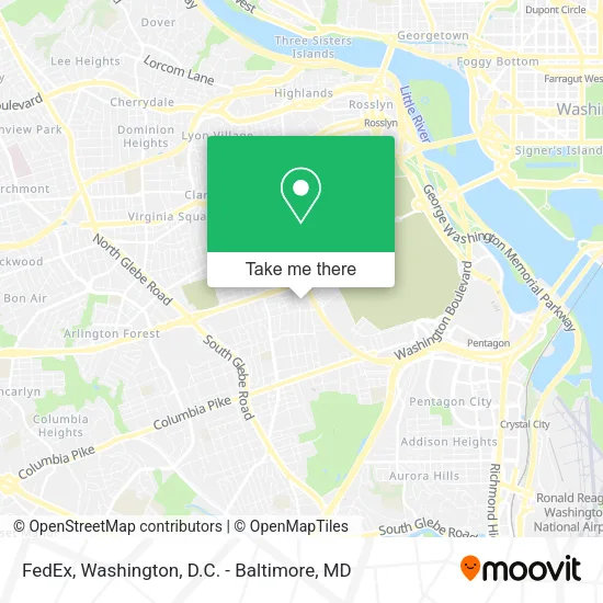
See FedEx, Arlington County, on the map
Public Transit to FedEx in Arlington County
Wondering how to get to FedEx in Arlington County? Moovit helps you find the best way to get to FedEx with step-by-step directions from the nearest public transit station.
Moovit provides free maps and live directions to help you navigate through your city. View schedules, routes, timetables, and find out how long does it take to get to FedEx in real time.
Looking for the nearest stop or station to FedEx? Check out this list of stops closest to your destination: S Uhle St Sb @ S Walter Reed Dr FS; S Courthouse Rd+2 St S; 2 St S+S Fillmore St; Clarendon; Arlington Cemetery.
Bus: 42, 45, 77, A49, A12.Metro: ORANGE, SILVER, BLUE.
Want to see if there’s another route that gets you there at an earlier time? Moovit helps you find alternative routes or times. Get directions from and directions to FedEx easily from the Moovit App or Website.
We make riding to FedEx easy, which is why over 1.5 million users, including users in Arlington County, trust Moovit as the best app for public transit. You don’t need to download an individual bus app or train app, Moovit is your all-in-one transit app that helps you find the best bus time or train time available.
For information on prices of bus and metro, costs and ride fares to FedEx, please check the Moovit app.
Use the app to navigate to popular places including to the airport, hospital, stadium, grocery store, mall, coffee shop, school, college, and university.
FedEx Address: 2110 Washington Blvd street in Arlington County
- Arlington Public Schools- Syphax Education Center,
- Penrose Neighborhood,
- S Court House Rd & S Walter Reed Dr,
- Army & A Force Base Fort Myer,
- Amazon Locker-Alfano,
- Hatfield Gate,
- Parcel Plus,
- Starbucks,
- Fort Myer,
- Joint Base Myer – Henderson Hall (JBMHH) | Fort Myer area,
- Penrose Park,
- Fort Tillinghast Historical Site Marker,
- Fort Myer Bowling Center,
- Joint Base Myer – Henderson Hall (JBMHH),
- NSF Arlington,
- Andrew Rader US Army Health Clinic,
- Naval Support Facility- Arlington,
- Arlington Heights, Virginia,
- Brucker Hall,
- 2nd St N (2nd n garfield)
Places Near FedEx (Arlington County)
- Washington DC VA Medical Center, Washington,
- Sibley Memorial Hospital, Washington,
- PG Mall, Prince George's County,
- M&T Bank Stadium, Baltimore,
- Camden Yards, Baltimore,
- National Museum of African American History and Culture, Washington,
- Warner Theatre, Washington,
- The Anthem, Washington,
- Washington National Cathedral, Washington,
- National Zoo, Washington,
- Museum Of The Bible, Washington,
- Amazon Hq2, Arlington County,
- Marriott Marquis Washington, DC, Washington,
- Georgetown, Washington,
- Basilica of the National Shrine, Washington,
- Rock Creek Tennis Center, Washington,
- National Theatre, Washington,
- Westfield Montgomery Mall, Montgomery County,
- Capital One Arena, Washington,
- Pennsylvania Ave NW (3rd st and pennsylvania), Washington
How to get to popular places in Washington, D.C. - Baltimore, MD with public transit
Get around Arlington County by public transit!
Traveling around Arlington County has never been so easy. See step by step directions as you travel to any attraction, street or major public transit station. View bus and train schedules, arrival times, service alerts and detailed routes on a map, so you know exactly how to get to anywhere in Arlington County.
When traveling to any destination around Arlington County use Moovit's Live Directions with Get Off Notifications to know exactly where and how far to walk, how long to wait for your line, and how many stops are left. Moovit will alert you when it's time to get off — no need to constantly re-check whether yours is the next stop.
Wondering how to use public transit in Arlington County or how to pay for public transit in Arlington County? Moovit public transit app can help you navigate your way with public transit easily, and at minimum cost. It includes public transit fees, ticket prices, and costs. Looking for a map of Arlington County public transit lines? Moovit public transit app shows all public transit maps in Arlington County with all Bus, Train, Metro, Light Rail and Ferry routes and stops on an interactive map.
Washington, D.C. - Baltimore, MD has 5 transit type(s), including: Bus, Train, Metro, Light Rail and Ferry, operated by several transit agencies, including WMATA, Montgomery County Ride On, Fairfax Connector, TheBus, PRTC, DASH - Alexandria, Arlington Transit (ART), RTA of Central Maryland, MDOT MTA, MDOT MTA Light RailLink, MDOT MTA Commuter Bus, MDOT MTA Local Bus, FXBGO!, Virginia Railway Express (VRE) and MARC