How to get to Parcel Plus by bus?
Click on the bus route to see step by step directions with maps, line arrival times and updated time schedules.
From Ronald Reagan Building & International Trade Center, Washington
67 minFrom ULTRABAR, Washington
65 minFrom Barnes & Noble, Washington
119 minFrom Rayburn House Staff Fitness Center, Washington
73 minFrom Avalon Theatre, Washington
94 minFrom The Catholic University of America (CUA), Washington
121 minFrom Hillwood Estate, Museum & Gardens, Washington
94 minFrom Bloomingdale, Washington DC, Washington
80 minFrom Rfk Stadium, Washington
102 minFrom THEARC, Washington
114 min
How to get to Parcel Plus by metro?
Click on the metro route to see step by step directions with maps, line arrival times and updated time schedules.
From Ronald Reagan Building & International Trade Center, Washington
48 minFrom ULTRABAR, Washington
45 minFrom Barnes & Noble, Washington
59 minFrom Rayburn House Staff Fitness Center, Washington
51 minFrom Avalon Theatre, Washington
72 minFrom The Catholic University of America (CUA), Washington
60 minFrom Hillwood Estate, Museum & Gardens, Washington
72 minFrom Bloomingdale, Washington DC, Washington
68 minFrom Rfk Stadium, Washington
75 minFrom THEARC, Washington
71 min
Bus stops near Parcel Plus in Arlington County
Metro stations near Parcel Plus in Arlington County
Bus lines to Parcel Plus in Arlington County
What are the closest stations to Parcel Plus?
The closest stations to Parcel Plus are:
- Washington Blvd Sb @ Arlington Blvd Ns is 291 yards away, 4 min walk.
- 2 St S+S Fillmore St is 706 yards away, 9 min walk.
- S Courthouse Rd+2 St S is 803 yards away, 10 min walk.
- Ballston - Mu is 3764 yards away, 44 min walk.
- Arlington Cemetery is 3820 yards away, 45 min walk.
Which bus lines stop near Parcel Plus?
These bus lines stop near Parcel Plus: 42, 45, 77.
Which metro lines stop near Parcel Plus?
These metro lines stop near Parcel Plus: ORANGE, SILVER.
What’s the nearest bus station to Parcel Plus in Arlington County?
The nearest bus station to Parcel Plus in Arlington County is Washington Blvd Sb @ Arlington Blvd Ns. It’s a 4 min walk away.
What time is the first metro to Parcel Plus in Arlington County?
The ORANGE is the first metro that goes to Parcel Plus in Arlington County. It stops nearby at 5:14 AM.
What time is the last metro to Parcel Plus in Arlington County?
The ORANGE is the last metro that goes to Parcel Plus in Arlington County. It stops nearby at 12:18 AM.
What time is the first bus to Parcel Plus in Arlington County?
The A12 is the first bus that goes to Parcel Plus in Arlington County. It stops nearby at 6:00 AM.
What time is the last bus to Parcel Plus in Arlington County?
The A12 is the last bus that goes to Parcel Plus in Arlington County. It stops nearby at 12:10 AM.
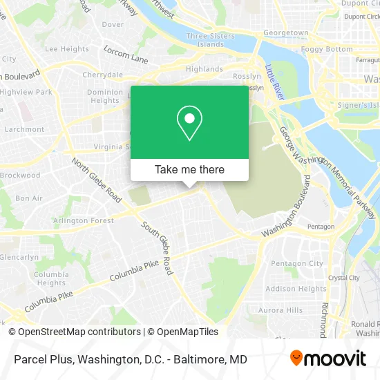
See Parcel Plus, Arlington County, on the map
Public Transit to Parcel Plus in Arlington County
Wondering how to get to Parcel Plus in Arlington County? Moovit helps you find the best way to get to Parcel Plus with step-by-step directions from the nearest public transit station.
Moovit provides free maps and live directions to help you navigate through your city. View schedules, routes, timetables, and find out how long does it take to get to Parcel Plus in real time.
Looking for the nearest stop or station to Parcel Plus? Check out this list of stops closest to your destination: Washington Blvd Sb @ Arlington Blvd Ns; 2 St S+S Fillmore St; S Courthouse Rd+2 St S; Ballston - Mu; Arlington Cemetery.
Bus: 42, 45, 77, A12, A49.Metro: ORANGE, SILVER, BLUE.
Want to see if there’s another route that gets you there at an earlier time? Moovit helps you find alternative routes or times. Get directions from and directions to Parcel Plus easily from the Moovit App or Website.
We make riding to Parcel Plus easy, which is why over 1.5 million users, including users in Arlington County, trust Moovit as the best app for public transit. You don’t need to download an individual bus app or train app, Moovit is your all-in-one transit app that helps you find the best bus time or train time available.
For information on prices of bus and metro, costs and ride fares to Parcel Plus, please check the Moovit app.
Use the app to navigate to popular places including to the airport, hospital, stadium, grocery store, mall, coffee shop, school, college, and university.
Parcel Plus Address: 2503 Arlington Blvd Arlington, VA 22201 street in Arlington County
- Penrose Neighborhood,
- FedEx,
- Arlington Public Schools- Syphax Education Center,
- Fort Tillinghast Historical Site Marker,
- S Court House Rd & S Walter Reed Dr,
- Army & A Force Base Fort Myer,
- 2nd St N (2nd n garfield),
- Joint Base Myer – Henderson Hall (JBMHH) | Fort Myer area,
- Amazon Locker-Alfano,
- NOVA Armory,
- Starbucks,
- US-50 (RT-50),
- Fort Myer,
- Hatfield Gate,
- Fort Myer Bowling Center,
- Days Inn Arlington / Washington DC,
- Bonchon Chicken - Arlington, VA,
- Lyon Park,
- Georgetown Rejuvenation,
- Arlington Heights, Virginia
Places Near Parcel Plus (Arlington County)
- National Museum of African American History and Culture, Washington,
- The Anthem, Washington,
- Amazon Hq2, Arlington County,
- Washington DC VA Medical Center, Washington,
- PG Mall, Prince George's County,
- Westfield Montgomery Mall, Montgomery County,
- Pennsylvania Ave NW (3rd st and pennsylvania), Washington,
- Washington National Cathedral, Washington,
- Sibley Memorial Hospital, Washington,
- National Zoo, Washington,
- Rock Creek Tennis Center, Washington,
- Georgetown, Washington,
- M&T Bank Stadium, Baltimore,
- Basilica of the National Shrine, Washington,
- National Mall, Washington,
- Warner Theatre, Washington,
- Museum Of The Bible, Washington,
- Marriott Marquis Washington, DC, Washington,
- Capital One Arena, Washington,
- Camden Yards, Baltimore
How to get to popular places in Washington, D.C. - Baltimore, MD with public transit
Get around Arlington County by public transit!
Traveling around Arlington County has never been so easy. See step by step directions as you travel to any attraction, street or major public transit station. View bus and train schedules, arrival times, service alerts and detailed routes on a map, so you know exactly how to get to anywhere in Arlington County.
When traveling to any destination around Arlington County use Moovit's Live Directions with Get Off Notifications to know exactly where and how far to walk, how long to wait for your line, and how many stops are left. Moovit will alert you when it's time to get off — no need to constantly re-check whether yours is the next stop.
Wondering how to use public transit in Arlington County or how to pay for public transit in Arlington County? Moovit public transit app can help you navigate your way with public transit easily, and at minimum cost. It includes public transit fees, ticket prices, and costs. Looking for a map of Arlington County public transit lines? Moovit public transit app shows all public transit maps in Arlington County with all Bus, Train, Metro, Light Rail and Ferry routes and stops on an interactive map.
Washington, D.C. - Baltimore, MD has 5 transit type(s), including: Bus, Train, Metro, Light Rail and Ferry, operated by several transit agencies, including WMATA, Montgomery County Ride On, Fairfax Connector, TheBus, PRTC, DASH - Alexandria, Arlington Transit (ART), RTA of Central Maryland, MDOT MTA, MDOT MTA Light RailLink, MDOT MTA Commuter Bus, MDOT MTA Local Bus, FXBGO!, Virginia Railway Express (VRE) and MARC