How to get to FedEx by bus?
Click on the bus route to see step by step directions with maps, line arrival times and updated time schedules.
From Residence Inn by Marriott Washington Capitol Hill Navy Yard, Washington
78 minFrom Fogo de Chao, Washington
51 minFrom Hamilton Hotel Washington DC, Washington
50 minFrom Us Capitol, Washington
60 minFrom Hechinger Mall, Washington
68 minFrom Ross Dress for Less, Washington
68 minFrom Foggy Bottom, Washington
36 minFrom Costco Wholesale, Arlington County
84 minFrom Amazon Hq2, Arlington County
63 min
How to get to FedEx by metro?
Click on the metro route to see step by step directions with maps, line arrival times and updated time schedules.
From Residence Inn by Marriott Washington Capitol Hill Navy Yard, Washington
39 minFrom Fogo de Chao, Washington
26 minFrom Hamilton Hotel Washington DC, Washington
26 minFrom Us Capitol, Washington
40 minFrom Hechinger Mall, Washington
56 minFrom Ross Dress for Less, Washington
56 minFrom Foggy Bottom, Washington
28 minFrom Costco Wholesale, Arlington County
40 minFrom Amazon Hq2, Arlington County
41 min
Bus stops near FedEx in Washington
Metro stations near FedEx in Washington
Bus lines to FedEx in Washington
What are the closest stations to FedEx?
The closest stations to FedEx are:
- Nebraska Av Nw+#4333 is 30 yards away, 1 min walk.
- Wisconsin Av Nw+Tenley Circle NW is 160 yards away, 3 min walk.
- Woodley Park-Zoo/Adams Morgan is 4194 yards away, 50 min walk.
- Columbia Heights is 5409 yards away, 64 min walk.
Which bus lines stop near FedEx?
These bus lines stop near FedEx: C51, D80, D82, D90.
Which metro line stops near FedEx?
RED (Shady Grove)
What’s the nearest bus station to FedEx in Washington?
The nearest bus station to FedEx in Washington is Nebraska Av Nw+#4333. It’s a 1 min walk away.
What time is the first metro to FedEx in Washington?
The GREEN is the first metro that goes to FedEx in Washington. It stops nearby at 5:16 AM.
What time is the last metro to FedEx in Washington?
The GREEN is the last metro that goes to FedEx in Washington. It stops nearby at 12:25 AM.
What time is the first bus to FedEx in Washington?
The C61 is the first bus that goes to FedEx in Washington. It stops nearby at 3:00 AM.
What time is the last bus to FedEx in Washington?
The D80 is the last bus that goes to FedEx in Washington. It stops nearby at 3:25 AM.
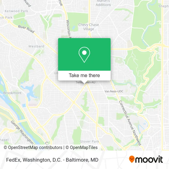
See FedEx, Washington, on the map
Public Transit to FedEx in Washington
Wondering how to get to FedEx in Washington? Moovit helps you find the best way to get to FedEx with step-by-step directions from the nearest public transit station.
Moovit provides free maps and live directions to help you navigate through your city. View schedules, routes, timetables, and find out how long does it take to get to FedEx in real time.
Looking for the nearest stop or station to FedEx? Check out this list of stops closest to your destination: Nebraska Av Nw+#4333; Wisconsin Av Nw+Tenley Circle NW; Woodley Park-Zoo/Adams Morgan; Columbia Heights.
Bus: C51, D80, D82, D90, C81, C61, C85.Metro: RED, GREEN, YELLOW.
Want to see if there’s another route that gets you there at an earlier time? Moovit helps you find alternative routes or times. Get directions from and directions to FedEx easily from the Moovit App or Website.
We make riding to FedEx easy, which is why over 1.5 million users, including users in Washington, trust Moovit as the best app for public transit. You don’t need to download an individual bus app or train app, Moovit is your all-in-one transit app that helps you find the best bus time or train time available.
For information on prices of metro and bus, costs and ride fares to FedEx, please check the Moovit app.
Use the app to navigate to popular places including to the airport, hospital, stadium, grocery store, mall, coffee shop, school, college, and university.
FedEx Address: 4300 Nebraska Ave NW Washington, DC 20016 street in Washington
- American University, Tenley Campus / Washington College Of Law,
- Pence Law Library,
- Equal Justice Foundation- WCL,
- American University (AU) - Tenley Campus,
- Metropolitan Memorial United Methodist Church,
- Tenley Circle,
- DC. Engine 20, Truck 12, BFC 5,
- Z Burger (Mrbeast Burger),
- Jamie L Jones,
- Pet Odor Cleaning,
- The Center for Movement Theatre,
- WESTERN UNION,
- Credit Union 1,
- Jerold M Share MD,
- Carolyn B Robinowitz,
- Datz Foundation,
- Locksmith for All,
- Visionworks (Visionworks Tenley Circle),
- Cakery Zivine,
- D.C. Public Library, Tenley-Friendship Branch
Places Near FedEx (Washington)
- Amazon Hq2, Arlington County,
- Camden Yards, Baltimore,
- The Anthem, Washington,
- Warner Theatre, Washington,
- Capital One Arena, Washington,
- Westfield Montgomery Mall, Montgomery County,
- Georgetown, Washington,
- Washington National Cathedral, Washington,
- National Museum of African American History and Culture, Washington,
- Rock Creek Tennis Center, Washington,
- Washington DC VA Medical Center, Washington,
- Marriott Marquis Washington, DC, Washington,
- Sibley Memorial Hospital, Washington,
- Basilica of the National Shrine, Washington,
- M&T Bank Stadium, Baltimore,
- National Theatre, Washington,
- Pennsylvania Ave NW (3rd st and pennsylvania), Washington,
- National Zoo, Washington,
- Museum Of The Bible, Washington,
- PG Mall, Prince George's County
How to get to popular places in Washington, D.C. - Baltimore, MD with public transit
Get around Washington by public transit!
Traveling around Washington has never been so easy. See step by step directions as you travel to any attraction, street or major public transit station. View bus and train schedules, arrival times, service alerts and detailed routes on a map, so you know exactly how to get to anywhere in Washington.
When traveling to any destination around Washington use Moovit's Live Directions with Get Off Notifications to know exactly where and how far to walk, how long to wait for your line, and how many stops are left. Moovit will alert you when it's time to get off — no need to constantly re-check whether yours is the next stop.
Wondering how to use public transit in Washington or how to pay for public transit in Washington? Moovit public transit app can help you navigate your way with public transit easily, and at minimum cost. It includes public transit fees, ticket prices, and costs. Looking for a map of Washington public transit lines? Moovit public transit app shows all public transit maps in Washington with all Bus, Train, Metro, Light Rail and Ferry routes and stops on an interactive map.
Washington, D.C. - Baltimore, MD has 5 transit type(s), including: Bus, Train, Metro, Light Rail and Ferry, operated by several transit agencies, including WMATA, Montgomery County Ride On, Fairfax Connector, TheBus, PRTC, DASH - Alexandria, Arlington Transit (ART), RTA of Central Maryland, MDOT MTA, MDOT MTA Light RailLink, MDOT MTA Commuter Bus, MDOT MTA Local Bus, FXBGO!, Virginia Railway Express (VRE) and MARC