How to get to Fedex by bus?
Click on the bus route to see step by step directions with maps, line arrival times and updated time schedules.
From AMC Theatres, Boston
68 minFrom Holiday Inn Express Boston, Boston
67 minFrom Lower Mills, Boston
33 minFrom Courtyard South Boston (COURTYARD by Marriott), Boston
67 minFrom Dorchester District Court, Boston
38 minFrom Dorchester, Boston
42 minFrom Home2 Suites-Boston South Bay (Home2 Stes by Hilton Boston S Bay), Boston
67 minFrom Uphams Corner, Boston
64 minFrom Home2 Suites-Boston South Bay, Boston
66 minFrom South Shore Hospital- Pratt 5, Weymouth Town
59 min
How to get to Fedex by train?
Click on the train route to see step by step directions with maps, line arrival times and updated time schedules.
From AMC Theatres, Boston
72 minFrom Holiday Inn Express Boston, Boston
76 minFrom Lower Mills, Boston
102 minFrom Courtyard South Boston (COURTYARD by Marriott), Boston
76 minFrom Dorchester District Court, Boston
81 minFrom Dorchester, Boston
82 minFrom Home2 Suites-Boston South Bay (Home2 Stes by Hilton Boston S Bay), Boston
73 minFrom Uphams Corner, Boston
63 minFrom Home2 Suites-Boston South Bay, Boston
74 min
How to get to Fedex by subway?
Click on the subway route to see step by step directions with maps, line arrival times and updated time schedules.
From AMC Theatres, Boston
37 minFrom Holiday Inn Express Boston, Boston
35 minFrom Lower Mills, Boston
52 minFrom Courtyard South Boston (COURTYARD by Marriott), Boston
35 minFrom Dorchester District Court, Boston
43 minFrom Dorchester, Boston
48 minFrom Home2 Suites-Boston South Bay (Home2 Stes by Hilton Boston S Bay), Boston
36 minFrom Uphams Corner, Boston
35 minFrom Home2 Suites-Boston South Bay, Boston
35 min
Bus stops near Fedex in Quincy
Subway station near Fedex in Quincy
- Wollaston, 5 min walk,VIEW
Train stations near Fedex in Quincy
Bus lines to Fedex in Quincy
What are the closest stations to Fedex?
The closest stations to Fedex are:
- Granite St @ Packards Lane is 13 yards away, 1 min walk.
- School St Opp Gay St is 194 yards away, 3 min walk.
- Wollaston is 334 yards away, 5 min walk.
- Quincy Ave @ School St is 346 yards away, 5 min walk.
- Weymouth Landing/East Braintree is 3666 yards away, 43 min walk.
- Braintree is 4358 yards away, 51 min walk.
Which bus lines stop near Fedex?
These bus lines stop near Fedex: 215, 225, 245.
Which train line stops near Fedex?
GREENBUSH (#1061 | Greenbush)
Which subway line stops near Fedex?
RED LINE (Ashmont/Braintree)
What’s the nearest subway station to Fedex in Quincy?
The nearest subway station to Fedex in Quincy is Wollaston. It’s a 5 min walk away.
What’s the nearest bus station to Fedex in Quincy?
The nearest bus station to Fedex in Quincy is Granite St @ Packards Lane. It’s a 1 min walk away.
What time is the first subway to Fedex in Quincy?
The RED LINE is the first subway that goes to Fedex in Quincy. It stops nearby at 5:18 AM.
What time is the last subway to Fedex in Quincy?
The RED LINE is the last subway that goes to Fedex in Quincy. It stops nearby at 1:49 AM.
What time is the first train to Fedex in Quincy?
The FALL RIVER/NEW BEDFORD is the first train that goes to Fedex in Quincy. It stops nearby at 5:27 AM.
What time is the last train to Fedex in Quincy?
The KINGSTON is the last train that goes to Fedex in Quincy. It stops nearby at 12:25 AM.
What time is the first bus to Fedex in Quincy?
The 230 is the first bus that goes to Fedex in Quincy. It stops nearby at 4:52 AM.
What time is the last bus to Fedex in Quincy?
The 215 is the last bus that goes to Fedex in Quincy. It stops nearby at 1:17 AM.
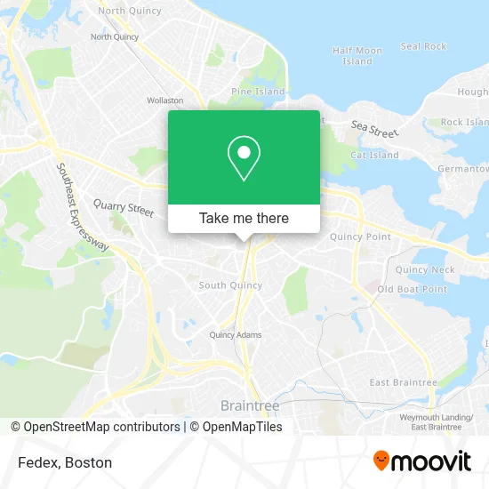
See Fedex, Quincy, on the map
Public Transit to Fedex in Quincy
Wondering how to get to Fedex in Quincy? Moovit helps you find the best way to get to Fedex with step-by-step directions from the nearest public transit station.
Moovit provides free maps and live directions to help you navigate through your city. View schedules, routes, timetables, and find out how long does it take to get to Fedex in real time.
Looking for the nearest stop or station to Fedex? Check out this list of stops closest to your destination: Granite St @ Packards Lane; School St Opp Gay St; Wollaston; Quincy Ave @ School St; Weymouth Landing/East Braintree; Braintree.
Bus: 215, 225, 245, 230, 236, 238.Train: GREENBUSH, CAPEFLYER, FALL RIVER/NEW BEDFORD, KINGSTON.Subway: RED LINE.
Want to see if there’s another route that gets you there at an earlier time? Moovit helps you find alternative routes or times. Get directions from and directions to Fedex easily from the Moovit App or Website.
We make riding to Fedex easy, which is why over 1.7 million users, including users in Quincy, trust Moovit as the best app for public transit. You don’t need to download an individual bus app or train app, Moovit is your all-in-one transit app that helps you find the best bus time or train time available.
For information on prices of bus, subway and train, costs and ride fares to Fedex, please check the Moovit app.
Use the app to navigate to popular places including to the airport, hospital, stadium, grocery store, mall, coffee shop, school, college, and university.
Fedex Address: 132 Granite St street in Quincy
- Keyme,
- Western Union,
- Zenshi Handcrafted Sushi,
- Coinstar Kiosk – Bitcoin Atm,
- STARBUCKS,
- Coinstar - Bitcoin ATM,
- T.J. Maxx,
- China Chopsticks Inc.,
- Royal KTV,
- Royal Hotpot Korean Bbq & Bar,
- Us Army Recruiting,
- Just Food For Dogs,
- Star Market #2573,
- Vetco Vaccination Clinic,
- Gather Health,
- Star Market,
- Fresenius Kidney Care,
- ChargePoint,
- Flags For Veterans Island,
- Hancock Park Rehabilitation And Nursing Center
Places Near Fedex (Quincy)
- Mgm Music Hall, Boston,
- Td Garden, Boston,
- Prudential Center, Boston,
- Castle Island, Boston,
- Seaport District, Boston,
- Boston Common, Boston,
- Cheers, Boston,
- House Of Blues, Boston,
- Wang Theater, Boston,
- Leader Bank Pavilion (Leader Bank Pavillion), Boston,
- Boston Children's Hospital, Boston,
- Museum Of Science, Boston,
- Massachusetts General Hospital, Boston,
- Wilbur Theatre, Boston,
- Faneuil Hall, Boston,
- Boston Convention & Exhibition Center, Boston,
- Quincy Market, Boston,
- Isabella Stewart Gardner Museum, Boston,
- Boston Medical Center, Boston,
- North End, Boston
How to get to popular places in Boston with public transit
Get around Quincy by public transit!
Traveling around Quincy has never been so easy. See step by step directions as you travel to any attraction, street or major public transit station. View bus and train schedules, arrival times, service alerts and detailed routes on a map, so you know exactly how to get to anywhere in Quincy.
When traveling to any destination around Quincy use Moovit's Live Directions with Get Off Notifications to know exactly where and how far to walk, how long to wait for your line, and how many stops are left. Moovit will alert you when it's time to get off — no need to constantly re-check whether yours is the next stop.
Wondering how to use public transit in Quincy or how to pay for public transit in Quincy? Moovit public transit app can help you navigate your way with public transit easily, and at minimum cost. It includes public transit fees, ticket prices, and costs. Looking for a map of Quincy public transit lines? Moovit public transit app shows all public transit maps in Quincy with all Bus, Train, Subway and Ferry routes and stops on an interactive map.
Boston has 4 transit type(s), including: Bus, Train, Subway and Ferry, operated by several transit agencies, including MBTA, Southeastern Regional Transit Authority, MetroWest Regional Transit Authority, Rhode Island Public Transit Authority, WRTA, Lowell Regional Transit Authority, Merrimack Valley Transit, Montachusett Regional Transit Authority, Cape Cod Regional Transit Authority, Brockton Area Transit Authority, Martha's Vineyard Transit Authority, the WAVE - Nantucket Regional Transit Authority, GATRA, Cape Ann Transportation Authority and Massport