Directions to Feinstein International Center (Boston) with public transportation
The following transit lines have routes that pass near Feinstein International Center
 Bus: 354, 504, 9, 92, SL3.
- Train: FRAMINGHAM/WORCESTER, LOWELL, NEEDHAM, NEWBURYPORT/ROCKPORT, COMMUTER RAIL SHUTTLE.
- Subway: GREEN LINE B, ORANGE LINE, RED LINE, GREEN LINE C, GREEN LINE D.
How to get to Feinstein International Center by bus?
Click on the bus route to see step by step directions with maps, line arrival times and updated time schedules.
From Regent Theatre, Arlington
77 minFrom Jamaica Plain, Boston
46 minFrom FOUR POINTS BY SHERATON Boston Newton, Newton
24 minFrom Beth Israel Deaconess Hospital-Milton, Milton
82 minFrom Wollaston Beach, Quincy
107 minFrom Revere Beach, Revere
79 minFrom Massachusetts, Boston
57 minFrom Everett, MA, Everett
68 minFrom Wegmans, Medford
67 minFrom Milton Academy, Milton
91 min
How to get to Feinstein International Center by train?
Click on the train route to see step by step directions with maps, line arrival times and updated time schedules.
How to get to Feinstein International Center by subway?
Click on the subway route to see step by step directions with maps, line arrival times and updated time schedules.
Bus stops near Feinstein International Center in Boston
Subway stations near Feinstein International Center in Boston
Train station near Feinstein International Center in Boston
- South Station, 5 min walk,VIEW
Bus lines to Feinstein International Center in Boston
- 9, City Point,VIEW
- 43, Ruggles,VIEW
- SL5, Nubian,VIEW
- 11, Chauncy & Summer,VIEW
- 15, Mattapan Via Nubian & Fields Corner,VIEW
- SL4, Nubian,VIEW
- 39, Forest Hills,VIEW
- 57, Watertown Via Kenmore,VIEW
- 501, Downtown Via Cambridge St And Copley (Express),VIEW
- 504, Watertown Via Copley And Newton Corner (Express),VIEW
- GREEN LINE E SHUTTLE, Heath Street (Shuttle),VIEW
- GREEN LINE SHUTTLE, Blandford Street (Shuttle),VIEW
- 505, Waltham (Express),VIEW
- FLIXBUS 2610, NYC - Boston,VIEW
- FLIXBUS 2611, NYC Chinatown - Boston,VIEW
- FLIXBUS 2612, NYC Queens - Boston,VIEW
- FLIXBUS 2614, Newark - Boston,VIEW
- FLIXBUS 2619, Boston - NYC - Philadelphia,VIEW
- FLIXBUS 2691, Boston - Albany - Ithaca,VIEW
- FLIXBUS 2693, Boston - Albany,VIEW
What are the closest stations to Feinstein International Center?
The closest stations to Feinstein International Center are:
- Herald St @ Harrison Ave is 102 yards away, 2 min walk.
- Chinatown is 154 yards away, 2 min walk.
- Tremont St @ Charles St S is 157 yards away, 2 min walk.
- Downtown Crossing is 173 yards away, 3 min walk.
- Washington St @ Essex St is 176 yards away, 3 min walk.
- Stuart St @ Charles St S is 247 yards away, 4 min walk.
- Tremont St @ Boylston Station is 255 yards away, 4 min walk.
- Boylston is 297 yards away, 4 min walk.
- South Station is 343 yards away, 5 min walk.
- Lincoln St @ Essex St is 482 yards away, 6 min walk.
- South Station Bus Terminal is 880 yards away, 11 min walk.
Which bus lines stop near Feinstein International Center?
These bus lines stop near Feinstein International Center: 354, 504, 9, 92, SL3, SL4.
Which train lines stop near Feinstein International Center?
These train lines stop near Feinstein International Center: FRAMINGHAM/WORCESTER, LOWELL, NEEDHAM, NEWBURYPORT/ROCKPORT.
Which subway lines stop near Feinstein International Center?
These subway lines stop near Feinstein International Center: GREEN LINE B, ORANGE LINE, RED LINE.
What’s the nearest subway station to Feinstein International Center in Boston?
The nearest subway station to Feinstein International Center in Boston is Chinatown. It’s a 2 min walk away.
What’s the nearest train station to Feinstein International Center in Boston?
The nearest train station to Feinstein International Center in Boston is South Station. It’s a 5 min walk away.
What’s the nearest bus station to Feinstein International Center in Boston?
The nearest bus stations to Feinstein International Center in Boston are Herald St @ Harrison Ave and Tremont St @ Charles St S. The closest one is a 2 min walk away.
What time is the first subway to Feinstein International Center in Boston?
The GREEN LINE D is the first subway that goes to Feinstein International Center in Boston. It stops nearby at 5:09 AM.
What time is the last subway to Feinstein International Center in Boston?
The GREEN LINE E is the last subway that goes to Feinstein International Center in Boston. It stops nearby at 2:16 AM.
What time is the first train to Feinstein International Center in Boston?
The PROVIDENCE/STOUGHTON is the first train that goes to Feinstein International Center in Boston. It stops nearby at 4:20 AM.
What time is the last train to Feinstein International Center in Boston?
The LAKE SHORE LIMITED is the last train that goes to Feinstein International Center in Boston. It stops nearby at 8:32 PM.
What time is the first bus to Feinstein International Center in Boston?
The SLW is the first bus that goes to Feinstein International Center in Boston. It stops nearby at 4:19 AM.
What time is the last bus to Feinstein International Center in Boston?
The FLIXBUS N2605 is the last bus that goes to Feinstein International Center in Boston. It stops nearby at 9:25 AM.
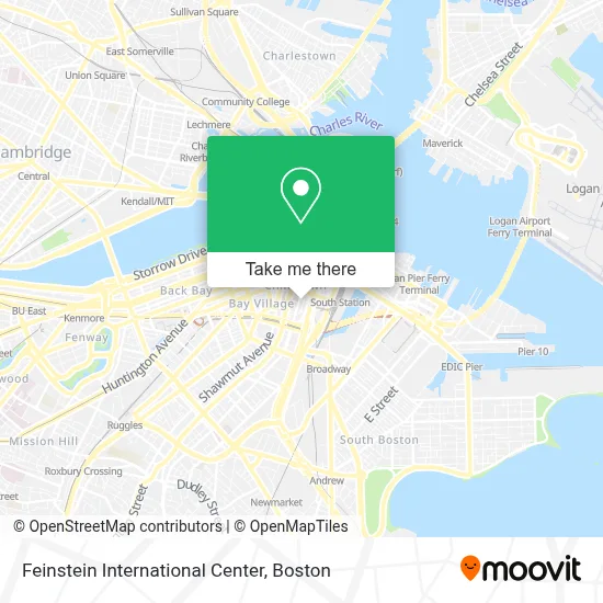
See Feinstein International Center, Boston, on the map
Public Transit to Feinstein International Center in Boston
Wondering how to get to Feinstein International Center in Boston? Moovit helps you find the best way to get to Feinstein International Center with step-by-step directions from the nearest public transit station.
Moovit provides free maps and live directions to help you navigate through your city. View schedules, routes, timetables, and find out how long does it take to get to Feinstein International Center in real time.
Looking for the nearest stop or station to Feinstein International Center? Check out this list of stops closest to your destination: Herald St @ Harrison Ave; Chinatown; Tremont St @ Charles St S; Downtown Crossing; Washington St @ Essex St; Stuart St @ Charles St S; Tremont St @ Boylston Station; Boylston; South Station; Lincoln St @ Essex St; South Station Bus Terminal.
Bus: 354, 504, 9, 92, SL3, SL4, 43.Train: FRAMINGHAM/WORCESTER, LOWELL, NEEDHAM, NEWBURYPORT/ROCKPORT, COMMUTER RAIL SHUTTLE, FAIRMOUNT LINE SHUTTLE, FRANKLIN LINE SHUTTLE, KINGSTON LINE SHUTTLE, SL1.Subway: GREEN LINE B, ORANGE LINE, RED LINE, GREEN LINE C, GREEN LINE D, GREEN LINE E.
Want to see if there’s another route that gets you there at an earlier time? Moovit helps you find alternative routes or times. Get directions from and directions to Feinstein International Center easily from the Moovit App or Website.
We make riding to Feinstein International Center easy, which is why over 1.7 million users, including users in Boston, trust Moovit as the best app for public transit. You don’t need to download an individual bus app or train app, Moovit is your all-in-one transit app that helps you find the best bus time or train time available.
For information on prices of bus, subway and train, costs and ride fares to Feinstein International Center, please check the Moovit app.
Use the app to navigate to popular places including to the airport, hospital, stadium, grocery store, mall, coffee shop, school, college, and university.
Feinstein International Center Address: 150 Harrison Ave street in Boston
- Tufts Sackler School of Graduate Biomedical Science Jaharis Building,
- Train 173,
- Tufts Medical Center Proger Building,
- St. James The Greater Church,
- Financial Aid Office, Tufts University School Of Medicine,
- Navin K Kapur, MD (Navin Krishna Yadlapalli),
- Diego Illanes, MD, Facog, Facs,
- Dustin Patil, MD,
- Raymond L. Comenzo, MD (Sheryl L Levy),
- Lori B. Olans, MD, MPH,
- Tufts Medical Center / Floating Hospital for Children,
- Chop'd & Top'd NEMC,
- Tufts University - Health Sciences Bookstore,
- Tufts Medical Center Emergency Room,
- The Tower Residences at One Greenway,
- Shing Hong Trading,
- Tupper Building (Tufts Medical Center),
- Tufts Dental School,
- Tufts Dental,
- Aqua World
Places Near Feinstein International Center (Boston)
- North End, Boston,
- Castle Island, Boston,
- Prudential Center, Boston,
- Wilbur Theatre, Boston,
- Faneuil Hall, Boston,
- Quincy Market, Boston,
- House Of Blues, Boston,
- Boston Common, Boston,
- Cheers, Boston,
- Td Garden, Boston,
- Seaport District, Boston,
- Isabella Stewart Gardner Museum, Boston,
- Boston Convention & Exhibition Center, Boston,
- Boston Medical Center, Boston,
- Leader Bank Pavilion (Leader Bank Pavillion), Boston,
- Massachusetts General Hospital, Boston,
- Boston Children's Hospital, Boston,
- Mgm Music Hall, Boston,
- Museum Of Science, Boston,
- Wang Theater, Boston
How to get to popular places in Boston with public transit
Get around Boston by public transit!
Traveling around Boston has never been so easy. See step by step directions as you travel to any attraction, street or major public transit station. View bus and train schedules, arrival times, service alerts and detailed routes on a map, so you know exactly how to get to anywhere in Boston.
When traveling to any destination around Boston use Moovit's Live Directions with Get Off Notifications to know exactly where and how far to walk, how long to wait for your line, and how many stops are left. Moovit will alert you when it's time to get off — no need to constantly re-check whether yours is the next stop.
Wondering how to use public transit in Boston or how to pay for public transit in Boston? Moovit public transit app can help you navigate your way with public transit easily, and at minimum cost. It includes public transit fees, ticket prices, and costs. Looking for a map of Boston public transit lines? Moovit public transit app shows all public transit maps in Boston with all Bus, Train, Subway and Ferry routes and stops on an interactive map.
Boston has 4 transit type(s), including: Bus, Train, Subway and Ferry, operated by several transit agencies, including MBTA, Southeastern Regional Transit Authority, MetroWest Regional Transit Authority, Rhode Island Public Transit Authority, WRTA, Lowell Regional Transit Authority, Merrimack Valley Transit, Montachusett Regional Transit Authority, Cape Cod Regional Transit Authority, Brockton Area Transit Authority, Martha's Vineyard Transit Authority, the WAVE - Nantucket Regional Transit Authority, GATRA, Cape Ann Transportation Authority and Massport