Directions to Fells Connector Parkways (Melrose) with public transportation
The following transit lines have routes that pass near Fells Connector Parkways
 Bus: 132, 99, 131, 137.
- Train: HAVERHILL, ORANGE LINE.
- Subway: ORANGE LINE.
How to get to Fells Connector Parkways by bus?
Click on the bus route to see step by step directions with maps, line arrival times and updated time schedules.
From Financial District, Boston
77 minFrom Boston Harbor Hotel, Boston
82 minFrom Faneuil Hall, Boston
74 minFrom Primark, Boston
81 minFrom Revere, MA, Revere
66 minFrom Walmart, Saugus
75 minFrom Macy's, Boston
81 minFrom 15 Parkman Street, Boston
81 minFrom Massachusetts Eye And Ear, Boston
84 minFrom Primark Boston, Boston
81 min
How to get to Fells Connector Parkways by train?
Click on the train route to see step by step directions with maps, line arrival times and updated time schedules.
How to get to Fells Connector Parkways by subway?
Click on the subway route to see step by step directions with maps, line arrival times and updated time schedules.
Bus stops near Fells Connector Parkways in Melrose
Train station near Fells Connector Parkways in Melrose
- Oak Grove, 42 min walk,VIEW
Bus lines to Fells Connector Parkways in Melrose
What are the closest stations to Fells Connector Parkways?
The closest stations to Fells Connector Parkways are:
- Pleasant St Opp Converse Ln is 241 yards away, 3 min walk.
- Main St @ Sylvan St is 2028 yards away, 24 min walk.
- Oak Grove is 3553 yards away, 42 min walk.
Which bus lines stop near Fells Connector Parkways?
These bus lines stop near Fells Connector Parkways: 132, 99.
Which train line stops near Fells Connector Parkways?
HAVERHILL (#229 | Haverhill)
Which subway line stops near Fells Connector Parkways?
ORANGE LINE (Oak Grove)
What’s the nearest bus station to Fells Connector Parkways in Melrose?
The nearest bus station to Fells Connector Parkways in Melrose is Pleasant St Opp Converse Ln. It’s a 3 min walk away.
What time is the first subway to Fells Connector Parkways in Melrose?
The ORANGE LINE is the first subway that goes to Fells Connector Parkways in Melrose. It stops nearby at 5:15 AM.
What time is the last subway to Fells Connector Parkways in Melrose?
The ORANGE LINE is the last subway that goes to Fells Connector Parkways in Melrose. It stops nearby at 1:59 AM.
What time is the first train to Fells Connector Parkways in Melrose?
The HAVERHILL is the first train that goes to Fells Connector Parkways in Melrose. It stops nearby at 5:35 AM.
What time is the last train to Fells Connector Parkways in Melrose?
The HAVERHILL is the last train that goes to Fells Connector Parkways in Melrose. It stops nearby at 11:53 PM.
What time is the first bus to Fells Connector Parkways in Melrose?
The 132 is the first bus that goes to Fells Connector Parkways in Melrose. It stops nearby at 5:32 AM.
What time is the last bus to Fells Connector Parkways in Melrose?
The 132 is the last bus that goes to Fells Connector Parkways in Melrose. It stops nearby at 11:39 PM.
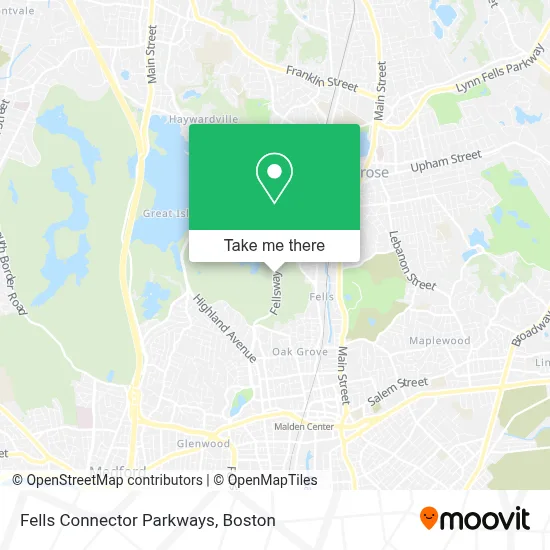
See Fells Connector Parkways, Melrose, on the map
Public Transit to Fells Connector Parkways in Melrose
Wondering how to get to Fells Connector Parkways in Melrose? Moovit helps you find the best way to get to Fells Connector Parkways with step-by-step directions from the nearest public transit station.
Moovit provides free maps and live directions to help you navigate through your city. View schedules, routes, timetables, and find out how long does it take to get to Fells Connector Parkways in real time.
Looking for the nearest stop or station to Fells Connector Parkways? Check out this list of stops closest to your destination: Pleasant St Opp Converse Ln; Main St @ Sylvan St; Oak Grove.
Bus: 132, 99, 131, 137.Train: HAVERHILL, ORANGE LINE.Subway: ORANGE LINE.
Want to see if there’s another route that gets you there at an earlier time? Moovit helps you find alternative routes or times. Get directions from and directions to Fells Connector Parkways easily from the Moovit App or Website.
We make riding to Fells Connector Parkways easy, which is why over 1.7 million users, including users in Melrose, trust Moovit as the best app for public transit. You don’t need to download an individual bus app or train app, Moovit is your all-in-one transit app that helps you find the best bus time or train time available.
For information on prices of subway, bus and train, costs and ride fares to Fells Connector Parkways, please check the Moovit app.
Use the app to navigate to popular places including to the airport, hospital, stadium, grocery store, mall, coffee shop, school, college, and university.
Location: Melrose, Boston
- New England Painting and Contracting,
- Steve Gyurina Photography,
- Little Sprouts,
- Cimetrics,
- Mando Fitness Gym,
- Towne Estates,
- Fastatm,
- 1-182nd Infantry Regiment,
- New Horizon Locksmith,
- Windsor at Oak Grove Apartments,
- Housing Oakwood,
- Melrose Chiropractor,
- ChargePoint,
- Simple Fitness,
- Alta Clara at the Fells,
- Hinge Fitness,
- Oak Grove - East,
- Oak Grove Station,
- Mt Cleaning Services,
- Troy's Painting & Remodeling
Places Near Fells Connector Parkways (Melrose)
- North End, Boston,
- Wang Theater, Boston,
- Massachusetts General Hospital, Boston,
- Quincy Market, Boston,
- Boston Medical Center, Boston,
- Wilbur Theatre, Boston,
- Faneuil Hall, Boston,
- Museum Of Science, Boston,
- Boston Common, Boston,
- House Of Blues, Boston,
- Isabella Stewart Gardner Museum, Boston,
- Boston Convention & Exhibition Center, Boston,
- Prudential Center, Boston,
- Castle Island, Boston,
- Mgm Music Hall, Boston,
- Boston Children's Hospital, Boston,
- Td Garden, Boston,
- Cheers, Boston,
- Seaport District, Boston,
- Leader Bank Pavilion (Leader Bank Pavillion), Boston
How to get to popular places in Boston with public transit
Get around Melrose by public transit!
Traveling around Melrose has never been so easy. See step by step directions as you travel to any attraction, street or major public transit station. View bus and train schedules, arrival times, service alerts and detailed routes on a map, so you know exactly how to get to anywhere in Melrose.
When traveling to any destination around Melrose use Moovit's Live Directions with Get Off Notifications to know exactly where and how far to walk, how long to wait for your line, and how many stops are left. Moovit will alert you when it's time to get off — no need to constantly re-check whether yours is the next stop.
Wondering how to use public transit in Melrose or how to pay for public transit in Melrose? Moovit public transit app can help you navigate your way with public transit easily, and at minimum cost. It includes public transit fees, ticket prices, and costs. Looking for a map of Melrose public transit lines? Moovit public transit app shows all public transit maps in Melrose with all Bus, Train, Subway and Ferry routes and stops on an interactive map.
Boston has 4 transit type(s), including: Bus, Train, Subway and Ferry, operated by several transit agencies, including MBTA, Southeastern Regional Transit Authority, MetroWest Regional Transit Authority, Rhode Island Public Transit Authority, WRTA, Lowell Regional Transit Authority, Merrimack Valley Transit, Montachusett Regional Transit Authority, Cape Cod Regional Transit Authority, Brockton Area Transit Authority, Martha's Vineyard Transit Authority, the WAVE - Nantucket Regional Transit Authority, GATRA, Cape Ann Transportation Authority and Massport