Directions to Fenway Forward (Boston) with public transportation
The following transit lines have routes that pass near Fenway Forward
 Bus: 1, 19, 22, 39, 60.
- Train: FITCHBURG, NEEDHAM.
- Subway: GREEN LINE B, GREEN LINE C, GREEN LINE D, GREEN LINE E, ORANGE LINE.
How to get to Fenway Forward by bus?
Click on the bus route to see step by step directions with maps, line arrival times and updated time schedules.
From Porter Square, Cambridge
47 minFrom Beth Israel Deaconess Hospital-Milton, Milton
85 minFrom Codman Square, Boston
55 minFrom Mount Ida College, Newton
73 minFrom Qea, Quincy
99 minFrom Alumni Stadium, Newton
67 minFrom Milton, MA, Milton
74 minFrom McLean Hospital, Belmont
67 minFrom Massachusetts Water Resource Authority (MWRA), Chelsea
67 minFrom Embassy Suites Boston At Logan, Boston
45 min
How to get to Fenway Forward by train?
Click on the train route to see step by step directions with maps, line arrival times and updated time schedules.
How to get to Fenway Forward by subway?
Click on the subway route to see step by step directions with maps, line arrival times and updated time schedules.
From Porter Square, Cambridge
37 minFrom Beth Israel Deaconess Hospital-Milton, Milton
81 minFrom Codman Square, Boston
53 minFrom Embassy Suites Boston At Logan, Boston
35 minFrom Qea, Quincy
47 minFrom Alumni Stadium, Newton
56 minFrom Milton, MA, Milton
82 minFrom Massachusetts Water Resource Authority (MWRA), Chelsea
54 min
Bus stops near Fenway Forward in Boston
- Ipswich St @ Boylston St, 4 min walk,VIEW
- Massachusetts Ave @ Huntington Ave, 4 min walk,VIEW
- Huntington Ave @ Opera Pl, 5 min walk,VIEW
- Hynes Convention Center - Cambria St @ Boylston St, 7 min walk,VIEW
- Hynes T Station (To Crc), 7 min walk,VIEW
- Dalton St @ Belvidere St, 8 min walk,VIEW
- Massachusetts Ave @ Newbury St, 8 min walk,VIEW
Subway stations near Fenway Forward in Boston
Bus lines to Fenway Forward in Boston
- 55, Arlington,VIEW
- 1, Harvard,VIEW
- 9, Kenmore Via Boston Latin,VIEW
- 39, Haymarket Via Forest Hills,VIEW
- GREEN LINE E SHUTTLE, Park Street (Shuttle),VIEW
- GREEN LINE E SHUTTLE, Prudential (Shuttle),VIEW
- GREEN LINE B SHUTTLE, Back Bay (Shuttle),VIEW
- GREEN LINE C SHUTTLE, Saint Mary's Street (Shuttle),VIEW
- 1 BU (CHARLES RIVER-MEDICAL CAMPUS), Comm Ave @ Buick St,VIEW
- 57, Watertown Via Kenmore,VIEW
- GREEN LINE SHUTTLE, Park Street (Shuttle),VIEW
What are the closest stations to Fenway Forward?
The closest stations to Fenway Forward are:
- Ipswich St @ Boylston St is 267 yards away, 4 min walk.
- Massachusetts Ave @ Huntington Ave is 307 yards away, 4 min walk.
- Massachusetts Ave. is 323 yards away, 4 min walk.
- Huntington Ave @ Opera Pl is 406 yards away, 5 min walk.
- Hynes Convention Center - Cambria St @ Boylston St is 533 yards away, 7 min walk.
- Hynes Convention Center is 534 yards away, 7 min walk.
- Hynes T Station (To Crc) is 586 yards away, 7 min walk.
- Dalton St @ Belvidere St is 589 yards away, 8 min walk.
- Massachusetts Ave @ Newbury St is 599 yards away, 8 min walk.
- Northeastern University is 759 yards away, 10 min walk.
Which bus lines stop near Fenway Forward?
These bus lines stop near Fenway Forward: 1, 19, 22, 39, 60, BB.
Which train lines stop near Fenway Forward?
These train lines stop near Fenway Forward: FITCHBURG, NEEDHAM.
Which subway lines stop near Fenway Forward?
These subway lines stop near Fenway Forward: GREEN LINE B, GREEN LINE C, GREEN LINE D, GREEN LINE E, ORANGE LINE.
What’s the nearest subway station to Fenway Forward in Boston?
The nearest subway station to Fenway Forward in Boston is Massachusetts Ave.. It’s a 4 min walk away.
What’s the nearest bus station to Fenway Forward in Boston?
The nearest bus stations to Fenway Forward in Boston are Ipswich St @ Boylston St and Massachusetts Ave @ Huntington Ave. The closest one is a 4 min walk away.
What time is the first subway to Fenway Forward in Boston?
The GREEN LINE D is the first subway that goes to Fenway Forward in Boston. It stops nearby at 5:03 AM.
What time is the last subway to Fenway Forward in Boston?
The GREEN LINE D is the last subway that goes to Fenway Forward in Boston. It stops nearby at 2:15 AM.
What time is the first bus to Fenway Forward in Boston?
The 1 is the first bus that goes to Fenway Forward in Boston. It stops nearby at 4:49 AM.
What time is the last bus to Fenway Forward in Boston?
The 1 is the last bus that goes to Fenway Forward in Boston. It stops nearby at 2:34 AM.
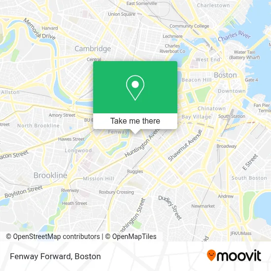
See Fenway Forward, Boston, on the map
Public Transit to Fenway Forward in Boston
Wondering how to get to Fenway Forward in Boston? Moovit helps you find the best way to get to Fenway Forward with step-by-step directions from the nearest public transit station.
Moovit provides free maps and live directions to help you navigate through your city. View schedules, routes, timetables, and find out how long does it take to get to Fenway Forward in real time.
Looking for the nearest stop or station to Fenway Forward? Check out this list of stops closest to your destination: Ipswich St @ Boylston St; Massachusetts Ave @ Huntington Ave; Massachusetts Ave.; Huntington Ave @ Opera Pl; Hynes Convention Center - Cambria St @ Boylston St; Hynes Convention Center; Hynes T Station (To Crc); Dalton St @ Belvidere St; Massachusetts Ave @ Newbury St; Northeastern University.
Bus: 1, 19, 22, 39, 60, BB, 55, 9, GREEN LINE E SHUTTLE, GREEN LINE E SHUTTLE.Train: FITCHBURG, NEEDHAM.Subway: GREEN LINE B, GREEN LINE C, GREEN LINE D, GREEN LINE E, ORANGE LINE.
Want to see if there’s another route that gets you there at an earlier time? Moovit helps you find alternative routes or times. Get directions from and directions to Fenway Forward easily from the Moovit App or Website.
We make riding to Fenway Forward easy, which is why over 1.7 million users, including users in Boston, trust Moovit as the best app for public transit. You don’t need to download an individual bus app or train app, Moovit is your all-in-one transit app that helps you find the best bus time or train time available.
For information on prices of subway, bus and train, costs and ride fares to Fenway Forward, please check the Moovit app.
Use the app to navigate to popular places including to the airport, hospital, stadium, grocery store, mall, coffee shop, school, college, and university.
Fenway Forward Address: 70 Burbank St street in Boston
- ATM,
- New Riding Club,
- Fenix Home Services,
- G Spot,
- Perkins Restaurant Solutions,
- Imove Moving/Labor,
- Blend Entertainment,
- The Penthouse,
- Kwon's Wash N' Fold,
- Seefile,
- New Edgerly Rd & Public Alley 904,
- The Charles Realty,
- Boston Conservatory Theater,
- Urban Leash,
- Bel Canto Academy of Music,
- Tech Bros,
- Eunheay Lee DC,
- The Veterans Affairs Community Care Network,
- Maverick Suites,
- Alankara Records
Places Near Fenway Forward (Boston)
- House Of Blues, Boston,
- Prudential Center, Boston,
- Wang Theater, Boston,
- Boston Convention & Exhibition Center, Boston,
- Wilbur Theatre, Boston,
- Boston Children's Hospital, Boston,
- North End, Boston,
- Boston Medical Center, Boston,
- Boston Common, Boston,
- Museum Of Science, Boston,
- Td Garden, Boston,
- Mgm Music Hall, Boston,
- Massachusetts General Hospital, Boston,
- Faneuil Hall, Boston,
- Seaport District, Boston,
- Quincy Market, Boston,
- Isabella Stewart Gardner Museum, Boston,
- Cheers, Boston,
- Leader Bank Pavilion (Leader Bank Pavillion), Boston,
- Castle Island, Boston
How to get to popular places in Boston with public transit
Get around Boston by public transit!
Traveling around Boston has never been so easy. See step by step directions as you travel to any attraction, street or major public transit station. View bus and train schedules, arrival times, service alerts and detailed routes on a map, so you know exactly how to get to anywhere in Boston.
When traveling to any destination around Boston use Moovit's Live Directions with Get Off Notifications to know exactly where and how far to walk, how long to wait for your line, and how many stops are left. Moovit will alert you when it's time to get off — no need to constantly re-check whether yours is the next stop.
Wondering how to use public transit in Boston or how to pay for public transit in Boston? Moovit public transit app can help you navigate your way with public transit easily, and at minimum cost. It includes public transit fees, ticket prices, and costs. Looking for a map of Boston public transit lines? Moovit public transit app shows all public transit maps in Boston with all Bus, Train, Subway and Ferry routes and stops on an interactive map.
Boston has 4 transit type(s), including: Bus, Train, Subway and Ferry, operated by several transit agencies, including MBTA, Southeastern Regional Transit Authority, MetroWest Regional Transit Authority, Rhode Island Public Transit Authority, WRTA, Lowell Regional Transit Authority, Merrimack Valley Transit, Montachusett Regional Transit Authority, Cape Cod Regional Transit Authority, Brockton Area Transit Authority, Martha's Vineyard Transit Authority, the WAVE - Nantucket Regional Transit Authority, GATRA, Cape Ann Transportation Authority and Massport