Directions to Fernandez Liquor Store (Boston) with public transportation
The following transit lines have routes that pass near Fernandez Liquor Store
 Bus: 14, 16, 22, 28, 29.
- Train: FAIRMOUNT, FRANKLIN/FOXBORO, FAIRMOUNT LINE SHUTTLE, PROVIDENCE/STOUGHTON.
- Subway: ORANGE LINE, RED LINE.
How to get to Fernandez Liquor Store by bus?
Click on the bus route to see step by step directions with maps, line arrival times and updated time schedules.
From City Hall Plaza, Boston
52 minFrom Assembly Square Mall Shopping Center, Somerville
98 minFrom Spaulding Rehabilitation Hospital, Boston
78 minFrom Watertown, MA, Watertown Town
88 minFrom Brighton Music Hall, Boston
53 minFrom FOUR POINTS BY SHERATON Boston Newton, Newton
62 minFrom Intercontinental-Boston (Intercontinental Hotel), Boston
51 minFrom Boston Common, Boston
41 minFrom Winter Hill, Somerville
103 min
How to get to Fernandez Liquor Store by train?
Click on the train route to see step by step directions with maps, line arrival times and updated time schedules.
How to get to Fernandez Liquor Store by subway?
Click on the subway route to see step by step directions with maps, line arrival times and updated time schedules.
Bus stops near Fernandez Liquor Store in Boston
Train stations near Fernandez Liquor Store in Boston
- Talbot Avenue, 21 min walk,VIEW
Subway station near Fernandez Liquor Store in Boston
- Fields Corner, 23 min walk,VIEW
Bus lines to Fernandez Liquor Store in Boston
- 22, Ruggles - Ashmont,VIEW
- 29, Jackson Square - Mattapan,VIEW
- 32, Forest Hills - Wolcott Square,VIEW
- 34, Forest Hills - Dedham Mall,VIEW
- 36, Forest Hills - VA Hospital,VIEW
- 10, Townsend & Humboldt,VIEW
- 14, Heath St,VIEW
- 23, Franklin Park,VIEW
- 28, Avenue Louis Pasteur Via Ruggles,VIEW
- 45, Malcolm X Blvd,VIEW
- 16, City Point Via Andrew,VIEW
- 38, Wren St,VIEW
- 19, Gallivan Blvd,VIEW
What are the closest stations to Fernandez Liquor Store?
The closest stations to Fernandez Liquor Store are:
- Seaver St @ Blue Hill Ave is 62 yards away, 1 min walk.
- Blue Hill Ave @ Seaver St is 83 yards away, 2 min walk.
- Columbia Rd @ Seaver St is 288 yards away, 4 min walk.
- Franklin Park Zoo @ Entrance is 349 yards away, 5 min walk.
- Washington St @ Columbia Rd is 367 yards away, 5 min walk.
- Talbot Avenue is 1722 yards away, 21 min walk.
- Fields Corner is 1923 yards away, 23 min walk.
Which bus lines stop near Fernandez Liquor Store?
These bus lines stop near Fernandez Liquor Store: 14, 16, 22, 28.
Which train line stops near Fernandez Liquor Store?
FAIRMOUNT (#1619 | Fairmount)
Which subway lines stop near Fernandez Liquor Store?
These subway lines stop near Fernandez Liquor Store: ORANGE LINE, RED LINE.
What’s the nearest subway station to Fernandez Liquor Store in Boston?
The nearest subway station to Fernandez Liquor Store in Boston is Fields Corner. It’s a 23 min walk away.
What’s the nearest train station to Fernandez Liquor Store in Boston?
The nearest train station to Fernandez Liquor Store in Boston is Talbot Avenue. It’s a 21 min walk away.
What’s the nearest bus station to Fernandez Liquor Store in Boston?
The nearest bus station to Fernandez Liquor Store in Boston is Seaver St @ Blue Hill Ave. It’s a 1 min walk away.
What time is the first subway to Fernandez Liquor Store in Boston?
The RED LINE is the first subway that goes to Fernandez Liquor Store in Boston. It stops nearby at 5:18 AM.
What time is the last subway to Fernandez Liquor Store in Boston?
The RED LINE is the last subway that goes to Fernandez Liquor Store in Boston. It stops nearby at 2:01 AM.
What time is the first train to Fernandez Liquor Store in Boston?
The FAIRMOUNT is the first train that goes to Fernandez Liquor Store in Boston. It stops nearby at 4:41 AM.
What time is the last train to Fernandez Liquor Store in Boston?
The FAIRMOUNT is the last train that goes to Fernandez Liquor Store in Boston. It stops nearby at 12:03 AM.
What time is the first bus to Fernandez Liquor Store in Boston?
The 28 is the first bus that goes to Fernandez Liquor Store in Boston. It stops nearby at 3:15 AM.
What time is the last bus to Fernandez Liquor Store in Boston?
The 23 is the last bus that goes to Fernandez Liquor Store in Boston. It stops nearby at 2:35 AM.
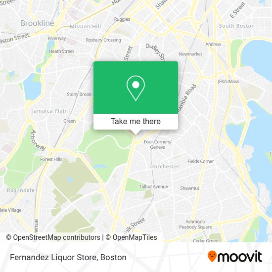
See Fernandez Liquor Store, Boston, on the map
Public Transit to Fernandez Liquor Store in Boston
Wondering how to get to Fernandez Liquor Store in Boston? Moovit helps you find the best way to get to Fernandez Liquor Store with step-by-step directions from the nearest public transit station.
Moovit provides free maps and live directions to help you navigate through your city. View schedules, routes, timetables, and find out how long does it take to get to Fernandez Liquor Store in real time.
Looking for the nearest stop or station to Fernandez Liquor Store? Check out this list of stops closest to your destination: Seaver St @ Blue Hill Ave; Blue Hill Ave @ Seaver St; Columbia Rd @ Seaver St; Franklin Park Zoo @ Entrance; Washington St @ Columbia Rd; Talbot Avenue; Fields Corner.
Bus: 14, 16, 22, 28, 29, 32, 34, 36, 10, 23, 45.Train: FAIRMOUNT, FRANKLIN/FOXBORO, FAIRMOUNT LINE SHUTTLE, PROVIDENCE/STOUGHTON.Subway: ORANGE LINE, RED LINE.
Want to see if there’s another route that gets you there at an earlier time? Moovit helps you find alternative routes or times. Get directions from and directions to Fernandez Liquor Store easily from the Moovit App or Website.
We make riding to Fernandez Liquor Store easy, which is why over 1.7 million users, including users in Boston, trust Moovit as the best app for public transit. You don’t need to download an individual bus app or train app, Moovit is your all-in-one transit app that helps you find the best bus time or train time available.
For information on prices of bus, subway and train, costs and ride fares to Fernandez Liquor Store, please check the Moovit app.
Use the app to navigate to popular places including to the airport, hospital, stadium, grocery store, mall, coffee shop, school, college, and university.
Fernandez Liquor Store Address: 562 Blue Hill Ave street in Boston
- Lilyp African Hair Braiding,
- Law Office of Susan T Aguiar (Law Offices of Susan T. Aguiar),
- Bulldog Towing Service,
- St Katharine Drexel,
- Boston Lights: A Lantern Experience,
- Brothers Supermarket (Brother's Supermarket),
- Jeremiah E Burke High School,
- Walaikum's Burger,
- Franklin Park Zoo,
- Ramzo African Market,
- Boston Public Library Grove Hall Branch,
- United House Of Prayer,
- Redbox,
- Blue Hill Ave & Georgia St,
- William J Devine Franklin Park Golf Course,
- Franklin Park Zoo @ Birds,
- Sunny Hill Garden Suites,
- Bebe's African Hair Braiding Salon,
- Zoorassic Park @ Franklin Park Zoo,
- Figueroa Mini Market
Places Near Fernandez Liquor Store (Boston)
- Faneuil Hall, Boston,
- Mgm Music Hall, Boston,
- Leader Bank Pavilion (Leader Bank Pavillion), Boston,
- Castle Island, Boston,
- Museum Of Science, Boston,
- Prudential Center, Boston,
- Cheers, Boston,
- Td Garden, Boston,
- Isabella Stewart Gardner Museum, Boston,
- Boston Children's Hospital, Boston,
- Boston Medical Center, Boston,
- North End, Boston,
- House Of Blues, Boston,
- Wilbur Theatre, Boston,
- Seaport District, Boston,
- Wang Theater, Boston,
- Boston Convention & Exhibition Center, Boston,
- Massachusetts General Hospital, Boston,
- Quincy Market, Boston,
- Boston Common, Boston
How to get to popular places in Boston with public transit
Get around Boston by public transit!
Traveling around Boston has never been so easy. See step by step directions as you travel to any attraction, street or major public transit station. View bus and train schedules, arrival times, service alerts and detailed routes on a map, so you know exactly how to get to anywhere in Boston.
When traveling to any destination around Boston use Moovit's Live Directions with Get Off Notifications to know exactly where and how far to walk, how long to wait for your line, and how many stops are left. Moovit will alert you when it's time to get off — no need to constantly re-check whether yours is the next stop.
Wondering how to use public transit in Boston or how to pay for public transit in Boston? Moovit public transit app can help you navigate your way with public transit easily, and at minimum cost. It includes public transit fees, ticket prices, and costs. Looking for a map of Boston public transit lines? Moovit public transit app shows all public transit maps in Boston with all Bus, Train, Subway and Ferry routes and stops on an interactive map.
Boston has 4 transit type(s), including: Bus, Train, Subway and Ferry, operated by several transit agencies, including MBTA, Southeastern Regional Transit Authority, MetroWest Regional Transit Authority, Rhode Island Public Transit Authority, WRTA, Lowell Regional Transit Authority, Merrimack Valley Transit, Montachusett Regional Transit Authority, Cape Cod Regional Transit Authority, Brockton Area Transit Authority, Martha's Vineyard Transit Authority, the WAVE - Nantucket Regional Transit Authority, GATRA, Cape Ann Transportation Authority and Massport