Directions to Fernando Oliveira (Boston) with public transportation
The following transit lines have routes that pass near Fernando Oliveira
 Bus: 203, 9.
- Ferry: SEASTREAK, SEASTREAK, CUTTYHUNK FERRY.
How to get to Fernando Oliveira by bus?
Click on the bus route to see step by step directions with maps, line arrival times and updated time schedules.
From RMV New Bedford, New Bedford
121 minFrom B.M.C. Durfee High School, Fall River
108 minFrom Bedford Industrial Park, New Bedford
123 minFrom Bristol Community College, Fall River
110 minFrom Charlton Memorial Hospital, Fall River
128 minFrom Lizzy Borden House, Fall River
80 minFrom Walmart Fall River Supercenter, Fall River
123 minFrom Amazon Fulfillment Bos7, Fall River
122 minFrom Falmouth MA USA, Falmouth
127 min
Ferry stations near Fernando Oliveira in Boston
What are the closest stations to Fernando Oliveira?
The closest stations to Fernando Oliveira are:
- New Bedford, MA is 4419 yards away, 52 min walk.
- Cuttyhunk Ferry Pier, New Bedford, MA is 4648 yards away, 55 min walk.
Which bus lines stop near Fernando Oliveira?
These bus lines stop near Fernando Oliveira: 203, 9.
What time is the first ferry to Fernando Oliveira in Boston?
The SEASTREAK is the first ferry that goes to Fernando Oliveira in Boston. It stops nearby at 8:20 AM.
What time is the last ferry to Fernando Oliveira in Boston?
The SEASTREAK is the last ferry that goes to Fernando Oliveira in Boston. It stops nearby at 8:40 PM.
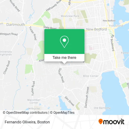
See Fernando Oliveira, Boston, on the map
Public Transit to Fernando Oliveira in Boston
Wondering how to get to Fernando Oliveira in Boston? Moovit helps you find the best way to get to Fernando Oliveira with step-by-step directions from the nearest public transit station.
Moovit provides free maps and live directions to help you navigate through your city. View schedules, routes, timetables, and find out how long does it take to get to Fernando Oliveira in real time.
Looking for the nearest stop or station to Fernando Oliveira? Check out this list of stops closest to your destination: New Bedford; Cuttyhunk Ferry Pier.
Bus: 203, 9.Ferry: SEASTREAK, SEASTREAK, CUTTYHUNK FERRY.
Want to see if there’s another route that gets you there at an earlier time? Moovit helps you find alternative routes or times. Get directions from and directions to Fernando Oliveira easily from the Moovit App or Website.
We make riding to Fernando Oliveira easy, which is why over 1.7 million users, including users in Boston, trust Moovit as the best app for public transit. You don’t need to download an individual bus app or train app, Moovit is your all-in-one transit app that helps you find the best bus time or train time available.
For information on prices of bus, costs and ride fares to Fernando Oliveira, please check the Moovit app.
Use the app to navigate to popular places including to the airport, hospital, stadium, grocery store, mall, coffee shop, school, college, and university.
Fernando Oliveira Address: 22 Leonor Dr street in Boston
- Lularoe Kristin Marie,
- Morton Tile Co,
- Taunton Federal Credit Union,
- Nat's Oil Burner Service,
- Betsey B. Winslow School Baseball Field,
- Friendly Sons of St Patrick Asso,
- Buttonwood Park Zoo,
- Hawthorn Street and Rockdale Avenue,
- Everything PC,
- Dartmouth, Massachusetts,
- James Perry Landscaping,
- Seaside Seafood,
- Cruz Painting & Drywall,
- Barry Auto Repair,
- Shevalin Grant SG Primerica,
- P6 Management Group,
- Dr James Lucarelli,
- Antonio M Goncalves DMD,
- Beauty Fix Studio,
- Salon Plush
Places Near Fernando Oliveira (Boston)
- Mgm Music Hall, Boston,
- Td Garden, Boston,
- Prudential Center, Boston,
- Castle Island, Boston,
- Seaport District, Boston,
- Boston Common, Boston,
- Cheers, Boston,
- House Of Blues, Boston,
- Wang Theater, Boston,
- Leader Bank Pavilion (Leader Bank Pavillion), Boston,
- Boston Children's Hospital, Boston,
- Museum Of Science, Boston,
- Massachusetts General Hospital, Boston,
- Wilbur Theatre, Boston,
- Faneuil Hall, Boston,
- Boston Convention & Exhibition Center, Boston,
- Quincy Market, Boston,
- Isabella Stewart Gardner Museum, Boston,
- Boston Medical Center, Boston,
- North End, Boston
How to get to popular places in Boston with public transit
Get around Boston by public transit!
Traveling around Boston has never been so easy. See step by step directions as you travel to any attraction, street or major public transit station. View bus and train schedules, arrival times, service alerts and detailed routes on a map, so you know exactly how to get to anywhere in Boston.
When traveling to any destination around Boston use Moovit's Live Directions with Get Off Notifications to know exactly where and how far to walk, how long to wait for your line, and how many stops are left. Moovit will alert you when it's time to get off — no need to constantly re-check whether yours is the next stop.
Wondering how to use public transit in Boston or how to pay for public transit in Boston? Moovit public transit app can help you navigate your way with public transit easily, and at minimum cost. It includes public transit fees, ticket prices, and costs. Looking for a map of Boston public transit lines? Moovit public transit app shows all public transit maps in Boston with all Bus, Train, Subway and Ferry routes and stops on an interactive map.
Boston has 4 transit type(s), including: Bus, Train, Subway and Ferry, operated by several transit agencies, including MBTA, Southeastern Regional Transit Authority, MetroWest Regional Transit Authority, Rhode Island Public Transit Authority, WRTA, Lowell Regional Transit Authority, Merrimack Valley Transit, Montachusett Regional Transit Authority, Cape Cod Regional Transit Authority, Brockton Area Transit Authority, Martha's Vineyard Transit Authority, the WAVE - Nantucket Regional Transit Authority, GATRA, Cape Ann Transportation Authority and Massport