Directions to Fetal Cardiology Program (Boston) with public transportation
The following transit lines have routes that pass near Fetal Cardiology Program
 Bus: 19, 354, 43, 450, SL4.
- Train: HAVERHILL, FITCHBURG, LOWELL, NEWBURYPORT/ROCKPORT, DOWNEASTER.
- Subway: BLUE LINE, ORANGE LINE, RED LINE, HAVERHILL LINE SHUTTLE, HAVERHILL LINE SHUTTLE.
How to get to Fetal Cardiology Program by bus?
Click on the bus route to see step by step directions with maps, line arrival times and updated time schedules.
From Melrose, MA, Melrose
78 minFrom Beth Israel Deaconess Medical Center, Brookline
45 minFrom Brookline High School (Brookline Town High School), Brookline
55 minFrom Heartbreak Hill, Newton
60 minFrom Market Basket, Revere
51 minFrom St. Elizabeth's, Boston
60 minFrom Wollaston Beach, Quincy
136 minFrom Marina Bay, Quincy
159 minFrom Newton, MA, Newton
60 minFrom Staybridge Suites Boston-Quincy, Quincy
115 min
How to get to Fetal Cardiology Program by train?
Click on the train route to see step by step directions with maps, line arrival times and updated time schedules.
How to get to Fetal Cardiology Program by subway?
Click on the subway route to see step by step directions with maps, line arrival times and updated time schedules.
From Beth Israel Deaconess Medical Center, Brookline
38 minFrom Brookline High School (Brookline Town High School), Brookline
42 minFrom Heartbreak Hill, Newton
62 minFrom St. Elizabeth's, Boston
53 minFrom Wollaston Beach, Quincy
49 minFrom Newton, MA, Newton
62 minFrom Staybridge Suites Boston-Quincy, Quincy
32 min
Bus stops near Fetal Cardiology Program in Boston
- Portland St @ Causeway St, 2 min walk,VIEW
- North Station - Lomasney Way @ Causeway St, 3 min walk,VIEW
- North Station - Nashua St @ Red Auerbach Way, 4 min walk,VIEW
- Charles/Mgh - 325 Cambridge St, 4 min walk,VIEW
- North Station - Haverhill St @ Causeway St, 4 min walk,VIEW
- North Station, 5 min walk,VIEW
- Beacon St @ Park St, 6 min walk,VIEW
- Government Center - Cambridge St @ Sudbury St, 8 min walk,VIEW
Train station near Fetal Cardiology Program in Boston
- North Station, 3 min walk,VIEW
Subway stations near Fetal Cardiology Program in Boston
Bus lines to Fetal Cardiology Program in Boston
- 4, Design Center,VIEW
- GREEN LINE SHUTTLE, Union Square (Shuttle),VIEW
- GREEN LINE SHUTTLE, Medford/Tufts Via Union Square (Shuttle),VIEW
- GREEN LINE E SHUTTLE, Government Center - Medford/Tufts (Shuttle),VIEW
- GREEN LINE E SHUTTLE, North Station - Medford/Tufts (Shuttle),VIEW
- GREEN LINE E SHUTTLE, Medford/Tufts - North Station,VIEW
- GREEN LINE SHUTTLE, Union Square - North Station,VIEW
- GREEN LINE SHUTTLE, Lechmere - North Station,VIEW
- GREEN LINE SHUTTLE, North Station - Sullivan Square via East Somerville,VIEW
- RED LINE SHUTTLE, Alewife - Park Street,VIEW
- RED LINE SHUTTLE, Kendall/MIT - Broadway via Pearl Street,VIEW
- RED LINE SHUTTLE, Harvard - JFK/UMass via Congress Street,VIEW
- RED LINE SHUTTLE, Harvard - Broadway,VIEW
- RED LINE SHUTTLE, Kendall/MIT - JFK/UMass,VIEW
- RED LINE SHUTTLE, Kendall/MIT - Broadway via Downtown Crossing,VIEW
- RED LINE SHUTTLE, Harvard - South Station,VIEW
- RED LINE SHUTTLE, Kendall/MIT - Park Street,VIEW
- RED LINE SHUTTLE, Harvard - JFK/UMass via State Street,VIEW
- RED LINE SHUTTLE, JFK/UMass - Kendall/MIT (Shuttle),VIEW
- RED LINE SHUTTLE, Harvard - Park Street,VIEW
What are the closest stations to Fetal Cardiology Program?
The closest stations to Fetal Cardiology Program are:
- Portland St @ Causeway St is 106 yards away, 2 min walk.
- North Station - Lomasney Way @ Causeway St is 166 yards away, 3 min walk.
- North Station is 222 yards away, 3 min walk.
- North Station - Nashua St @ Red Auerbach Way is 233 yards away, 4 min walk.
- Causeway St (East) is 237 yards away, 4 min walk.
- Charles/Mgh - 325 Cambridge St is 272 yards away, 4 min walk.
- North Station - Haverhill St @ Causeway St is 311 yards away, 4 min walk.
- Charles/Mgh is 322 yards away, 4 min walk.
- Bowdoin is 453 yards away, 6 min walk.
- Beacon St @ Park St is 455 yards away, 6 min walk.
- Government Center - Cambridge St @ Sudbury St is 601 yards away, 8 min walk.
Which bus lines stop near Fetal Cardiology Program?
These bus lines stop near Fetal Cardiology Program: 19, 354, 43, 450, SL4.
Which train line stops near Fetal Cardiology Program?
HAVERHILL (#1220 | North Station)
Which subway lines stop near Fetal Cardiology Program?
These subway lines stop near Fetal Cardiology Program: BLUE LINE, ORANGE LINE, RED LINE.
What’s the nearest subway station to Fetal Cardiology Program in Boston?
The nearest subway stations to Fetal Cardiology Program in Boston are Causeway St (East) and Charles/Mgh. The closest one is a 4 min walk away.
What’s the nearest train station to Fetal Cardiology Program in Boston?
The nearest train station to Fetal Cardiology Program in Boston is North Station. It’s a 3 min walk away.
What’s the nearest bus station to Fetal Cardiology Program in Boston?
The nearest bus station to Fetal Cardiology Program in Boston is Portland St @ Causeway St. It’s a 2 min walk away.
What time is the first subway to Fetal Cardiology Program in Boston?
The GREEN LINE E is the first subway that goes to Fetal Cardiology Program in Boston. It stops nearby at 4:57 AM.
What time is the last subway to Fetal Cardiology Program in Boston?
The GREEN LINE E is the last subway that goes to Fetal Cardiology Program in Boston. It stops nearby at 2:28 AM.
What time is the first train to Fetal Cardiology Program in Boston?
The LOWELL is the first train that goes to Fetal Cardiology Program in Boston. It stops nearby at 5:20 AM.
What time is the last train to Fetal Cardiology Program in Boston?
The LOWELL is the last train that goes to Fetal Cardiology Program in Boston. It stops nearby at 12:34 AM.
What time is the first bus to Fetal Cardiology Program in Boston?
The 43 is the first bus that goes to Fetal Cardiology Program in Boston. It stops nearby at 5:09 AM.
What time is the last bus to Fetal Cardiology Program in Boston?
The 43 is the last bus that goes to Fetal Cardiology Program in Boston. It stops nearby at 12:42 AM.
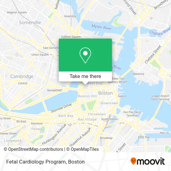
See Fetal Cardiology Program, Boston, on the map
Public Transit to Fetal Cardiology Program in Boston
Wondering how to get to Fetal Cardiology Program in Boston? Moovit helps you find the best way to get to Fetal Cardiology Program with step-by-step directions from the nearest public transit station.
Moovit provides free maps and live directions to help you navigate through your city. View schedules, routes, timetables, and find out how long does it take to get to Fetal Cardiology Program in real time.
Looking for the nearest stop or station to Fetal Cardiology Program? Check out this list of stops closest to your destination: Portland St @ Causeway St; North Station - Lomasney Way @ Causeway St; North Station; North Station - Nashua St @ Red Auerbach Way; Causeway St (East); Charles/Mgh - 325 Cambridge St; North Station - Haverhill St @ Causeway St; Charles/Mgh; Bowdoin; Beacon St @ Park St; Government Center - Cambridge St @ Sudbury St.
Bus: 19, 354, 43, 450, SL4, 4, GREEN LINE SHUTTLE, GREEN LINE SHUTTLE.Train: HAVERHILL, FITCHBURG, LOWELL, NEWBURYPORT/ROCKPORT, DOWNEASTER.Subway: BLUE LINE, ORANGE LINE, RED LINE, HAVERHILL LINE SHUTTLE, HAVERHILL LINE SHUTTLE, LOWELL LINE SHUTTLE, LOWELL LINE SHUTTLE, NEWBURYPORT/ROCKPORT LINE SHUTTLE.
Want to see if there’s another route that gets you there at an earlier time? Moovit helps you find alternative routes or times. Get directions from and directions to Fetal Cardiology Program easily from the Moovit App or Website.
We make riding to Fetal Cardiology Program easy, which is why over 1.7 million users, including users in Boston, trust Moovit as the best app for public transit. You don’t need to download an individual bus app or train app, Moovit is your all-in-one transit app that helps you find the best bus time or train time available.
For information on prices of subway, bus and train, costs and ride fares to Fetal Cardiology Program, please check the Moovit app.
Use the app to navigate to popular places including to the airport, hospital, stadium, grocery store, mall, coffee shop, school, college, and university.
Fetal Cardiology Program Address: Yawkey Center for Outpatient Care, 55 Fruit St 6 C street in Boston
- Bigelow Amphitheater,
- Massachusetts General Hospital,
- Massachusetts General Hospital Cancer Center,
- Massachusetts General Hospital / Harvard Medical School,
- Mgh morgue - Warren 2 basement,
- Ether Dome,
- 300 Longwood Ave,
- 15 Parkman Street,
- Lehrich James R Phys (Dr James Warren May, MD),
- Massachusetts General Hospital - Wang Acc Lobby Valet,
- MGH Parking Yawkey Val,
- Bulfinch Building (MGH),
- MGH Bigelow 11 - General Medicine,
- Prout George R Jr,
- MEEI - ENT Clinic,
- Massachusetts Eye And Ear,
- David Forcione,
- Andrew Oseran MD,
- Nina Shervin MD,
- Massachusetts Infectious Disss Soc (Kuter David John MD - Massachusetts General Hospital)
Places Near Fetal Cardiology Program (Boston)
- Castle Island, Boston,
- Boston Convention & Exhibition Center, Boston,
- Seaport District, Boston,
- Prudential Center, Boston,
- Wilbur Theatre, Boston,
- Museum Of Science, Boston,
- Mgm Music Hall, Boston,
- Wang Theater, Boston,
- Faneuil Hall, Boston,
- Td Garden, Boston,
- Quincy Market, Boston,
- Massachusetts General Hospital, Boston,
- Boston Medical Center, Boston,
- North End, Boston,
- Leader Bank Pavilion (Leader Bank Pavillion), Boston,
- Cheers, Boston,
- Boston Children's Hospital, Boston,
- House Of Blues, Boston,
- Boston Common, Boston,
- Isabella Stewart Gardner Museum, Boston
How to get to popular places in Boston with public transit
Get around Boston by public transit!
Traveling around Boston has never been so easy. See step by step directions as you travel to any attraction, street or major public transit station. View bus and train schedules, arrival times, service alerts and detailed routes on a map, so you know exactly how to get to anywhere in Boston.
When traveling to any destination around Boston use Moovit's Live Directions with Get Off Notifications to know exactly where and how far to walk, how long to wait for your line, and how many stops are left. Moovit will alert you when it's time to get off — no need to constantly re-check whether yours is the next stop.
Wondering how to use public transit in Boston or how to pay for public transit in Boston? Moovit public transit app can help you navigate your way with public transit easily, and at minimum cost. It includes public transit fees, ticket prices, and costs. Looking for a map of Boston public transit lines? Moovit public transit app shows all public transit maps in Boston with all Bus, Train, Subway and Ferry routes and stops on an interactive map.
Boston has 4 transit type(s), including: Bus, Train, Subway and Ferry, operated by several transit agencies, including MBTA, Southeastern Regional Transit Authority, MetroWest Regional Transit Authority, Rhode Island Public Transit Authority, WRTA, Lowell Regional Transit Authority, Merrimack Valley Transit, Montachusett Regional Transit Authority, Cape Cod Regional Transit Authority, Brockton Area Transit Authority, Martha's Vineyard Transit Authority, the WAVE - Nantucket Regional Transit Authority, GATRA, Cape Ann Transportation Authority and Massport