How to get to Field Locksmith Shop by bus?
Click on the bus route to see step by step directions with maps, line arrival times and updated time schedules.
From Chestnut Hill, Boston
87 minFrom Hanscom AFB, Hanscom Afb
60 minFrom Boston College (BC), Boston
86 minFrom Costco, Everett
94 minFrom Mass Ave, Cambridge
39 minFrom Le Meridien Cambridge-Mit, Cambridge
51 minFrom Scullers Jazz Club, Boston
68 minFrom Gateway Center, Everett
92 minFrom Harvard Square T Station - Red Line, Cambridge
37 minFrom Melrose Wakefield Hospital, Malden
98 min
How to get to Field Locksmith Shop by train?
Click on the train route to see step by step directions with maps, line arrival times and updated time schedules.
Bus stops near Field Locksmith Shop in Arlington
Train station near Field Locksmith Shop in Arlington
- Belmont, 19 min walk,VIEW
What are the closest stations to Field Locksmith Shop?
The closest stations to Field Locksmith Shop are:
- Wachusett Ave @ Dow Ave is 34 yards away, 1 min walk.
- Massachusetts Ave @ Park Ave is 420 yards away, 5 min walk.
- Belmont is 1564 yards away, 19 min walk.
Which bus lines stop near Field Locksmith Shop?
These bus lines stop near Field Locksmith Shop: 62, 77.
Which train line stops near Field Locksmith Shop?
FITCHBURG (#413 | Wachusett)
What’s the nearest train station to Field Locksmith Shop in Arlington?
The nearest train station to Field Locksmith Shop in Arlington is Belmont. It’s a 19 min walk away.
What’s the nearest bus station to Field Locksmith Shop in Arlington?
The nearest bus station to Field Locksmith Shop in Arlington is Wachusett Ave @ Dow Ave. It’s a 1 min walk away.
What time is the first train to Field Locksmith Shop in Arlington?
The FITCHBURG is the first train that goes to Field Locksmith Shop in Arlington. It stops nearby at 5:41 AM.
What time is the last train to Field Locksmith Shop in Arlington?
The FITCHBURG is the last train that goes to Field Locksmith Shop in Arlington. It stops nearby at 12:11 AM.
What time is the first bus to Field Locksmith Shop in Arlington?
The 77 is the first bus that goes to Field Locksmith Shop in Arlington. It stops nearby at 4:49 AM.
What time is the last bus to Field Locksmith Shop in Arlington?
The 77 is the last bus that goes to Field Locksmith Shop in Arlington. It stops nearby at 1:29 AM.
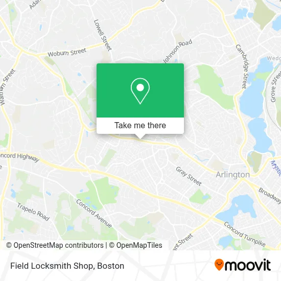
See Field Locksmith Shop, Arlington, on the map
Public Transit to Field Locksmith Shop in Arlington
Wondering how to get to Field Locksmith Shop in Arlington? Moovit helps you find the best way to get to Field Locksmith Shop with step-by-step directions from the nearest public transit station.
Moovit provides free maps and live directions to help you navigate through your city. View schedules, routes, timetables, and find out how long does it take to get to Field Locksmith Shop in real time.
Looking for the nearest stop or station to Field Locksmith Shop? Check out this list of stops closest to your destination: Wachusett Ave @ Dow Ave; Massachusetts Ave @ Park Ave; Belmont.
Bus: 62, 77, 78.Train: FITCHBURG.
Want to see if there’s another route that gets you there at an earlier time? Moovit helps you find alternative routes or times. Get directions from and directions to Field Locksmith Shop easily from the Moovit App or Website.
We make riding to Field Locksmith Shop easy, which is why over 1.7 million users, including users in Arlington, trust Moovit as the best app for public transit. You don’t need to download an individual bus app or train app, Moovit is your all-in-one transit app that helps you find the best bus time or train time available.
For information on prices of bus, subway and train, costs and ride fares to Field Locksmith Shop, please check the Moovit app.
Use the app to navigate to popular places including to the airport, hospital, stadium, grocery store, mall, coffee shop, school, college, and university.
Field Locksmith Shop Address: 1425 Massachusetts Ave street in Arlington
- American Locksmith,
- Starbucks,
- Bright and Beautiful Carpet Cleaning,
- Arlington Lock and Key Inc,
- Arlington Village Shops,
- Hong Zhou Restaurant,
- Thai Sticky Rice,
- Mckay Security,
- Nextburb,
- Victoria Painting of Massachusetts,
- James Trano Realtor Arlington Real Estate Senn Re,
- Rephairations,
- Shred Nations,
- Ugandan North American Association - Unaa,
- Kds Productions,
- 28 Litsea,
- Xfinity,
- Reservoir Field,
- Brite Harvest Farm,
- 7 Mass Ave Arlington Mal's Towing
Places Near Field Locksmith Shop (Arlington)
- Faneuil Hall, Boston,
- Boston Medical Center, Boston,
- Museum Of Science, Boston,
- Td Garden, Boston,
- Castle Island, Boston,
- Mgm Music Hall, Boston,
- Prudential Center, Boston,
- Leader Bank Pavilion (Leader Bank Pavillion), Boston,
- Boston Children's Hospital, Boston,
- North End, Boston,
- Seaport District, Boston,
- Quincy Market, Boston,
- Cheers, Boston,
- Wang Theater, Boston,
- Isabella Stewart Gardner Museum, Boston,
- Wilbur Theatre, Boston,
- Massachusetts General Hospital, Boston,
- House Of Blues, Boston,
- Boston Common, Boston,
- Boston Convention & Exhibition Center, Boston
How to get to popular places in Boston with public transit
Get around Arlington by public transit!
Traveling around Arlington has never been so easy. See step by step directions as you travel to any attraction, street or major public transit station. View bus and train schedules, arrival times, service alerts and detailed routes on a map, so you know exactly how to get to anywhere in Arlington.
When traveling to any destination around Arlington use Moovit's Live Directions with Get Off Notifications to know exactly where and how far to walk, how long to wait for your line, and how many stops are left. Moovit will alert you when it's time to get off — no need to constantly re-check whether yours is the next stop.
Wondering how to use public transit in Arlington or how to pay for public transit in Arlington? Moovit public transit app can help you navigate your way with public transit easily, and at minimum cost. It includes public transit fees, ticket prices, and costs. Looking for a map of Arlington public transit lines? Moovit public transit app shows all public transit maps in Arlington with all Bus, Train, Subway and Ferry routes and stops on an interactive map.
Boston has 4 transit type(s), including: Bus, Train, Subway and Ferry, operated by several transit agencies, including MBTA, Southeastern Regional Transit Authority, MetroWest Regional Transit Authority, Rhode Island Public Transit Authority, WRTA, Lowell Regional Transit Authority, Merrimack Valley Transit, Montachusett Regional Transit Authority, Cape Cod Regional Transit Authority, Brockton Area Transit Authority, Martha's Vineyard Transit Authority, the WAVE - Nantucket Regional Transit Authority, GATRA, Cape Ann Transportation Authority and Massport