Directions to Fierce by Choice (Needham) with public transportation
The following transit lines have routes that pass near Fierce by Choice
 Bus: 01, 59.
- Train: NEEDHAM.
- Subway: GREEN LINE D.
How to get to Fierce by Choice by bus?
Click on the bus route to see step by step directions with maps, line arrival times and updated time schedules.
From Sanofi-Genzyme, Waltham
111 minFrom Studio Allston, Boston
58 minFrom VA Hospital, Boston
103 minFrom VA Medical Center, Boston (Jamaica Plain), Boston
102 minFrom Brookline High School (Brookline Town High School), Brookline
77 minFrom Jamaica Plain VA Medical Center (VA Hospital), Boston
101 minFrom Six Flags New England, Newton
33 minFrom Watertown Mall, Watertown Town
51 minFrom Conte Forum, Boston
78 min
How to get to Fierce by Choice by train?
Click on the train route to see step by step directions with maps, line arrival times and updated time schedules.
How to get to Fierce by Choice by subway?
Click on the subway route to see step by step directions with maps, line arrival times and updated time schedules.
Bus stop near Fierce by Choice in Needham
- Central Ave @ Reservoir St, 5 min walk,VIEW
Subway station near Fierce by Choice in Needham
- Eliot, 15 min walk,VIEW
Train station near Fierce by Choice in Needham
- Needham Center, 21 min walk,VIEW
Bus lines to Fierce by Choice in Needham
- 59, Needham Junction Via Needham St,VIEW
What are the closest stations to Fierce by Choice?
The closest stations to Fierce by Choice are:
- Central Ave @ Reservoir St is 388 yards away, 5 min walk.
- Eliot is 1214 yards away, 15 min walk.
- Needham Center is 1766 yards away, 21 min walk.
Which bus lines stop near Fierce by Choice?
These bus lines stop near Fierce by Choice: 01, 59.
Which train line stops near Fierce by Choice?
NEEDHAM (#625 | Needham Heights)
Which subway line stops near Fierce by Choice?
GREEN LINE D (Riverside)
What’s the nearest subway station to Fierce by Choice in Needham?
The nearest subway station to Fierce by Choice in Needham is Eliot. It’s a 15 min walk away.
What’s the nearest train station to Fierce by Choice in Needham?
The nearest train station to Fierce by Choice in Needham is Needham Center. It’s a 21 min walk away.
What’s the nearest bus station to Fierce by Choice in Needham?
The nearest bus station to Fierce by Choice in Needham is Central Ave @ Reservoir St. It’s a 5 min walk away.
What time is the first subway to Fierce by Choice in Needham?
The GREEN LINE D is the first subway that goes to Fierce by Choice in Needham. It stops nearby at 4:48 AM.
What time is the last subway to Fierce by Choice in Needham?
The GREEN LINE D is the last subway that goes to Fierce by Choice in Needham. It stops nearby at 2:44 AM.
What time is the first train to Fierce by Choice in Needham?
The NEEDHAM is the first train that goes to Fierce by Choice in Needham. It stops nearby at 7:05 AM.
What time is the last train to Fierce by Choice in Needham?
The NEEDHAM is the last train that goes to Fierce by Choice in Needham. It stops nearby at 6:38 PM.
What time is the first bus to Fierce by Choice in Needham?
The 59 is the first bus that goes to Fierce by Choice in Needham. It stops nearby at 6:25 AM.
What time is the last bus to Fierce by Choice in Needham?
The 59 is the last bus that goes to Fierce by Choice in Needham. It stops nearby at 8:00 PM.
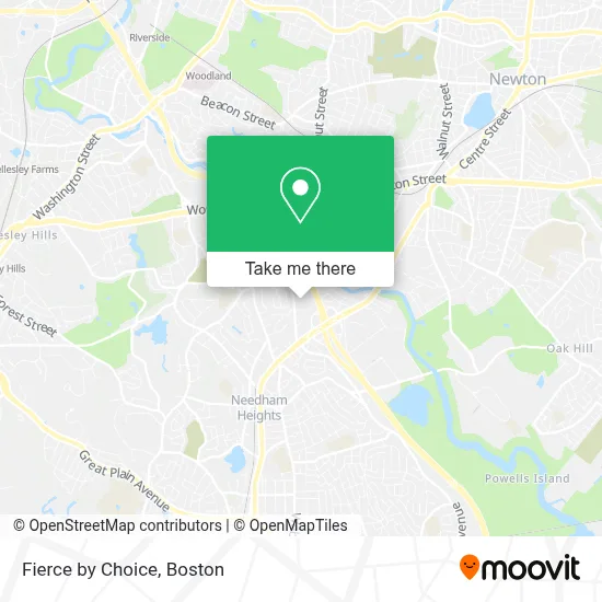
See Fierce by Choice, Needham, on the map
Public Transit to Fierce by Choice in Needham
Wondering how to get to Fierce by Choice in Needham? Moovit helps you find the best way to get to Fierce by Choice with step-by-step directions from the nearest public transit station.
Moovit provides free maps and live directions to help you navigate through your city. View schedules, routes, timetables, and find out how long does it take to get to Fierce by Choice in real time.
Looking for the nearest stop or station to Fierce by Choice? Check out this list of stops closest to your destination: Central Ave @ Reservoir St; Eliot; Needham Center.
Bus: 01, 59.Train: NEEDHAM.Subway: GREEN LINE D.
Want to see if there’s another route that gets you there at an earlier time? Moovit helps you find alternative routes or times. Get directions from and directions to Fierce by Choice easily from the Moovit App or Website.
We make riding to Fierce by Choice easy, which is why over 1.7 million users, including users in Needham, trust Moovit as the best app for public transit. You don’t need to download an individual bus app or train app, Moovit is your all-in-one transit app that helps you find the best bus time or train time available.
For information on prices of bus, subway and train, costs and ride fares to Fierce by Choice, please check the Moovit app.
Use the app to navigate to popular places including to the airport, hospital, stadium, grocery store, mall, coffee shop, school, college, and university.
Fierce by Choice Address: 140 Gould St street in Needham
- Russian Cultural Center Lukomorie,
- Mass Discount Fuel,
- Rodman Insurance Agency,
- GF Spraque,
- Garment Machinery Company, Inc.,
- Ihloom Cybersecurity,
- Fix It Guy,
- Nauset,
- Gretta Enterprises,
- Scott Corporation Boston,
- Laboratory & Testing Mobile Testing Service,
- St Equipment & Technology,
- Newscenter 5 (WCVB-TV),
- Chiropractic Auto Accident Services,
- Exit 35C-B-A/Highland Ave/S,
- Number One Source,
- Charles River Media Group,
- Genalco Inc,
- Ostelis Aesthetic Medical Center,
- PRN Software
Places Near Fierce by Choice (Needham)
- Boston Common, Boston,
- Isabella Stewart Gardner Museum, Boston,
- North End, Boston,
- Boston Medical Center, Boston,
- House Of Blues, Boston,
- Quincy Market, Boston,
- Massachusetts General Hospital, Boston,
- Museum Of Science, Boston,
- Cheers, Boston,
- Td Garden, Boston,
- Faneuil Hall, Boston,
- Castle Island, Boston,
- Boston Convention & Exhibition Center, Boston,
- Leader Bank Pavilion (Leader Bank Pavillion), Boston,
- Boston Children's Hospital, Boston,
- Wilbur Theatre, Boston,
- Seaport District, Boston,
- Prudential Center, Boston,
- Mgm Music Hall, Boston,
- Wang Theater, Boston
How to get to popular places in Boston with public transit
Get around Needham by public transit!
Traveling around Needham has never been so easy. See step by step directions as you travel to any attraction, street or major public transit station. View bus and train schedules, arrival times, service alerts and detailed routes on a map, so you know exactly how to get to anywhere in Needham.
When traveling to any destination around Needham use Moovit's Live Directions with Get Off Notifications to know exactly where and how far to walk, how long to wait for your line, and how many stops are left. Moovit will alert you when it's time to get off — no need to constantly re-check whether yours is the next stop.
Wondering how to use public transit in Needham or how to pay for public transit in Needham? Moovit public transit app can help you navigate your way with public transit easily, and at minimum cost. It includes public transit fees, ticket prices, and costs. Looking for a map of Needham public transit lines? Moovit public transit app shows all public transit maps in Needham with all Bus, Train, Subway and Ferry routes and stops on an interactive map.
Boston has 4 transit type(s), including: Bus, Train, Subway and Ferry, operated by several transit agencies, including MBTA, Southeastern Regional Transit Authority, MetroWest Regional Transit Authority, Rhode Island Public Transit Authority, WRTA, Lowell Regional Transit Authority, Merrimack Valley Transit, Montachusett Regional Transit Authority, Cape Cod Regional Transit Authority, Brockton Area Transit Authority, Martha's Vineyard Transit Authority, the WAVE - Nantucket Regional Transit Authority, GATRA, Cape Ann Transportation Authority and Massport