How to get to Fiola by bus?
Click on the bus route to see step by step directions with maps, line arrival times and updated time schedules.
From Alexandria Courthouse, Alexandria
43 minFrom Montgomery College-Takoma Park/Silver Spring, Montgomery County
55 minFrom Washington Yu Ying Public Charter School, Washington
44 minFrom Germantown Md, Washington
44 minFrom The Mall at Prince Georges, Prince George's County
76 minFrom Washington National Cathedral (Atlantic Services Location, Washington
46 minFrom Nova- Alexandria Campus, Alexandria
61 minFrom MedStar Georgetown University Hospital, Washington
42 minFrom Sheraton Pentagon City Hotel, Arlington County
47 minFrom Old Town Alexandria, Alexandria
42 min
How to get to Fiola by train?
Click on the train route to see step by step directions with maps, line arrival times and updated time schedules.
How to get to Fiola by metro?
Click on the metro route to see step by step directions with maps, line arrival times and updated time schedules.
From Alexandria Courthouse, Alexandria
42 minFrom Montgomery College-Takoma Park/Silver Spring, Montgomery County
38 minFrom Washington Yu Ying Public Charter School, Washington
37 minFrom The Mall at Prince Georges, Prince George's County
39 minFrom Washington National Cathedral (Atlantic Services Location, Washington
45 minFrom Sheraton Pentagon City Hotel, Arlington County
39 minFrom Old Town Alexandria, Alexandria
40 min
Bus stops near Fiola in Washington
- Pennsylvania Av Nw+6 St NW, 2 min walk,VIEW
- Pennsylvania Ave & 6th St NW Eb, 2 min walk,VIEW
- 7 St Nw+Pennsylvania Av NW, 2 min walk,VIEW
- Pennsylvania Av Nw+7 St NW, 3 min walk,VIEW
- Pennsylvania Ave & 7th St NW FS Wb, 3 min walk,VIEW
- Pennsylvania Ave & 7th St Nw, 3 min walk,VIEW
- 7th St NW & Constitution Ave Eb, 4 min walk,VIEW
- Pennsylvania Ave & 9th St NW Eb, 4 min walk,VIEW
Metro stations near Fiola in Washington
Bus lines to Fiola in Washington
- D10, West To Foggy Bottom,VIEW
- 230, 230/9 Annapolis,VIEW
- 250, 250/1 Washington Dc,VIEW
- D4X, 7 St-Georgia Av Limited,VIEW
- D40, 7 St-Georgia Av,VIEW
- D1X, East To Naylor Rd,VIEW
- D60, South To L'Enfant Plaza,VIEW
- 610, 610/7 Washington Dc,VIEW
- 640, 640/5 Washington Dc,VIEW
- 650, 650/8 La Plata,VIEW
- 705, 705/3 Washington Dc,VIEW
- 810, 810/5 Pindell,VIEW
- 820, 820/2 Washington Dc,VIEW
- 830, 830/2 Washington Dc,VIEW
- 840, 840/3 Washington Dc,VIEW
- 943, 543 - L'Enfant Plaza - Washington, Dc,VIEW
- 953, 234 Lot / Montclair,VIEW
- 305, 305/3 Washington Dc,VIEW
- 315, 315/2 Washington Dc,VIEW
- 325, 325/6 Columbia,VIEW
What are the closest stations to Fiola?
The closest stations to Fiola are:
- Pennsylvania Av Nw+6 St NW is 100 yards away, 2 min walk.
- Pennsylvania Ave & 6th St NW Eb is 118 yards away, 2 min walk.
- 7 St Nw+Pennsylvania Av NW is 152 yards away, 2 min walk.
- Pennsylvania Av Nw+7 St NW is 174 yards away, 3 min walk.
- Pennsylvania Ave & 7th St NW FS Wb is 183 yards away, 3 min walk.
- Pennsylvania Ave & 7th St Nw is 189 yards away, 3 min walk.
- Archives-Navy Memorial-Penn Quarter Metro Station is 237 yards away, 3 min walk.
- 7th St NW & Constitution Ave Eb is 273 yards away, 4 min walk.
- Pennsylvania Ave & 9th St NW Eb is 297 yards away, 4 min walk.
- Judiciary Square is 949 yards away, 12 min walk.
- Smithsonian Metrorail is 1260 yards away, 15 min walk.
Which bus lines stop near Fiola?
These bus lines stop near Fiola: 953, D10, D4X, D6X, F19.
Which train lines stop near Fiola?
These train lines stop near Fiola: MARC, NORTHEAST REGIONAL.
Which metro lines stop near Fiola?
These metro lines stop near Fiola: GREEN, RED, YELLOW.
What’s the nearest metro station to Fiola in Washington?
The nearest metro station to Fiola in Washington is Archives-Navy Memorial-Penn Quarter Metro Station. It’s a 3 min walk away.
What’s the nearest bus station to Fiola in Washington?
The nearest bus stations to Fiola in Washington are Pennsylvania Av Nw+6 St NW, Pennsylvania Ave & 6th St NW Eb and 7 St Nw+Pennsylvania Av NW. The closest one is a 2 min walk away.
What time is the first metro to Fiola in Washington?
The BLUE is the first metro that goes to Fiola in Washington. It stops nearby at 5:19 AM.
What time is the last metro to Fiola in Washington?
The GREEN is the last metro that goes to Fiola in Washington. It stops nearby at 12:17 AM.
What time is the first bus to Fiola in Washington?
The D40 is the first bus that goes to Fiola in Washington. It stops nearby at 3:00 AM.
What time is the last bus to Fiola in Washington?
The D40 is the last bus that goes to Fiola in Washington. It stops nearby at 3:20 AM.
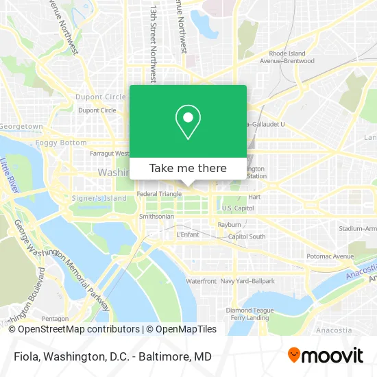
See Fiola, Washington, on the map
Public Transit to Fiola in Washington
Wondering how to get to Fiola in Washington? Moovit helps you find the best way to get to Fiola with step-by-step directions from the nearest public transit station.
Moovit provides free maps and live directions to help you navigate through your city. View schedules, routes, timetables, and find out how long does it take to get to Fiola in real time.
Looking for the nearest stop or station to Fiola? Check out this list of stops closest to your destination: Pennsylvania Av Nw+6 St NW; Pennsylvania Ave & 6th St NW Eb; 7 St Nw+Pennsylvania Av NW; Pennsylvania Av Nw+7 St NW; Pennsylvania Ave & 7th St NW FS Wb; Pennsylvania Ave & 7th St Nw; Archives-Navy Memorial-Penn Quarter Metro Station; 7th St NW & Constitution Ave Eb; Pennsylvania Ave & 9th St NW Eb; Judiciary Square; Smithsonian Metrorail.
Bus: 953, D10, D4X, D6X, F19, 230, 250, D40.Train: MARC, NORTHEAST REGIONAL.Metro: GREEN, RED, YELLOW, BLUE, ORANGE, SILVER.
Want to see if there’s another route that gets you there at an earlier time? Moovit helps you find alternative routes or times. Get directions from and directions to Fiola easily from the Moovit App or Website.
We make riding to Fiola easy, which is why over 1.5 million users, including users in Washington, trust Moovit as the best app for public transit. You don’t need to download an individual bus app or train app, Moovit is your all-in-one transit app that helps you find the best bus time or train time available.
For information on prices of bus, metro and train, costs and ride fares to Fiola, please check the Moovit app.
Use the app to navigate to popular places including to the airport, hospital, stadium, grocery store, mall, coffee shop, school, college, and university.
Fiola Address: 601 Pennsylvania Ave NW street in Washington
- Mendoza Law Firm,
- The Commonwealth of Virginia Public Defenders Service,
- United States Business Association of E-Commerce,
- Cisco Systems (Cisco Systems Government Affairs),
- Michael Best Strategies,
- The Capital Grille,
- Federal Trade Commission (Katherine Race Brin Fed Trade Comm),
- 601 Pennsylvania Ave North Buiding,
- Constitution Avenue and 6th Avenue,
- Orientation Theater (Big Screen Theater),
- Capital Grille,
- Holiday Party at Newseum (Byt Newseum 2 : Way Out of Line),
- Newseum,
- 7th St & Constitution Ave NW,
- Constitution Ave NW and 6th St NW,
- Newseum Store,
- Penn Quarter Sports Tavern,
- 7th & Indiana,
- Snallygaster,
- Juror's Lounge
Places Near Fiola (Washington)
- Camden Yards, Baltimore,
- Pennsylvania Ave NW (3rd st and pennsylvania), Washington,
- Museum Of The Bible, Washington,
- National Museum of African American History and Culture, Washington,
- Marriott Marquis Washington, DC, Washington,
- Georgetown, Washington,
- Rock Creek Tennis Center, Washington,
- Capital One Arena, Washington,
- M&T Bank Stadium, Baltimore,
- Washington DC VA Medical Center, Washington,
- The Anthem, Washington,
- Washington National Cathedral, Washington,
- Basilica of the National Shrine, Washington,
- National Mall, Washington,
- Westfield Montgomery Mall, Montgomery County,
- Amazon Hq2, Arlington County,
- PG Mall, Prince George's County,
- Sibley Memorial Hospital, Washington,
- Warner Theatre, Washington,
- National Zoo, Washington
How to get to popular places in Washington, D.C. - Baltimore, MD with public transit
Get around Washington by public transit!
Traveling around Washington has never been so easy. See step by step directions as you travel to any attraction, street or major public transit station. View bus and train schedules, arrival times, service alerts and detailed routes on a map, so you know exactly how to get to anywhere in Washington.
When traveling to any destination around Washington use Moovit's Live Directions with Get Off Notifications to know exactly where and how far to walk, how long to wait for your line, and how many stops are left. Moovit will alert you when it's time to get off — no need to constantly re-check whether yours is the next stop.
Wondering how to use public transit in Washington or how to pay for public transit in Washington? Moovit public transit app can help you navigate your way with public transit easily, and at minimum cost. It includes public transit fees, ticket prices, and costs. Looking for a map of Washington public transit lines? Moovit public transit app shows all public transit maps in Washington with all Bus, Train, Metro, Light Rail and Ferry routes and stops on an interactive map.
Washington, D.C. - Baltimore, MD has 5 transit type(s), including: Bus, Train, Metro, Light Rail and Ferry, operated by several transit agencies, including WMATA, Montgomery County Ride On, Fairfax Connector, TheBus, PRTC, DASH - Alexandria, Arlington Transit (ART), RTA of Central Maryland, MDOT MTA, MDOT MTA Light RailLink, MDOT MTA Commuter Bus, MDOT MTA Local Bus, FXBGO!, Virginia Railway Express (VRE) and MARC