Directions to First Baptist Church (Boston) with public transportation
The following transit lines have routes that pass near First Baptist Church
 Bus: 202, 21, 215, 23, 201.
- Train: FAIRMOUNT, FAIRMOUNT LINE SHUTTLE, FRANKLIN/FOXBORO, PROVIDENCE/STOUGHTON.
- Subway: RED LINE, MATTAPAN LINE.
How to get to First Baptist Church by bus?
Click on the bus route to see step by step directions with maps, line arrival times and updated time schedules.
From Brighton, Boston
84 minFrom Inman Sq, Cambridge
85 minFrom Le Meridien, Boston
75 minFrom Charlestown, Boston
99 minFrom Braintree, MA, Braintree Town
57 minFrom Boston Harbor, Boston
82 minFrom VA Hospital, Boston
61 minFrom Prudential Center, Boston
69 minFrom Spaulding Rehabilitation Hospital, Boston
97 minFrom Rino's Place, Boston
103 min
How to get to First Baptist Church by train?
Click on the train route to see step by step directions with maps, line arrival times and updated time schedules.
How to get to First Baptist Church by subway?
Click on the subway route to see step by step directions with maps, line arrival times and updated time schedules.
Bus stops near First Baptist Church in Boston
Subway stations near First Baptist Church in Boston
Train station near First Baptist Church in Boston
- Talbot Avenue, 20 min walk,VIEW
Bus lines to First Baptist Church in Boston
What are the closest stations to First Baptist Church?
The closest stations to First Baptist Church are:
- Adams St @ Franconia St is 30 yards away, 1 min walk.
- Adams St @ Minot St is 180 yards away, 3 min walk.
- Gallivan Blvd @ Kenmere Rd is 323 yards away, 4 min walk.
- Fields Corner is 646 yards away, 8 min walk.
- Cedar Grove is 943 yards away, 12 min walk.
- Talbot Avenue is 1650 yards away, 20 min walk.
Which bus lines stop near First Baptist Church?
These bus lines stop near First Baptist Church: 202, 21, 215, 23.
Which train line stops near First Baptist Church?
FAIRMOUNT (#1619 | Fairmount)
Which subway line stops near First Baptist Church?
RED LINE (Ashmont/Braintree)
What’s the nearest subway station to First Baptist Church in Boston?
The nearest subway station to First Baptist Church in Boston is Fields Corner. It’s a 8 min walk away.
What’s the nearest train station to First Baptist Church in Boston?
The nearest train station to First Baptist Church in Boston is Talbot Avenue. It’s a 20 min walk away.
What’s the nearest bus station to First Baptist Church in Boston?
The nearest bus station to First Baptist Church in Boston is Adams St @ Franconia St. It’s a 1 min walk away.
What time is the first subway to First Baptist Church in Boston?
The MATTAPAN LINE is the first subway that goes to First Baptist Church in Boston. It stops nearby at 5:07 AM.
What time is the last subway to First Baptist Church in Boston?
The MATTAPAN LINE is the last subway that goes to First Baptist Church in Boston. It stops nearby at 2:34 AM.
What time is the first train to First Baptist Church in Boston?
The FAIRMOUNT is the first train that goes to First Baptist Church in Boston. It stops nearby at 6:33 AM.
What time is the last train to First Baptist Church in Boston?
The FAIRMOUNT is the last train that goes to First Baptist Church in Boston. It stops nearby at 12:03 AM.
What time is the first bus to First Baptist Church in Boston?
The 201 is the first bus that goes to First Baptist Church in Boston. It stops nearby at 5:20 AM.
What time is the last bus to First Baptist Church in Boston?
The 215 is the last bus that goes to First Baptist Church in Boston. It stops nearby at 12:49 AM.
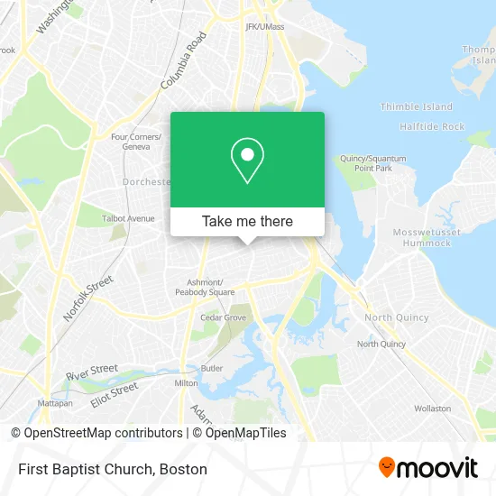
See First Baptist Church, Boston, on the map
Public Transit to First Baptist Church in Boston
Wondering how to get to First Baptist Church in Boston? Moovit helps you find the best way to get to First Baptist Church with step-by-step directions from the nearest public transit station.
Moovit provides free maps and live directions to help you navigate through your city. View schedules, routes, timetables, and find out how long does it take to get to First Baptist Church in real time.
Looking for the nearest stop or station to First Baptist Church? Check out this list of stops closest to your destination: Adams St @ Franconia St; Adams St @ Minot St; Gallivan Blvd @ Kenmere Rd; Fields Corner; Cedar Grove; Talbot Avenue.
Bus: 202, 21, 215, 23, 201, 19.Train: FAIRMOUNT, FAIRMOUNT LINE SHUTTLE, FRANKLIN/FOXBORO, PROVIDENCE/STOUGHTON.Subway: RED LINE, MATTAPAN LINE.
Want to see if there’s another route that gets you there at an earlier time? Moovit helps you find alternative routes or times. Get directions from and directions to First Baptist Church easily from the Moovit App or Website.
We make riding to First Baptist Church easy, which is why over 1.7 million users, including users in Boston, trust Moovit as the best app for public transit. You don’t need to download an individual bus app or train app, Moovit is your all-in-one transit app that helps you find the best bus time or train time available.
For information on prices of bus, subway and train, costs and ride fares to First Baptist Church, please check the Moovit app.
Use the app to navigate to popular places including to the airport, hospital, stadium, grocery store, mall, coffee shop, school, college, and university.
First Baptist Church Address: 401 Ashmont St street in Boston
- My Hair Salon,
- O'Neill Builders,
- Ashmont St Building 360,
- Adams House Condos,
- B & T & Sons,
- Hemenway Park,
- Adams Village,
- Local 67 Hall,
- Redline Properties,
- Neponset / Port Norfolk, Massachusetts,
- Carls Custom Painting,
- Corey & Coe,
- J.P. Talbot Landscaping,
- Thicky Chicky,
- Sisters in Motion Travel,
- Adams Corner Cafe & Butcher Shop Market,
- David Arrow Locksmith,
- Southie Apparel,
- King St,
- Metabank
Places Near First Baptist Church (Boston)
- Wilbur Theatre, Boston,
- Cheers, Boston,
- Isabella Stewart Gardner Museum, Boston,
- Seaport District, Boston,
- Mgm Music Hall, Boston,
- Quincy Market, Boston,
- Wang Theater, Boston,
- Leader Bank Pavilion (Leader Bank Pavillion), Boston,
- Td Garden, Boston,
- Boston Medical Center, Boston,
- House Of Blues, Boston,
- Boston Children's Hospital, Boston,
- Faneuil Hall, Boston,
- Museum Of Science, Boston,
- Boston Common, Boston,
- Boston Convention & Exhibition Center, Boston,
- Castle Island, Boston,
- North End, Boston,
- Prudential Center, Boston,
- Massachusetts General Hospital, Boston
How to get to popular places in Boston with public transit
Get around Boston by public transit!
Traveling around Boston has never been so easy. See step by step directions as you travel to any attraction, street or major public transit station. View bus and train schedules, arrival times, service alerts and detailed routes on a map, so you know exactly how to get to anywhere in Boston.
When traveling to any destination around Boston use Moovit's Live Directions with Get Off Notifications to know exactly where and how far to walk, how long to wait for your line, and how many stops are left. Moovit will alert you when it's time to get off — no need to constantly re-check whether yours is the next stop.
Wondering how to use public transit in Boston or how to pay for public transit in Boston? Moovit public transit app can help you navigate your way with public transit easily, and at minimum cost. It includes public transit fees, ticket prices, and costs. Looking for a map of Boston public transit lines? Moovit public transit app shows all public transit maps in Boston with all Bus, Train, Subway and Ferry routes and stops on an interactive map.
Boston has 4 transit type(s), including: Bus, Train, Subway and Ferry, operated by several transit agencies, including MBTA, Southeastern Regional Transit Authority, MetroWest Regional Transit Authority, Rhode Island Public Transit Authority, WRTA, Lowell Regional Transit Authority, Merrimack Valley Transit, Montachusett Regional Transit Authority, Cape Cod Regional Transit Authority, Brockton Area Transit Authority, Martha's Vineyard Transit Authority, the WAVE - Nantucket Regional Transit Authority, GATRA, Cape Ann Transportation Authority and Massport