How to get to First Chrysler Dodge Jeep Ram by bus?
Click on the bus route to see step by step directions with maps, line arrival times and updated time schedules.
Bus stops near First Chrysler Dodge Jeep Ram in Boston
Bus lines to First Chrysler Dodge Jeep Ram in Boston
What are the closest stations to First Chrysler Dodge Jeep Ram?
The closest stations to First Chrysler Dodge Jeep Ram are:
- Elm St. is 260 yards away, 4 min walk.
- North Attleboro is 404 yards away, 6 min walk.
- North Hub is 571 yards away, 8 min walk.
Which bus lines stop near First Chrysler Dodge Jeep Ram?
These bus lines stop near First Chrysler Dodge Jeep Ram: 10, 11, 14.
What’s the nearest bus station to First Chrysler Dodge Jeep Ram in Boston?
The nearest bus station to First Chrysler Dodge Jeep Ram in Boston is Elm St.. It’s a 4 min walk away.
What time is the first bus to First Chrysler Dodge Jeep Ram in Boston?
The 11 is the first bus that goes to First Chrysler Dodge Jeep Ram in Boston. It stops nearby at 5:30 AM.
What time is the last bus to First Chrysler Dodge Jeep Ram in Boston?
The 11 is the last bus that goes to First Chrysler Dodge Jeep Ram in Boston. It stops nearby at 8:15 PM.
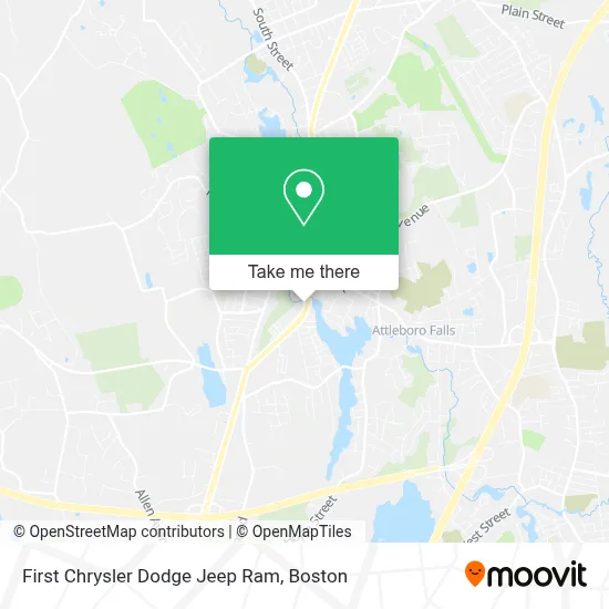
See First Chrysler Dodge Jeep Ram, Boston, on the map
Public Transit to First Chrysler Dodge Jeep Ram in Boston
Wondering how to get to First Chrysler Dodge Jeep Ram in Boston? Moovit helps you find the best way to get to First Chrysler Dodge Jeep Ram with step-by-step directions from the nearest public transit station.
Moovit provides free maps and live directions to help you navigate through your city. View schedules, routes, timetables, and find out how long does it take to get to First Chrysler Dodge Jeep Ram in real time.
Looking for the nearest stop or station to First Chrysler Dodge Jeep Ram? Check out this list of stops closest to your destination: Elm St.; North Attleboro; North Hub.
Bus: 10, 11, 14.
Want to see if there’s another route that gets you there at an earlier time? Moovit helps you find alternative routes or times. Get directions from and directions to First Chrysler Dodge Jeep Ram easily from the Moovit App or Website.
We make riding to First Chrysler Dodge Jeep Ram easy, which is why over 1.7 million users, including users in Boston, trust Moovit as the best app for public transit. You don’t need to download an individual bus app or train app, Moovit is your all-in-one transit app that helps you find the best bus time or train time available.
For information on prices of bus and train, costs and ride fares to First Chrysler Dodge Jeep Ram, please check the Moovit app.
Use the app to navigate to popular places including to the airport, hospital, stadium, grocery store, mall, coffee shop, school, college, and university.
First Chrysler Dodge Jeep Ram Address: 280 E Washington St street in Boston
- R & P Auto Sales Llc.,
- North Attleboro Orthodontics,
- Brothers Pizzeria & Mediterranean Grill,
- Mary's Supreme Cleaning,
- Save Our Souls,
- JN Service Hvac & Plumbing,
- Mariah's Cookies,
- Glolam Massage,
- DRF Custom Woodworking,
- Affordable Mold Busters,
- Brett's Novelty's,
- Confidently Love Yourself,
- Zomadre,
- Quest Landscapes,
- Halima's Heart and Hold Center,
- On Point Services,
- Guy Fieri's Flavortown Kitchen,
- Cedar Creek Construction,
- Fong and Sullivan Heating and Cooling,
- Mrbeast Burger
Places Near First Chrysler Dodge Jeep Ram (Boston)
- North End, Boston,
- Wilbur Theatre, Boston,
- Boston Convention & Exhibition Center, Boston,
- Isabella Stewart Gardner Museum, Boston,
- Quincy Market, Boston,
- Leader Bank Pavilion (Leader Bank Pavillion), Boston,
- Boston Common, Boston,
- Boston Medical Center, Boston,
- Boston Children's Hospital, Boston,
- Museum Of Science, Boston,
- Cheers, Boston,
- Mgm Music Hall, Boston,
- House Of Blues, Boston,
- Prudential Center, Boston,
- Castle Island, Boston,
- Wang Theater, Boston,
- Faneuil Hall, Boston,
- Td Garden, Boston,
- Seaport District, Boston,
- Massachusetts General Hospital, Boston
How to get to popular places in Boston with public transit
Get around Boston by public transit!
Traveling around Boston has never been so easy. See step by step directions as you travel to any attraction, street or major public transit station. View bus and train schedules, arrival times, service alerts and detailed routes on a map, so you know exactly how to get to anywhere in Boston.
When traveling to any destination around Boston use Moovit's Live Directions with Get Off Notifications to know exactly where and how far to walk, how long to wait for your line, and how many stops are left. Moovit will alert you when it's time to get off — no need to constantly re-check whether yours is the next stop.
Wondering how to use public transit in Boston or how to pay for public transit in Boston? Moovit public transit app can help you navigate your way with public transit easily, and at minimum cost. It includes public transit fees, ticket prices, and costs. Looking for a map of Boston public transit lines? Moovit public transit app shows all public transit maps in Boston with all Bus, Train, Subway and Ferry routes and stops on an interactive map.
Boston has 4 transit type(s), including: Bus, Train, Subway and Ferry, operated by several transit agencies, including MBTA, Southeastern Regional Transit Authority, MetroWest Regional Transit Authority, Rhode Island Public Transit Authority, WRTA, Lowell Regional Transit Authority, Merrimack Valley Transit, Montachusett Regional Transit Authority, Cape Cod Regional Transit Authority, Brockton Area Transit Authority, Martha's Vineyard Transit Authority, the WAVE - Nantucket Regional Transit Authority, GATRA, Cape Ann Transportation Authority and Massport