Directions to First Electronics Corp (Boston) with public transportation
The following transit lines have routes that pass near First Electronics Corp
 Bus: 10, 11, 16, 8, CT3.
- Train: FAIRMOUNT, NEEDHAM, FRANKLIN/FOXBORO, PROVIDENCE/STOUGHTON, FALL RIVER/NEW BEDFORD.
- Subway: RED LINE.
How to get to First Electronics Corp by bus?
Click on the bus route to see step by step directions with maps, line arrival times and updated time schedules.
From Sarma, Somerville
80 minFrom Revere, MA, Revere
84 minFrom Sommerville Theatre, Somerville
93 minFrom West Roxbury, Boston
64 minFrom Charlestown, Boston
75 minFrom Watertown Mall, Watertown Town
81 minFrom The Mall At Chestnut Hill, Newton
86 minFrom Danehy Park, Cambridge
85 minFrom Rino's Place, Boston
72 minFrom Spaulding Rehabilitation Center, Boston
78 min
How to get to First Electronics Corp by train?
Click on the train route to see step by step directions with maps, line arrival times and updated time schedules.
How to get to First Electronics Corp by subway?
Click on the subway route to see step by step directions with maps, line arrival times and updated time schedules.
Bus stops near First Electronics Corp in Boston
Train stations near First Electronics Corp in Boston
Subway station near First Electronics Corp in Boston
- Andrew, 17 min walk,VIEW
Bus lines to First Electronics Corp in Boston
- 18, Andrew,VIEW
- 8, Harbor Point Via South Bay Center,VIEW
- 41, Jfk/Umass,VIEW
- RED LINE SHUTTLE, Ashmont - JFK/UMass (Shuttle),VIEW
- RED LINE SHUTTLE, JFK/UMass - Kendall/MIT (Shuttle),VIEW
- RED LINE SHUTTLE, Ashmont - JFK/UMass,VIEW
- RED/MATTAPAN LINE SHUTTLE, Mattapan - JFK/UMass,VIEW
- 16, Harbor Point Via South Bay Center,VIEW
- RED LINE SHUTTLE, JFK/UMass - Broadway,VIEW
- RED LINE SHUTTLE, Braintree - Broadway,VIEW
- RED LINE SHUTTLE, Harvard - JFK/UMass via Congress Street,VIEW
- RED LINE SHUTTLE, North Quincy - Broadway (Shuttle),VIEW
- RED LINE SHUTTLE, Quincy Center - Broadway (Shuttle),VIEW
- RED LINE SHUTTLE, North Quincy - JFK/UMass,VIEW
- RED LINE SHUTTLE, JFK/UMass - Park Street,VIEW
- RED LINE SHUTTLE, Kendall/MIT - JFK/UMass,VIEW
- RED LINE SHUTTLE, Ashmont - Park Street via Post Office,VIEW
- RED LINE SHUTTLE, JFK/UMass - Park Street via Post Office,VIEW
- RED LINE SHUTTLE, Braintree - JFK/UMass (Shuttle),VIEW
- RED LINE SHUTTLE, Harvard - JFK/UMass via State Street,VIEW
What are the closest stations to First Electronics Corp?
The closest stations to First Electronics Corp are:
- Dorchester Ave @ Howell St is 7 yards away, 1 min walk.
- Uphams Corner is 144 yards away, 2 min walk.
- Columbia Rd @ Buttonwood St is 359 yards away, 5 min walk.
- Jfk/Umass - Columbia Rd @ I-93 is 509 yards away, 7 min walk.
- Old Colony Ave @ Msgr O'Callaghan Way is 595 yards away, 8 min walk.
- Jfk/Umass is 670 yards away, 9 min walk.
- Andrew is 1377 yards away, 17 min walk.
Which bus lines stop near First Electronics Corp?
These bus lines stop near First Electronics Corp: 10, 11, 16, 8, CT3.
Which train lines stop near First Electronics Corp?
These train lines stop near First Electronics Corp: FAIRMOUNT, NEEDHAM.
Which subway line stops near First Electronics Corp?
RED LINE (Ashmont/Braintree)
What’s the nearest subway station to First Electronics Corp in Boston?
The nearest subway station to First Electronics Corp in Boston is Andrew. It’s a 17 min walk away.
What’s the nearest train station to First Electronics Corp in Boston?
The nearest train station to First Electronics Corp in Boston is Uphams Corner. It’s a 2 min walk away.
What’s the nearest bus station to First Electronics Corp in Boston?
The nearest bus station to First Electronics Corp in Boston is Dorchester Ave @ Howell St. It’s a 1 min walk away.
What time is the first subway to First Electronics Corp in Boston?
The RED LINE is the first subway that goes to First Electronics Corp in Boston. It stops nearby at 5:21 AM.
What time is the last subway to First Electronics Corp in Boston?
The RED LINE is the last subway that goes to First Electronics Corp in Boston. It stops nearby at 1:57 AM.
What time is the first train to First Electronics Corp in Boston?
The FAIRMOUNT is the first train that goes to First Electronics Corp in Boston. It stops nearby at 4:47 AM.
What time is the last train to First Electronics Corp in Boston?
The FAIRMOUNT is the last train that goes to First Electronics Corp in Boston. It stops nearby at 11:57 PM.
What time is the first bus to First Electronics Corp in Boston?
The 41 is the first bus that goes to First Electronics Corp in Boston. It stops nearby at 5:05 AM.
What time is the last bus to First Electronics Corp in Boston?
The 8 is the last bus that goes to First Electronics Corp in Boston. It stops nearby at 12:53 AM.
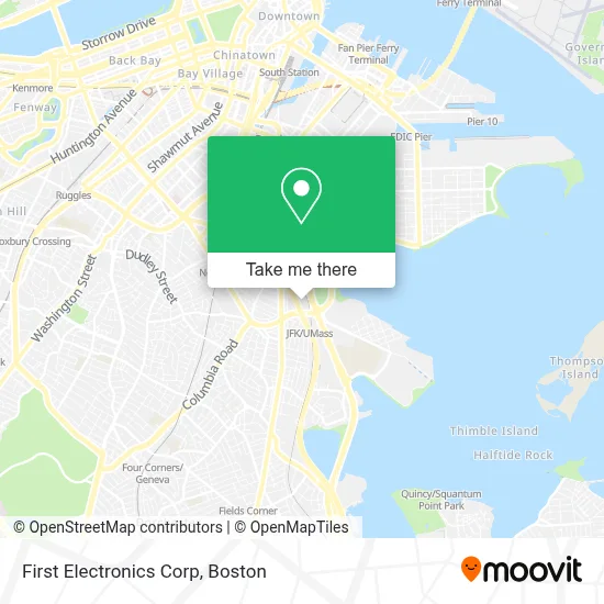
See First Electronics Corp, Boston, on the map
Public Transit to First Electronics Corp in Boston
Wondering how to get to First Electronics Corp in Boston? Moovit helps you find the best way to get to First Electronics Corp with step-by-step directions from the nearest public transit station.
Moovit provides free maps and live directions to help you navigate through your city. View schedules, routes, timetables, and find out how long does it take to get to First Electronics Corp in real time.
Looking for the nearest stop or station to First Electronics Corp? Check out this list of stops closest to your destination: Dorchester Ave @ Howell St; Uphams Corner; Columbia Rd @ Buttonwood St; Jfk/Umass - Columbia Rd @ I-93; Old Colony Ave @ Msgr O'Callaghan Way; Jfk/Umass; Andrew.
Bus: 10, 11, 16, 8, CT3, 18, 41, RED LINE SHUTTLE, RED LINE SHUTTLE, RED LINE SHUTTLE, RED/MATTAPAN LINE SHUTTLE.Train: FAIRMOUNT, NEEDHAM, FRANKLIN/FOXBORO, PROVIDENCE/STOUGHTON, FALL RIVER/NEW BEDFORD, GREENBUSH, KINGSTON.Subway: RED LINE.
Want to see if there’s another route that gets you there at an earlier time? Moovit helps you find alternative routes or times. Get directions from and directions to First Electronics Corp easily from the Moovit App or Website.
We make riding to First Electronics Corp easy, which is why over 1.7 million users, including users in Boston, trust Moovit as the best app for public transit. You don’t need to download an individual bus app or train app, Moovit is your all-in-one transit app that helps you find the best bus time or train time available.
For information on prices of bus, subway and train, costs and ride fares to First Electronics Corp, please check the Moovit app.
Use the app to navigate to popular places including to the airport, hospital, stadium, grocery store, mall, coffee shop, school, college, and university.
First Electronics Corp Address: 400 Wood Rd street in Boston
- Exit 18/on Ramp 93N,
- M&M Moving and Storage Company,
- I-93,
- LMA Shuttle to Longwood Medical Area,
- JFK Station,
- Rotary At JFK STATION,
- MTBA,
- Fleet Corps,
- Neurological Rehabilitation,
- Government Offices Banks Division,
- Registry of Vital Records,
- MBTA Bus #8,
- I-93 Exit 15,
- JFK / Umass Braintree - Inbound (JFK / Umass Ashmont - Outbound),
- Steven and Francines Locksmiths,
- Edward J. McCormack Bathhouse at Carson Beach,
- Ashmont Platform,
- Miami,
- UMass Boston Shuttle Bus,
- MBTA JFK/UMass Station
Places Near First Electronics Corp (Boston)
- Seaport District, Boston,
- Museum Of Science, Boston,
- Boston Children's Hospital, Boston,
- Faneuil Hall, Boston,
- Leader Bank Pavilion (Leader Bank Pavillion), Boston,
- Wilbur Theatre, Boston,
- House Of Blues, Boston,
- North End, Boston,
- Boston Medical Center, Boston,
- Castle Island, Boston,
- Boston Convention & Exhibition Center, Boston,
- Quincy Market, Boston,
- Boston Common, Boston,
- Td Garden, Boston,
- Wang Theater, Boston,
- Massachusetts General Hospital, Boston,
- Cheers, Boston,
- Mgm Music Hall, Boston,
- Prudential Center, Boston,
- Isabella Stewart Gardner Museum, Boston
How to get to popular places in Boston with public transit
Get around Boston by public transit!
Traveling around Boston has never been so easy. See step by step directions as you travel to any attraction, street or major public transit station. View bus and train schedules, arrival times, service alerts and detailed routes on a map, so you know exactly how to get to anywhere in Boston.
When traveling to any destination around Boston use Moovit's Live Directions with Get Off Notifications to know exactly where and how far to walk, how long to wait for your line, and how many stops are left. Moovit will alert you when it's time to get off — no need to constantly re-check whether yours is the next stop.
Wondering how to use public transit in Boston or how to pay for public transit in Boston? Moovit public transit app can help you navigate your way with public transit easily, and at minimum cost. It includes public transit fees, ticket prices, and costs. Looking for a map of Boston public transit lines? Moovit public transit app shows all public transit maps in Boston with all Bus, Train, Subway and Ferry routes and stops on an interactive map.
Boston has 4 transit type(s), including: Bus, Train, Subway and Ferry, operated by several transit agencies, including MBTA, Southeastern Regional Transit Authority, MetroWest Regional Transit Authority, Rhode Island Public Transit Authority, WRTA, Lowell Regional Transit Authority, Merrimack Valley Transit, Montachusett Regional Transit Authority, Cape Cod Regional Transit Authority, Brockton Area Transit Authority, Martha's Vineyard Transit Authority, the WAVE - Nantucket Regional Transit Authority, GATRA, Cape Ann Transportation Authority and Massport