Directions to First Lutheran Church (Malden) with public transportation
The following transit lines have routes that pass near First Lutheran Church
 Bus: 108, 109, 411, 430.
- Train: HAVERHILL, NEWBURYPORT/ROCKPORT, ORANGE LINE.
- Subway: ORANGE LINE.
How to get to First Lutheran Church by bus?
Click on the bus route to see step by step directions with maps, line arrival times and updated time schedules.
From Theatre District, Boston
46 minFrom The Lenox Hotel - Boston, Boston
83 minFrom Pine Street Inn, Boston
72 minFrom Belle Isle Lobster & Seafood, Winthrop Town
75 minFrom Boston North Station, Boston
47 minFrom Dartmouth, Boston
69 minFrom Cyclorama, Boston
97 minFrom The Capital Grille, Boston
69 minFrom HJB, Boston
69 minFrom Beehive, Boston
97 min
How to get to First Lutheran Church by train?
Click on the train route to see step by step directions with maps, line arrival times and updated time schedules.
How to get to First Lutheran Church by subway?
Click on the subway route to see step by step directions with maps, line arrival times and updated time schedules.
From Theatre District, Boston
63 minFrom The Lenox Hotel - Boston, Boston
67 minFrom Pine Street Inn, Boston
70 minFrom Belle Isle Lobster & Seafood, Winthrop Town
86 minFrom Boston North Station, Boston
57 minFrom Dartmouth, Boston
62 minFrom Cyclorama, Boston
69 minFrom The Capital Grille, Boston
77 minFrom HJB, Boston
77 minFrom Beehive, Boston
68 min
Bus stops near First Lutheran Church in Malden
Train stations near First Lutheran Church in Malden
Bus lines to First Lutheran Church in Malden
What are the closest stations to First Lutheran Church?
The closest stations to First Lutheran Church are:
- Salem St @ Maplewood St is 63 yards away, 2 min walk.
- Chelsea is 762 yards away, 12 min walk.
- Broadway @ Sheafe St is 1143 yards away, 14 min walk.
- Oak Grove is 2948 yards away, 35 min walk.
Which bus lines stop near First Lutheran Church?
These bus lines stop near First Lutheran Church: 108, 109, 411, 430.
Which train line stops near First Lutheran Church?
HAVERHILL (#229 | Haverhill)
Which subway line stops near First Lutheran Church?
ORANGE LINE (Oak Grove)
What’s the nearest train station to First Lutheran Church in Malden?
The nearest train station to First Lutheran Church in Malden is Chelsea. It’s a 12 min walk away.
What’s the nearest bus station to First Lutheran Church in Malden?
The nearest bus station to First Lutheran Church in Malden is Salem St @ Maplewood St. It’s a 2 min walk away.
What time is the first subway to First Lutheran Church in Malden?
The ORANGE LINE is the first subway that goes to First Lutheran Church in Malden. It stops nearby at 5:15 AM.
What time is the last subway to First Lutheran Church in Malden?
The ORANGE LINE is the last subway that goes to First Lutheran Church in Malden. It stops nearby at 1:59 AM.
What time is the first train to First Lutheran Church in Malden?
The HAVERHILL is the first train that goes to First Lutheran Church in Malden. It stops nearby at 5:35 AM.
What time is the last train to First Lutheran Church in Malden?
The NEWBURYPORT/ROCKPORT is the last train that goes to First Lutheran Church in Malden. It stops nearby at 12:06 AM.
What time is the first bus to First Lutheran Church in Malden?
The 109 is the first bus that goes to First Lutheran Church in Malden. It stops nearby at 4:31 AM.
What time is the last bus to First Lutheran Church in Malden?
The 108 is the last bus that goes to First Lutheran Church in Malden. It stops nearby at 1:42 AM.
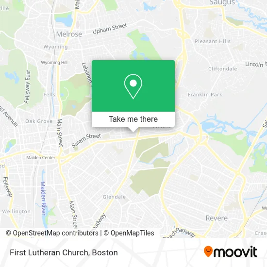
See First Lutheran Church, Malden, on the map
Public Transit to First Lutheran Church in Malden
Wondering how to get to First Lutheran Church in Malden? Moovit helps you find the best way to get to First Lutheran Church with step-by-step directions from the nearest public transit station.
Moovit provides free maps and live directions to help you navigate through your city. View schedules, routes, timetables, and find out how long does it take to get to First Lutheran Church in real time.
Looking for the nearest stop or station to First Lutheran Church? Check out this list of stops closest to your destination: Salem St @ Maplewood St; Chelsea; Broadway @ Sheafe St; Oak Grove.
Bus: 108, 109, 411, 430.Train: HAVERHILL, NEWBURYPORT/ROCKPORT, ORANGE LINE.Subway: ORANGE LINE.
Want to see if there’s another route that gets you there at an earlier time? Moovit helps you find alternative routes or times. Get directions from and directions to First Lutheran Church easily from the Moovit App or Website.
We make riding to First Lutheran Church easy, which is why over 1.7 million users, including users in Malden, trust Moovit as the best app for public transit. You don’t need to download an individual bus app or train app, Moovit is your all-in-one transit app that helps you find the best bus time or train time available.
For information on prices of bus, subway and train, costs and ride fares to First Lutheran Church, please check the Moovit app.
Use the app to navigate to popular places including to the airport, hospital, stadium, grocery store, mall, coffee shop, school, college, and university.
First Lutheran Church Address: 62 Church St street in Malden
- First Lutheran Church, Malden, Ma,
- Little Rascal's Day Care Center,
- Master Team Barbershop,
- Auto Wholesalers,
- Precision Auto Wor,
- MGS Professional Painting,
- Comm Tech Consultants,
- Denise Photographer,
- Salem Realty Trust,
- Maplewood Wellness Pharmacy,
- Health Mart Pharmacy,
- Econo Lodge,
- United Printer Aid,
- American Concrete CTNG,
- Diplo Brand and Services,
- Paolo D. Parrucchiere,
- Zoe smart,
- Fajita's Mexican Grill,
- L Footwear,
- Maplewood Square
Places Near First Lutheran Church (Malden)
- Seaport District, Boston,
- Boston Medical Center, Boston,
- Boston Children's Hospital, Boston,
- Quincy Market, Boston,
- Mgm Music Hall, Boston,
- Cheers, Boston,
- House Of Blues, Boston,
- Leader Bank Pavilion (Leader Bank Pavillion), Boston,
- Massachusetts General Hospital, Boston,
- Castle Island, Boston,
- Museum Of Science, Boston,
- Boston Common, Boston,
- Faneuil Hall, Boston,
- North End, Boston,
- Isabella Stewart Gardner Museum, Boston,
- Boston Convention & Exhibition Center, Boston,
- Wang Theater, Boston,
- Prudential Center, Boston,
- Td Garden, Boston,
- Wilbur Theatre, Boston
How to get to popular places in Boston with public transit
Get around Malden by public transit!
Traveling around Malden has never been so easy. See step by step directions as you travel to any attraction, street or major public transit station. View bus and train schedules, arrival times, service alerts and detailed routes on a map, so you know exactly how to get to anywhere in Malden.
When traveling to any destination around Malden use Moovit's Live Directions with Get Off Notifications to know exactly where and how far to walk, how long to wait for your line, and how many stops are left. Moovit will alert you when it's time to get off — no need to constantly re-check whether yours is the next stop.
Wondering how to use public transit in Malden or how to pay for public transit in Malden? Moovit public transit app can help you navigate your way with public transit easily, and at minimum cost. It includes public transit fees, ticket prices, and costs. Looking for a map of Malden public transit lines? Moovit public transit app shows all public transit maps in Malden with all Bus, Train, Subway and Ferry routes and stops on an interactive map.
Boston has 4 transit type(s), including: Bus, Train, Subway and Ferry, operated by several transit agencies, including MBTA, Southeastern Regional Transit Authority, MetroWest Regional Transit Authority, Rhode Island Public Transit Authority, WRTA, Lowell Regional Transit Authority, Merrimack Valley Transit, Montachusett Regional Transit Authority, Cape Cod Regional Transit Authority, Brockton Area Transit Authority, Martha's Vineyard Transit Authority, the WAVE - Nantucket Regional Transit Authority, GATRA, Cape Ann Transportation Authority and Massport