Directions to Fishhappens Charters (South Yarmouth) with public transportation
The following transit lines have routes that pass near Fishhappens Charters
 Bus: H2O HYANNIS-ORLEANS.
How to get to Fishhappens Charters by bus?
Click on the bus route to see step by step directions with maps, line arrival times and updated time schedules.
Bus stop near Fishhappens Charters in South Yarmouth
- Main Street, South Yarmouth, 3 min walk,VIEW
Bus lines to Fishhappens Charters in South Yarmouth
- H2O HYANNIS-ORLEANS, Stop & Shop, Orleans,VIEW
What are the closest stations to Fishhappens Charters?
The closest stations to Fishhappens Charters are:
- Main Street, South Yarmouth is 229 yards away, 3 min walk.
Which bus line stops near Fishhappens Charters?
H2O HYANNIS-ORLEANS (Hyannis Transportation Center (Htc)→Stop & Shop, Orleans)
What’s the nearest bus station to Fishhappens Charters in South Yarmouth?
The nearest bus station to Fishhappens Charters in South Yarmouth is Main Street, South Yarmouth. It’s a 3 min walk away.
What time is the first bus to Fishhappens Charters in South Yarmouth?
The H2O HYANNIS-ORLEANS is the first bus that goes to Fishhappens Charters in South Yarmouth. It stops nearby at 6:25 AM.
What time is the last bus to Fishhappens Charters in South Yarmouth?
The H2O HYANNIS-ORLEANS is the last bus that goes to Fishhappens Charters in South Yarmouth. It stops nearby at 8:47 PM.
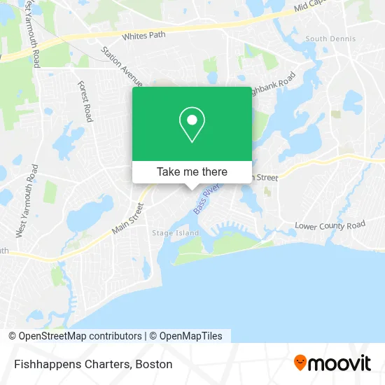
See Fishhappens Charters, South Yarmouth, on the map
Public Transit to Fishhappens Charters in South Yarmouth
Wondering how to get to Fishhappens Charters in South Yarmouth? Moovit helps you find the best way to get to Fishhappens Charters with step-by-step directions from the nearest public transit station.
Moovit provides free maps and live directions to help you navigate through your city. View schedules, routes, timetables, and find out how long does it take to get to Fishhappens Charters in real time.
Looking for the nearest stop or station to Fishhappens Charters? Check out this list of stops closest to your destination: Main Street.
Bus: H2O HYANNIS-ORLEANS.
Want to see if there’s another route that gets you there at an earlier time? Moovit helps you find alternative routes or times. Get directions from and directions to Fishhappens Charters easily from the Moovit App or Website.
We make riding to Fishhappens Charters easy, which is why over 1.7 million users, including users in South Yarmouth, trust Moovit as the best app for public transit. You don’t need to download an individual bus app or train app, Moovit is your all-in-one transit app that helps you find the best bus time or train time available.
For information on prices of bus, costs and ride fares to Fishhappens Charters, please check the Moovit app.
Use the app to navigate to popular places including to the airport, hospital, stadium, grocery store, mall, coffee shop, school, college, and university.
Fishhappens Charters Address: 130 Pleasant St street in South Yarmouth
- Sperry,
- South Yarmouth / Bass River Historic District,
- Yankee Village Motor Inn,
- Jason Frazier,
- Veranda Cape Cod Family Resort,
- Automotive, Jeep and Truck Service and Sales That You Can Depend On.,
- Oceanside Insurance Agency,
- Cape Cod Festival of Magic,
- Sur Tan Leather & Western Wear,
- David M Callahan, PHD,
- Aliette Aesthetics,
- Sandwich Center,
- ChargePoint,
- Fresh Paint Artists,
- Bass River Press,
- Village Music,
- Caffè Gelato Bertini,
- Petal & Stem Florist,
- Yarmouth Rotary [Club 26580, District 7950],
- Whitten Landscaping
Places Near Fishhappens Charters (South Yarmouth)
- Td Garden, Boston,
- Castle Island, Boston,
- Wilbur Theatre, Boston,
- Prudential Center, Boston,
- North End, Boston,
- Faneuil Hall, Boston,
- Massachusetts General Hospital, Boston,
- Seaport District, Boston,
- Boston Medical Center, Boston,
- House Of Blues, Boston,
- Boston Common, Boston,
- Boston Convention & Exhibition Center, Boston,
- Museum Of Science, Boston,
- Cheers, Boston,
- Boston Children's Hospital, Boston,
- Mgm Music Hall, Boston,
- Quincy Market, Boston,
- Isabella Stewart Gardner Museum, Boston,
- Wang Theater, Boston,
- Leader Bank Pavilion (Leader Bank Pavillion), Boston
How to get to popular places in Boston with public transit
Get around South Yarmouth by public transit!
Traveling around South Yarmouth has never been so easy. See step by step directions as you travel to any attraction, street or major public transit station. View bus and train schedules, arrival times, service alerts and detailed routes on a map, so you know exactly how to get to anywhere in South Yarmouth.
When traveling to any destination around South Yarmouth use Moovit's Live Directions with Get Off Notifications to know exactly where and how far to walk, how long to wait for your line, and how many stops are left. Moovit will alert you when it's time to get off — no need to constantly re-check whether yours is the next stop.
Wondering how to use public transit in South Yarmouth or how to pay for public transit in South Yarmouth? Moovit public transit app can help you navigate your way with public transit easily, and at minimum cost. It includes public transit fees, ticket prices, and costs. Looking for a map of South Yarmouth public transit lines? Moovit public transit app shows all public transit maps in South Yarmouth with all Bus, Train, Subway and Ferry routes and stops on an interactive map.
Boston has 4 transit type(s), including: Bus, Train, Subway and Ferry, operated by several transit agencies, including MBTA, Southeastern Regional Transit Authority, MetroWest Regional Transit Authority, Rhode Island Public Transit Authority, WRTA, Lowell Regional Transit Authority, Merrimack Valley Transit, Montachusett Regional Transit Authority, Cape Cod Regional Transit Authority, Brockton Area Transit Authority, Martha's Vineyard Transit Authority, the WAVE - Nantucket Regional Transit Authority, GATRA, Cape Ann Transportation Authority and Massport