Directions to Fishing Friends Inc. (Boston) with public transportation
The following transit lines have routes that pass near Fishing Friends Inc.
 Bus: B23.
How to get to Fishing Friends Inc. by bus?
Click on the bus route to see step by step directions with maps, line arrival times and updated time schedules.
Bus stop near Fishing Friends Inc. in Boston
- Westfield / Fini (Flag Stop), 13 min walk,VIEW
Bus lines to Fishing Friends Inc. in Boston
- B23, Holyoke Trans. Ctr. Via Hcc,VIEW
What are the closest stations to Fishing Friends Inc.?
The closest stations to Fishing Friends Inc. are:
- Westfield / Fini (Flag Stop) is 1063 yards away, 13 min walk.
Which bus line stops near Fishing Friends Inc.?
B23 (Holyoke Trans. Ctr. Via Hcc)
What’s the nearest bus station to Fishing Friends Inc. in Boston?
The nearest bus station to Fishing Friends Inc. in Boston is Westfield / Fini (Flag Stop). It’s a 13 min walk away.
What time is the first bus to Fishing Friends Inc. in Boston?
The B23 is the first bus that goes to Fishing Friends Inc. in Boston. It stops nearby at 5:54 AM.
What time is the last bus to Fishing Friends Inc. in Boston?
The B23 is the last bus that goes to Fishing Friends Inc. in Boston. It stops nearby at 6:38 PM.
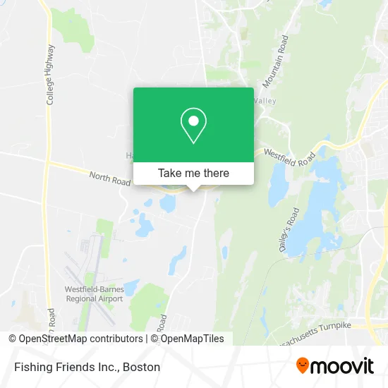
See Fishing Friends Inc., Boston, on the map
Public Transit to Fishing Friends Inc. in Boston
Wondering how to get to Fishing Friends Inc. in Boston? Moovit helps you find the best way to get to Fishing Friends Inc. with step-by-step directions from the nearest public transit station.
Moovit provides free maps and live directions to help you navigate through your city. View schedules, routes, timetables, and find out how long does it take to get to Fishing Friends Inc. in real time.
Looking for the nearest stop or station to Fishing Friends Inc.? Check out this list of stops closest to your destination: Westfield / Fini (Flag Stop).
Bus: B23.
Want to see if there’s another route that gets you there at an earlier time? Moovit helps you find alternative routes or times. Get directions from and directions to Fishing Friends Inc. easily from the Moovit App or Website.
We make riding to Fishing Friends Inc. easy, which is why over 1.7 million users, including users in Boston, trust Moovit as the best app for public transit. You don’t need to download an individual bus app or train app, Moovit is your all-in-one transit app that helps you find the best bus time or train time available.
For information on prices of bus, costs and ride fares to Fishing Friends Inc., please check the Moovit app.
Use the app to navigate to popular places including to the airport, hospital, stadium, grocery store, mall, coffee shop, school, college, and university.
Fishing Friends Inc. Address: 1029 North Rd street in Boston
- East Mountain Plaza,
- Westfield Menus,
- SK Auto Parts,
- Tanya Costigan Events,
- Bioskills Solutions,
- Pioneer Valley Rider Training,
- Studio 20,
- USPS Collection Box - Blue Box,
- Key Comfort at Home,
- Gundam Galaxy,
- Children's,
- Austin Rogers, LMHC,
- Ninoss Pizzeria Restaurant,
- Identogo,
- Race Town,
- Thuraya Anastas Cable, L.Ac,
- Window of Western Mass,
- Mineral Hills Winery,
- Record Nations,
- Furniture Recyclers
Places Near Fishing Friends Inc. (Boston)
- Mgm Music Hall, Boston,
- Quincy Market, Boston,
- Td Garden, Boston,
- Boston Common, Boston,
- House Of Blues, Boston,
- Wilbur Theatre, Boston,
- Isabella Stewart Gardner Museum, Boston,
- Leader Bank Pavilion (Leader Bank Pavillion), Boston,
- Boston Children's Hospital, Boston,
- Boston Medical Center, Boston,
- Wang Theater, Boston,
- Museum Of Science, Boston,
- Massachusetts General Hospital, Boston,
- Castle Island, Boston,
- Prudential Center, Boston,
- Cheers, Boston,
- Faneuil Hall, Boston,
- Seaport District, Boston,
- North End, Boston,
- Boston Convention & Exhibition Center, Boston
How to get to popular places in Boston with public transit
Get around Boston by public transit!
Traveling around Boston has never been so easy. See step by step directions as you travel to any attraction, street or major public transit station. View bus and train schedules, arrival times, service alerts and detailed routes on a map, so you know exactly how to get to anywhere in Boston.
When traveling to any destination around Boston use Moovit's Live Directions with Get Off Notifications to know exactly where and how far to walk, how long to wait for your line, and how many stops are left. Moovit will alert you when it's time to get off — no need to constantly re-check whether yours is the next stop.
Wondering how to use public transit in Boston or how to pay for public transit in Boston? Moovit public transit app can help you navigate your way with public transit easily, and at minimum cost. It includes public transit fees, ticket prices, and costs. Looking for a map of Boston public transit lines? Moovit public transit app shows all public transit maps in Boston with all Bus, Train, Subway and Ferry routes and stops on an interactive map.
Boston has 4 transit type(s), including: Bus, Train, Subway and Ferry, operated by several transit agencies, including MBTA, Southeastern Regional Transit Authority, MetroWest Regional Transit Authority, Rhode Island Public Transit Authority, WRTA, Lowell Regional Transit Authority, Merrimack Valley Transit, Montachusett Regional Transit Authority, Cape Cod Regional Transit Authority, Brockton Area Transit Authority, Martha's Vineyard Transit Authority, the WAVE - Nantucket Regional Transit Authority, GATRA, Cape Ann Transportation Authority and Massport