Directions to Fitness Together (Boston) with public transportation
The following transit lines have routes that pass near Fitness Together
 Bus: 85, 92, 93, ORANGE LINE SHUTTLE, ORANGE LINE SHUTTLE.
- Train: FAIRMOUNT, FRAMINGHAM/WORCESTER, KINGSTON, LOWELL, NEEDHAM.
- Subway: ORANGE LINE, GREEN LINE B, GREEN LINE C, GREEN LINE D, GREEN LINE E.
How to get to Fitness Together by bus?
Click on the bus route to see step by step directions with maps, line arrival times and updated time schedules.
From Hebrew Rehab Center, Boston
106 minFrom Winchester, MA, Winchester
66 minFrom Boston Latin School, Boston
64 minFrom Prometric Testing Center, Boston
58 minFrom Ramada by Wyndham Boston, Boston
108 minFrom 240 Mount Vernon Street, Boston
81 minFrom Dorchester District Court, Boston
80 minFrom FOUR POINTS BY SHERATON Boston Newton, Newton
55 minFrom Spaulding Rehab, Boston
91 min
How to get to Fitness Together by train?
Click on the train route to see step by step directions with maps, line arrival times and updated time schedules.
From Hebrew Rehab Center, Boston
83 minFrom Winchester, MA, Winchester
56 minFrom Boston Latin School, Boston
70 minFrom Prometric Testing Center, Boston
79 minFrom 240 Mount Vernon Street, Boston
60 minFrom Dorchester District Court, Boston
70 minFrom FOUR POINTS BY SHERATON Boston Newton, Newton
91 minFrom Spaulding Rehab, Boston
85 min
How to get to Fitness Together by subway?
Click on the subway route to see step by step directions with maps, line arrival times and updated time schedules.
Bus stops near Fitness Together in Boston
Subway stations near Fitness Together in Boston
Bus lines to Fitness Together in Boston
What are the closest stations to Fitness Together?
The closest stations to Fitness Together are:
- Main St @ Union St is 213 yards away, 3 min walk.
- Bunker Hill St @ Pearl St is 513 yards away, 7 min walk.
- Community College - Rutherford Ave @ Austin St is 542 yards away, 7 min walk.
- Bunker Hill St @ Sullivan St is 622 yards away, 8 min walk.
- Community Collge is 731 yards away, 9 min walk.
- Lechmere is 776 yards away, 10 min walk.
Which bus lines stop near Fitness Together?
These bus lines stop near Fitness Together: 85, 92, 93.
Which train lines stop near Fitness Together?
These train lines stop near Fitness Together: FAIRMOUNT, FRAMINGHAM/WORCESTER, KINGSTON, LOWELL, NEEDHAM, PROVIDENCE/STOUGHTON.
Which subway line stops near Fitness Together?
ORANGE LINE (Oak Grove)
What’s the nearest subway station to Fitness Together in Boston?
The nearest subway station to Fitness Together in Boston is Community Collge. It’s a 9 min walk away.
What’s the nearest bus station to Fitness Together in Boston?
The nearest bus station to Fitness Together in Boston is Main St @ Union St. It’s a 3 min walk away.
What time is the first subway to Fitness Together in Boston?
The GREEN LINE E is the first subway that goes to Fitness Together in Boston. It stops nearby at 4:55 AM.
What time is the last subway to Fitness Together in Boston?
The GREEN LINE E is the last subway that goes to Fitness Together in Boston. It stops nearby at 2:30 AM.
What time is the first bus to Fitness Together in Boston?
The 89/93 is the first bus that goes to Fitness Together in Boston. It stops nearby at 4:48 AM.
What time is the last bus to Fitness Together in Boston?
The 93 is the last bus that goes to Fitness Together in Boston. It stops nearby at 1:46 AM.
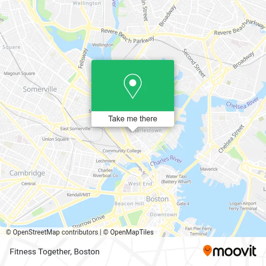
See Fitness Together, Boston, on the map
Public Transit to Fitness Together in Boston
Wondering how to get to Fitness Together in Boston? Moovit helps you find the best way to get to Fitness Together with step-by-step directions from the nearest public transit station.
Moovit provides free maps and live directions to help you navigate through your city. View schedules, routes, timetables, and find out how long does it take to get to Fitness Together in real time.
Looking for the nearest stop or station to Fitness Together? Check out this list of stops closest to your destination: Main St @ Union St; Bunker Hill St @ Pearl St; Community College - Rutherford Ave @ Austin St; Bunker Hill St @ Sullivan St; Community Collge; Lechmere.
Bus: 85, 92, 93, ORANGE LINE SHUTTLE, ORANGE LINE SHUTTLE, ORANGE LINE SHUTTLE, 89/93.Train: FAIRMOUNT, FRAMINGHAM/WORCESTER, KINGSTON, LOWELL, NEEDHAM, PROVIDENCE/STOUGHTON.Subway: ORANGE LINE, GREEN LINE B, GREEN LINE C, GREEN LINE D, GREEN LINE E.
Want to see if there’s another route that gets you there at an earlier time? Moovit helps you find alternative routes or times. Get directions from and directions to Fitness Together easily from the Moovit App or Website.
We make riding to Fitness Together easy, which is why over 1.7 million users, including users in Boston, trust Moovit as the best app for public transit. You don’t need to download an individual bus app or train app, Moovit is your all-in-one transit app that helps you find the best bus time or train time available.
For information on prices of bus, subway and train, costs and ride fares to Fitness Together, please check the Moovit app.
Use the app to navigate to popular places including to the airport, hospital, stadium, grocery store, mall, coffee shop, school, college, and university.
Fitness Together Address: 271 Main St street in Boston
- Mishawum Park,
- Toda Moving & Storage,
- MGH Charlestown Healthcare Center (Simmons, Leigh, MD - MGH Charlestown Health Care),
- Mgh Charlestown Healthcare Center,
- Best Asian in Charlestown,
- Bunker Hill Mall Charlestown,
- Golden Bull Mobizz,
- Warren Tavern historical,
- Haven Boston,
- Austin St & Main St,
- Friday afternoon rush-hour traffic,
- Charlestown Liquors,
- Lamb William,
- Carr Funeral Service (Carr Funeral Home Funeral Director),
- Philip Edward Salon (Austria and Helaine Hair Salon),
- Austin St & New Rutherford Ave,
- BHCC,
- Cicco Stephen,
- BHCC Health & Wellness Center,
- Costa Fruit & Produce
Places Near Fitness Together (Boston)
- Td Garden, Boston,
- Museum Of Science, Boston,
- Mgm Music Hall, Boston,
- Isabella Stewart Gardner Museum, Boston,
- Faneuil Hall, Boston,
- Cheers, Boston,
- Massachusetts General Hospital, Boston,
- House Of Blues, Boston,
- Boston Medical Center, Boston,
- Quincy Market, Boston,
- North End, Boston,
- Castle Island, Boston,
- Boston Common, Boston,
- Wang Theater, Boston,
- Prudential Center, Boston,
- Boston Children's Hospital, Boston,
- Seaport District, Boston,
- Leader Bank Pavilion (Leader Bank Pavillion), Boston,
- Boston Convention & Exhibition Center, Boston,
- Wilbur Theatre, Boston
How to get to popular places in Boston with public transit
Get around Boston by public transit!
Traveling around Boston has never been so easy. See step by step directions as you travel to any attraction, street or major public transit station. View bus and train schedules, arrival times, service alerts and detailed routes on a map, so you know exactly how to get to anywhere in Boston.
When traveling to any destination around Boston use Moovit's Live Directions with Get Off Notifications to know exactly where and how far to walk, how long to wait for your line, and how many stops are left. Moovit will alert you when it's time to get off — no need to constantly re-check whether yours is the next stop.
Wondering how to use public transit in Boston or how to pay for public transit in Boston? Moovit public transit app can help you navigate your way with public transit easily, and at minimum cost. It includes public transit fees, ticket prices, and costs. Looking for a map of Boston public transit lines? Moovit public transit app shows all public transit maps in Boston with all Bus, Train, Subway and Ferry routes and stops on an interactive map.
Boston has 4 transit type(s), including: Bus, Train, Subway and Ferry, operated by several transit agencies, including MBTA, Southeastern Regional Transit Authority, MetroWest Regional Transit Authority, Rhode Island Public Transit Authority, WRTA, Lowell Regional Transit Authority, Merrimack Valley Transit, Montachusett Regional Transit Authority, Cape Cod Regional Transit Authority, Brockton Area Transit Authority, Martha's Vineyard Transit Authority, the WAVE - Nantucket Regional Transit Authority, GATRA, Cape Ann Transportation Authority and Massport