How to get to Fitzgerald Fences, Inc. by bus?
Click on the bus route to see step by step directions with maps, line arrival times and updated time schedules.
From Registry Of Motor Vehicles (Rmv) Branch Office, Worcester
177 minFrom Worcester, MA, Worcester
173 minFrom Foxwoods, Worcester
198 minFrom Palladium, Worcester
178 minFrom Quinsigamond Community College, Worcester
186 minFrom South High Community School, Worcester
265 minFrom Gardner, MA, Gardner
212 min
Bus stop near Fitzgerald Fences, Inc. in Boston
- Florence Center (Inbound), 2 min walk,VIEW
Train station near Fitzgerald Fences, Inc. in Boston
- Northampton, 2 min walk,VIEW
Bus lines to Fitzgerald Fences, Inc. in Boston
What are the closest stations to Fitzgerald Fences, Inc.?
The closest stations to Fitzgerald Fences, Inc. are:
- Florence Center (Inbound) is 106 yards away, 2 min walk.
- Northampton is 137 yards away, 2 min walk.
Which bus lines stop near Fitzgerald Fences, Inc.?
These bus lines stop near Fitzgerald Fences, Inc.: 31, G73E, R42, R44.
What’s the nearest train station to Fitzgerald Fences, Inc. in Boston?
The nearest train station to Fitzgerald Fences, Inc. in Boston is Northampton. It’s a 2 min walk away.
What’s the nearest bus station to Fitzgerald Fences, Inc. in Boston?
The nearest bus station to Fitzgerald Fences, Inc. in Boston is Florence Center (Inbound). It’s a 2 min walk away.
What time is the first train to Fitzgerald Fences, Inc. in Boston?
The VALLEY FLYER is the first train that goes to Fitzgerald Fences, Inc. in Boston. It stops nearby at 6:30 AM.
What time is the last train to Fitzgerald Fences, Inc. in Boston?
The VALLEY FLYER is the last train that goes to Fitzgerald Fences, Inc. in Boston. It stops nearby at 10:07 PM.
What time is the first bus to Fitzgerald Fences, Inc. in Boston?
The R42 is the first bus that goes to Fitzgerald Fences, Inc. in Boston. It stops nearby at 5:54 AM.
What time is the last bus to Fitzgerald Fences, Inc. in Boston?
The 904 is the last bus that goes to Fitzgerald Fences, Inc. in Boston. It stops nearby at 8:45 PM.
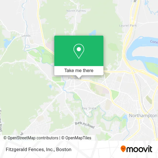
See Fitzgerald Fences, Inc., Boston, on the map
Public Transit to Fitzgerald Fences, Inc. in Boston
Wondering how to get to Fitzgerald Fences, Inc. in Boston? Moovit helps you find the best way to get to Fitzgerald Fences, Inc. with step-by-step directions from the nearest public transit station.
Moovit provides free maps and live directions to help you navigate through your city. View schedules, routes, timetables, and find out how long does it take to get to Fitzgerald Fences, Inc. in real time.
Looking for the nearest stop or station to Fitzgerald Fences, Inc.? Check out this list of stops closest to your destination: Florence Center (Inbound); Northampton.
Bus: 31, G73E, R42, R44, 904.Train: VALLEY FLYER, VERMONTER.
Want to see if there’s another route that gets you there at an earlier time? Moovit helps you find alternative routes or times. Get directions from and directions to Fitzgerald Fences, Inc. easily from the Moovit App or Website.
We make riding to Fitzgerald Fences, Inc. easy, which is why over 1.7 million users, including users in Boston, trust Moovit as the best app for public transit. You don’t need to download an individual bus app or train app, Moovit is your all-in-one transit app that helps you find the best bus time or train time available.
For information on prices of bus, costs and ride fares to Fitzgerald Fences, Inc., please check the Moovit app.
Use the app to navigate to popular places including to the airport, hospital, stadium, grocery store, mall, coffee shop, school, college, and university.
Fitzgerald Fences, Inc. Address: PO Box 60005 street in Boston
- Burns,
- Off the Wall Picture Framing,
- Florence Pizza,
- E-Modern,
- Amanuz Cafe,
- Zen Restaurant,
- George Falk DDS,
- Integrated Wildlife Control,
- Valley Mindfulness,
- Tak Upholstery,
- Mobil,
- Esrick Steven, MD,
- Psychotherapy,
- Dodson & Flinker,
- Keiter Builders Inc.,
- Drawing Board Brewing Company,
- The Wellspring,
- Uya Poke Bowl,
- Lynn M. Curry,
- Florence Golden Roofers
Places Near Fitzgerald Fences, Inc. (Boston)
- Museum Of Science, Boston,
- Massachusetts General Hospital, Boston,
- Td Garden, Boston,
- Cheers, Boston,
- House Of Blues, Boston,
- Leader Bank Pavilion (Leader Bank Pavillion), Boston,
- Isabella Stewart Gardner Museum, Boston,
- Boston Children's Hospital, Boston,
- North End, Boston,
- Wilbur Theatre, Boston,
- Seaport District, Boston,
- Boston Medical Center, Boston,
- Boston Common, Boston,
- Wang Theater, Boston,
- Castle Island, Boston,
- Mgm Music Hall, Boston,
- Boston Convention & Exhibition Center, Boston,
- Prudential Center, Boston,
- Faneuil Hall, Boston,
- Quincy Market, Boston
How to get to popular places in Boston with public transit
Get around Boston by public transit!
Traveling around Boston has never been so easy. See step by step directions as you travel to any attraction, street or major public transit station. View bus and train schedules, arrival times, service alerts and detailed routes on a map, so you know exactly how to get to anywhere in Boston.
When traveling to any destination around Boston use Moovit's Live Directions with Get Off Notifications to know exactly where and how far to walk, how long to wait for your line, and how many stops are left. Moovit will alert you when it's time to get off — no need to constantly re-check whether yours is the next stop.
Wondering how to use public transit in Boston or how to pay for public transit in Boston? Moovit public transit app can help you navigate your way with public transit easily, and at minimum cost. It includes public transit fees, ticket prices, and costs. Looking for a map of Boston public transit lines? Moovit public transit app shows all public transit maps in Boston with all Bus, Train, Subway and Ferry routes and stops on an interactive map.
Boston has 4 transit type(s), including: Bus, Train, Subway and Ferry, operated by several transit agencies, including MBTA, Southeastern Regional Transit Authority, MetroWest Regional Transit Authority, Rhode Island Public Transit Authority, WRTA, Lowell Regional Transit Authority, Merrimack Valley Transit, Montachusett Regional Transit Authority, Cape Cod Regional Transit Authority, Brockton Area Transit Authority, Martha's Vineyard Transit Authority, the WAVE - Nantucket Regional Transit Authority, GATRA, Cape Ann Transportation Authority and Massport