Directions to Five Star Flag Football (Waltham) with public transportation
The following transit lines have routes that pass near Five Star Flag Football
 Bus: 553, 558, 70, FITCHBURG LINE SHUTTLE.
- Train: FITCHBURG, FRAMINGHAM/WORCESTER.
How to get to Five Star Flag Football by bus?
Click on the bus route to see step by step directions with maps, line arrival times and updated time schedules.
From Charles W. Eliot Bridge, Boston
77 minFrom Apple Cinemas, Cambridge
92 minFrom Boston College (BC), Boston
73 minFrom Brighton Music Hall, Boston
61 minFrom Danehy Park, Cambridge
88 minFrom Roadrunner, Boston
72 minFrom Allston, Boston
62 minFrom Lexington, MA, Lexington
142 minFrom Regina Pizzeria, Boston
65 minFrom Babson College, Wellesley
168 min
How to get to Five Star Flag Football by train?
Click on the train route to see step by step directions with maps, line arrival times and updated time schedules.
Bus stops near Five Star Flag Football in Waltham
Train stations near Five Star Flag Football in Waltham
Bus lines to Five Star Flag Football in Waltham
What are the closest stations to Five Star Flag Football?
The closest stations to Five Star Flag Football are:
- Opp 48 Woerd Ave is 209 yards away, 3 min walk.
- South St @ Shapiro Athletic Center is 271 yards away, 4 min walk.
- Brandeis/Roberts is 873 yards away, 11 min walk.
- Waltham is 2281 yards away, 27 min walk.
- West Newton is 4863 yards away, 58 min walk.
Which bus lines stop near Five Star Flag Football?
These bus lines stop near Five Star Flag Football: 553, 558, 70.
Which train lines stop near Five Star Flag Football?
These train lines stop near Five Star Flag Football: FITCHBURG, FRAMINGHAM/WORCESTER.
What’s the nearest train station to Five Star Flag Football in Waltham?
The nearest train station to Five Star Flag Football in Waltham is Waltham. It’s a 27 min walk away.
What’s the nearest bus station to Five Star Flag Football in Waltham?
The nearest bus station to Five Star Flag Football in Waltham is Opp 48 Woerd Ave. It’s a 3 min walk away.
What time is the first train to Five Star Flag Football in Waltham?
The FRAMINGHAM/WORCESTER is the first train that goes to Five Star Flag Football in Waltham. It stops nearby at 5:19 AM.
What time is the last train to Five Star Flag Football in Waltham?
The FRAMINGHAM/WORCESTER is the last train that goes to Five Star Flag Football in Waltham. It stops nearby at 12:22 AM.
What time is the first bus to Five Star Flag Football in Waltham?
The 553 is the first bus that goes to Five Star Flag Football in Waltham. It stops nearby at 6:25 AM.
What time is the last bus to Five Star Flag Football in Waltham?
The 553 is the last bus that goes to Five Star Flag Football in Waltham. It stops nearby at 9:03 PM.
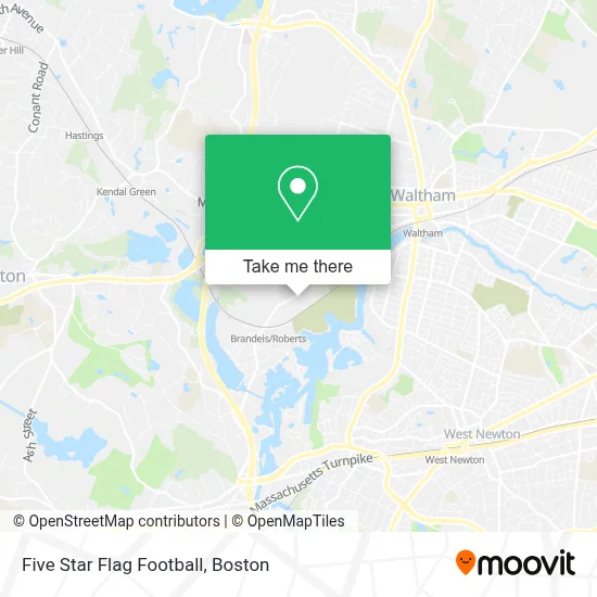
See Five Star Flag Football, Waltham, on the map
Public Transit to Five Star Flag Football in Waltham
Wondering how to get to Five Star Flag Football in Waltham? Moovit helps you find the best way to get to Five Star Flag Football with step-by-step directions from the nearest public transit station.
Moovit provides free maps and live directions to help you navigate through your city. View schedules, routes, timetables, and find out how long does it take to get to Five Star Flag Football in real time.
Looking for the nearest stop or station to Five Star Flag Football? Check out this list of stops closest to your destination: Opp 48 Woerd Ave; South St @ Shapiro Athletic Center; Brandeis/Roberts; Waltham; West Newton.
Bus: 553, 558, 70, FITCHBURG LINE SHUTTLE.Train: FITCHBURG, FRAMINGHAM/WORCESTER.
Want to see if there’s another route that gets you there at an earlier time? Moovit helps you find alternative routes or times. Get directions from and directions to Five Star Flag Football easily from the Moovit App or Website.
We make riding to Five Star Flag Football easy, which is why over 1.7 million users, including users in Waltham, trust Moovit as the best app for public transit. You don’t need to download an individual bus app or train app, Moovit is your all-in-one transit app that helps you find the best bus time or train time available.
For information on prices of bus, train and subway, costs and ride fares to Five Star Flag Football, please check the Moovit app.
Use the app to navigate to popular places including to the airport, hospital, stadium, grocery store, mall, coffee shop, school, college, and university.
Five Star Flag Football Address: 415 South St street in Waltham
- Brandeis Department of Theater Arts,
- Brandeis University,
- Brandeis Sims,
- FedEx,
- Louis' Deli,
- Bu Einstein's,
- Gosman Sports and Convocation Center (Brandeis University Gosman Sports and Convention Center),
- Mandel Center for Studies in Jewish Education, Brandeis University,
- Ridgewood C,
- Brandeis Hillel,
- Brandeis Cafe,
- Shapiro Academic Complex,
- Brandeis Univ-Spingold Theater,
- Domenic's in the Ibs,
- Brandeis University Archives & Special Collections,
- Rosenthal Quad East,
- Massell Quad,
- Campus Bo 415 South St,
- Brandeis University East Quad (Hassenfeld / Pomerantz),
- Brandeis University
Places Near Five Star Flag Football (Waltham)
- Boston Convention & Exhibition Center, Boston,
- Quincy Market, Boston,
- North End, Boston,
- Museum Of Science, Boston,
- Massachusetts General Hospital, Boston,
- Wang Theater, Boston,
- Prudential Center, Boston,
- Mgm Music Hall, Boston,
- Wilbur Theatre, Boston,
- House Of Blues, Boston,
- Cheers, Boston,
- Isabella Stewart Gardner Museum, Boston,
- Seaport District, Boston,
- Td Garden, Boston,
- Boston Children's Hospital, Boston,
- Faneuil Hall, Boston,
- Boston Common, Boston,
- Castle Island, Boston,
- Leader Bank Pavilion (Leader Bank Pavillion), Boston,
- Boston Medical Center, Boston
How to get to popular places in Boston with public transit
Get around Waltham by public transit!
Traveling around Waltham has never been so easy. See step by step directions as you travel to any attraction, street or major public transit station. View bus and train schedules, arrival times, service alerts and detailed routes on a map, so you know exactly how to get to anywhere in Waltham.
When traveling to any destination around Waltham use Moovit's Live Directions with Get Off Notifications to know exactly where and how far to walk, how long to wait for your line, and how many stops are left. Moovit will alert you when it's time to get off — no need to constantly re-check whether yours is the next stop.
Wondering how to use public transit in Waltham or how to pay for public transit in Waltham? Moovit public transit app can help you navigate your way with public transit easily, and at minimum cost. It includes public transit fees, ticket prices, and costs. Looking for a map of Waltham public transit lines? Moovit public transit app shows all public transit maps in Waltham with all Bus, Train, Subway and Ferry routes and stops on an interactive map.
Boston has 4 transit type(s), including: Bus, Train, Subway and Ferry, operated by several transit agencies, including MBTA, Southeastern Regional Transit Authority, MetroWest Regional Transit Authority, Rhode Island Public Transit Authority, WRTA, Lowell Regional Transit Authority, Merrimack Valley Transit, Montachusett Regional Transit Authority, Cape Cod Regional Transit Authority, Brockton Area Transit Authority, Martha's Vineyard Transit Authority, the WAVE - Nantucket Regional Transit Authority, GATRA, Cape Ann Transportation Authority and Massport