How to get to Fixx Chocolates by bus?
Click on the bus route to see step by step directions with maps, line arrival times and updated time schedules.
How to get to Fixx Chocolates by train?
Click on the train route to see step by step directions with maps, line arrival times and updated time schedules.
Bus stops near Fixx Chocolates in Salem
Bus lines to Fixx Chocolates in Salem
- 455, West Lynn Garage Via Central Square,VIEW
- 435, Neptune Towers - Salem Depot,VIEW
- 450, Haymarket - Salem Depot,VIEW
- 451, Salem Depot via Cabot St - North Beverly via Cabot St,VIEW
- 456, Central Square - Salem Depot,VIEW
- NEWBURYPORT LINE SHUTTLE, Newburyport - Salem (Local),VIEW
- NEWBURYPORT LINE SHUTTLE, Rockport - Oak Grove (Limited),VIEW
- NEWBURYPORT LINE SHUTTLE, Newburyport - Oak Grove (Limited),VIEW
- NEWBURYPORT LINE SHUTTLE, Salem - Oak Grove (Local),VIEW
- NEWBURYPORT LINE SHUTTLE, Newburyport - Salem (Express),VIEW
- NEWBURYPORT/ROCKPORT LINE SHUTTLE, Beverly - North Station (Limited),VIEW
- ROCKPORT LINE SHUTTLE, Rockport - Salem (Express),VIEW
- ROCKPORT LINE SHUTTLE, Rockport - Salem (Local),VIEW
- NEWBURYPORT/ROCKPORT, Newburyport/Rockport,VIEW
What are the closest stations to Fixx Chocolates?
The closest stations to Fixx Chocolates are:
- Lafayette St @ Palmer St is 384 yards away, 5 min walk.
- Salem is 654 yards away, 8 min walk.
Which bus lines stop near Fixx Chocolates?
These bus lines stop near Fixx Chocolates: 435, 455.
Which train line stops near Fixx Chocolates?
NEWBURYPORT/ROCKPORT (#125 | Newburyport)
What’s the nearest bus station to Fixx Chocolates in Salem?
The nearest bus station to Fixx Chocolates in Salem is Lafayette St @ Palmer St. It’s a 5 min walk away.
What time is the first train to Fixx Chocolates in Salem?
The NEWBURYPORT/ROCKPORT is the first train that goes to Fixx Chocolates in Salem. It stops nearby at 5:16 AM.
What time is the last train to Fixx Chocolates in Salem?
The NEWBURYPORT/ROCKPORT is the last train that goes to Fixx Chocolates in Salem. It stops nearby at 12:31 AM.
What time is the first bus to Fixx Chocolates in Salem?
The 455 is the first bus that goes to Fixx Chocolates in Salem. It stops nearby at 5:00 AM.
What time is the last bus to Fixx Chocolates in Salem?
The 450 is the last bus that goes to Fixx Chocolates in Salem. It stops nearby at 1:19 AM.
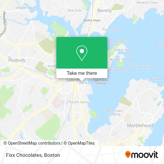
See Fixx Chocolates, Salem, on the map
Public Transit to Fixx Chocolates in Salem
Wondering how to get to Fixx Chocolates in Salem? Moovit helps you find the best way to get to Fixx Chocolates with step-by-step directions from the nearest public transit station.
Moovit provides free maps and live directions to help you navigate through your city. View schedules, routes, timetables, and find out how long does it take to get to Fixx Chocolates in real time.
Looking for the nearest stop or station to Fixx Chocolates? Check out this list of stops closest to your destination: Lafayette St @ Palmer St; Salem.
Bus: 435, 455, 450, 451, 456, NEWBURYPORT LINE SHUTTLE.Train: NEWBURYPORT/ROCKPORT.
Want to see if there’s another route that gets you there at an earlier time? Moovit helps you find alternative routes or times. Get directions from and directions to Fixx Chocolates easily from the Moovit App or Website.
We make riding to Fixx Chocolates easy, which is why over 1.7 million users, including users in Salem, trust Moovit as the best app for public transit. You don’t need to download an individual bus app or train app, Moovit is your all-in-one transit app that helps you find the best bus time or train time available.
For information on prices of bus and train, costs and ride fares to Fixx Chocolates, please check the Moovit app.
Use the app to navigate to popular places including to the airport, hospital, stadium, grocery store, mall, coffee shop, school, college, and university.
Fixx Chocolates Address: 285 Derby St street in Salem
- Casa Tequila Mexican Restaurant & Bar,
- Salem Witch Trials Memorial,
- Christopher J Patenaude,
- Charter Street Cemetery Welcome Center,
- Sage,
- Turtle Alley Chocolates,
- Sarai by Day Hair,
- Chris and Sons Painting & Carpentry,
- Edward Jones - Financial Advisor: Jake Runnals,
- Salem Water Taxi,
- Ragazza Hospitality Group,
- Keller Williams Realty Evolution,
- Cemetery of Salem Witch Trials,
- Century Bank Branches,
- Harley davidson,
- Drug Rehab Salem,
- City of Salem Arson Investigation,
- New York Fried Chicken,
- Couch Dog Brewing Company,
- Larry Leavitt Fitness and Self Defense
Places Near Fixx Chocolates (Salem)
- Wang Theater, Boston,
- Mgm Music Hall, Boston,
- Castle Island, Boston,
- Faneuil Hall, Boston,
- Massachusetts General Hospital, Boston,
- Td Garden, Boston,
- Cheers, Boston,
- Museum Of Science, Boston,
- Boston Common, Boston,
- Isabella Stewart Gardner Museum, Boston,
- Boston Children's Hospital, Boston,
- Leader Bank Pavilion (Leader Bank Pavillion), Boston,
- Boston Medical Center, Boston,
- North End, Boston,
- Wilbur Theatre, Boston,
- Prudential Center, Boston,
- House Of Blues, Boston,
- Boston Convention & Exhibition Center, Boston,
- Seaport District, Boston,
- Quincy Market, Boston
How to get to popular places in Boston with public transit
Get around Salem by public transit!
Traveling around Salem has never been so easy. See step by step directions as you travel to any attraction, street or major public transit station. View bus and train schedules, arrival times, service alerts and detailed routes on a map, so you know exactly how to get to anywhere in Salem.
When traveling to any destination around Salem use Moovit's Live Directions with Get Off Notifications to know exactly where and how far to walk, how long to wait for your line, and how many stops are left. Moovit will alert you when it's time to get off — no need to constantly re-check whether yours is the next stop.
Wondering how to use public transit in Salem or how to pay for public transit in Salem? Moovit public transit app can help you navigate your way with public transit easily, and at minimum cost. It includes public transit fees, ticket prices, and costs. Looking for a map of Salem public transit lines? Moovit public transit app shows all public transit maps in Salem with all Bus, Train, Subway and Ferry routes and stops on an interactive map.
Boston has 4 transit type(s), including: Bus, Train, Subway and Ferry, operated by several transit agencies, including MBTA, Southeastern Regional Transit Authority, MetroWest Regional Transit Authority, Rhode Island Public Transit Authority, WRTA, Lowell Regional Transit Authority, Merrimack Valley Transit, Montachusett Regional Transit Authority, Cape Cod Regional Transit Authority, Brockton Area Transit Authority, Martha's Vineyard Transit Authority, the WAVE - Nantucket Regional Transit Authority, GATRA, Cape Ann Transportation Authority and Massport