Directions to Fiya Chicken (Brookline) with public transportation
The following transit lines have routes that pass near Fiya Chicken
 Bus: 15, 57, 85, GREEN LINE B SHUTTLE, GREEN LINE B SHUTTLE.
- Train: FRAMINGHAM/WORCESTER.
- Subway: GREEN LINE B, GREEN LINE C.
How to get to Fiya Chicken by bus?
Click on the bus route to see step by step directions with maps, line arrival times and updated time schedules.
From Costco Wholesale, Everett
72 minFrom Newton-Wellesley Hospital, Newton
86 minFrom Lasell College, Newton
57 minFrom Freedom Trail, Boston
53 minFrom Malden Catholic High School, Malden
81 minFrom Omni Parker House, Boston
47 minFrom Best Western Adams Inn Quincy - Boston, Quincy
92 minFrom Boston Navy Yard, Boston
67 minFrom Marina Bay, Quincy
155 minFrom Silver Line Stop Terminal B, Boston
40 min
How to get to Fiya Chicken by train?
Click on the train route to see step by step directions with maps, line arrival times and updated time schedules.
How to get to Fiya Chicken by subway?
Click on the subway route to see step by step directions with maps, line arrival times and updated time schedules.
From Silver Line Stop Terminal B, Boston
63 minFrom Costco Wholesale, Everett
64 minFrom Newton-Wellesley Hospital, Newton
62 minFrom Lasell College, Newton
74 minFrom Freedom Trail, Boston
37 minFrom Omni Parker House, Boston
31 minFrom Best Western Adams Inn Quincy - Boston, Quincy
69 minFrom Boston Navy Yard, Boston
59 min
Bus stops near Fiya Chicken in Brookline
Subway stations near Fiya Chicken in Brookline
Bus lines to Fiya Chicken in Brookline
- 57, Kenmore - Watertown Yard,VIEW
- GREEN LINE B SHUTTLE, Boston College - Back Bay (Shuttle),VIEW
- GREEN LINE B SHUTTLE, Washington Street - Blandford Street,VIEW
- GREEN LINE B SHUTTLE, Boston College - Babcock Street,VIEW
- GREEN LINE B SHUTTLE, Babcock Street - Blandford Street,VIEW
- GREEN LINE B SHUTTLE, Babcock Street - Copley,VIEW
- GREEN LINE B SHUTTLE, Boston College - Blandford Street,VIEW
- GREEN LINE B SHUTTLE, Babcock Street - Kenmore,VIEW
- GREEN LINE B SHUTTLE, Washington Street - Kenmore,VIEW
- GREEN LINE B SHUTTLE, Babcock Street - Back Bay via Copley (Shuttle),VIEW
- GREEN LINE B SHUTTLE, Babcock Street - Back Bay,VIEW
- SHUTTLE, Boston College - Kenmore (Shuttle),VIEW
- GREEN LINE B SHUTTLE, Boston College (Shuttle),VIEW
- 1 BU (CHARLES RIVER-MEDICAL CAMPUS), Comm Ave @ Buick St,VIEW
- COMM AVE, Agganis Way,VIEW
What are the closest stations to Fiya Chicken?
The closest stations to Fiya Chicken are:
- Commonwealth Ave @ Babcock St is 65 yards away, 1 min walk.
- Packard's Corner is 292 yards away, 4 min walk.
- Comm Ave @ Amory St is 308 yards away, 4 min walk.
- Packards Corner is 386 yards away, 5 min walk.
- Saint Paul Street is 1267 yards away, 15 min walk.
Which bus lines stop near Fiya Chicken?
These bus lines stop near Fiya Chicken: 15, 57, 85.
Which train line stops near Fiya Chicken?
FRAMINGHAM/WORCESTER (#518 | South Station)
Which subway line stops near Fiya Chicken?
GREEN LINE B (Boston College)
What’s the nearest subway station to Fiya Chicken in Brookline?
The nearest subway station to Fiya Chicken in Brookline is Packards Corner. It’s a 5 min walk away.
What’s the nearest bus station to Fiya Chicken in Brookline?
The nearest bus station to Fiya Chicken in Brookline is Commonwealth Ave @ Babcock St. It’s a 1 min walk away.
What time is the first subway to Fiya Chicken in Brookline?
The GREEN LINE C is the first subway that goes to Fiya Chicken in Brookline. It stops nearby at 5:11 AM.
What time is the last subway to Fiya Chicken in Brookline?
The GREEN LINE B is the last subway that goes to Fiya Chicken in Brookline. It stops nearby at 2:24 AM.
What time is the first bus to Fiya Chicken in Brookline?
The 57 is the first bus that goes to Fiya Chicken in Brookline. It stops nearby at 4:41 AM.
What time is the last bus to Fiya Chicken in Brookline?
The 57 is the last bus that goes to Fiya Chicken in Brookline. It stops nearby at 2:18 AM.
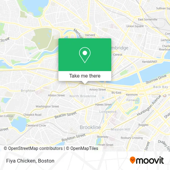
See Fiya Chicken, Brookline, on the map
Public Transit to Fiya Chicken in Brookline
Wondering how to get to Fiya Chicken in Brookline? Moovit helps you find the best way to get to Fiya Chicken with step-by-step directions from the nearest public transit station.
Moovit provides free maps and live directions to help you navigate through your city. View schedules, routes, timetables, and find out how long does it take to get to Fiya Chicken in real time.
Looking for the nearest stop or station to Fiya Chicken? Check out this list of stops closest to your destination: Commonwealth Ave @ Babcock St; Packard's Corner; Comm Ave @ Amory St; Packards Corner; Saint Paul Street.
Bus: 15, 57, 85, GREEN LINE B SHUTTLE, GREEN LINE B SHUTTLE, GREEN LINE B SHUTTLE, GREEN LINE B SHUTTLE, GREEN LINE B SHUTTLE, 1 BU (CHARLES RIVER-MEDICAL CAMPUS), COMM AVE.Train: FRAMINGHAM/WORCESTER.Subway: GREEN LINE B, GREEN LINE C.
Want to see if there’s another route that gets you there at an earlier time? Moovit helps you find alternative routes or times. Get directions from and directions to Fiya Chicken easily from the Moovit App or Website.
We make riding to Fiya Chicken easy, which is why over 1.7 million users, including users in Brookline, trust Moovit as the best app for public transit. You don’t need to download an individual bus app or train app, Moovit is your all-in-one transit app that helps you find the best bus time or train time available.
For information on prices of bus, subway and train, costs and ride fares to Fiya Chicken, please check the Moovit app.
Use the app to navigate to popular places including to the airport, hospital, stadium, grocery store, mall, coffee shop, school, college, and university.
Fiya Chicken Address: 1024 Commonwealth Ave street in Brookline
- MBTA Bus Route 57,
- Hri Hospital (Arbour Human Resource Institute Hospital),
- FILENE'S BASEMENT,
- Dollar Tree,
- Planned Parenthood,
- Planned Parenthood League Of Massachusetts,
- Planned Parenthood - Greater Boston Health Center,
- The Ring Boxing Club,
- Boston University Sleeper Hall (BU Sleeper),
- Gopchang Story Boston,
- Limered Teahouse,
- Sleeper Hall - Boston University,
- Paradise Rock Club & Lounge,
- Paradise Rock Club,
- The Goodwill Store (Allston / Brighton),
- Mtlc Music Software & Hardware,
- Goodwill Store,
- 967 Commonwealth Ave,
- Boston University West Campus Dining Hall,
- A+ Program
Places Near Fiya Chicken (Brookline)
- Boston Children's Hospital, Boston,
- Castle Island, Boston,
- House Of Blues, Boston,
- North End, Boston,
- Seaport District, Boston,
- Faneuil Hall, Boston,
- Leader Bank Pavilion (Leader Bank Pavillion), Boston,
- Wang Theater, Boston,
- Boston Convention & Exhibition Center, Boston,
- Boston Common, Boston,
- Massachusetts General Hospital, Boston,
- Boston Medical Center, Boston,
- Prudential Center, Boston,
- Cheers, Boston,
- Td Garden, Boston,
- Mgm Music Hall, Boston,
- Quincy Market, Boston,
- Wilbur Theatre, Boston,
- Museum Of Science, Boston,
- Isabella Stewart Gardner Museum, Boston
How to get to popular places in Boston with public transit
Get around Brookline by public transit!
Traveling around Brookline has never been so easy. See step by step directions as you travel to any attraction, street or major public transit station. View bus and train schedules, arrival times, service alerts and detailed routes on a map, so you know exactly how to get to anywhere in Brookline.
When traveling to any destination around Brookline use Moovit's Live Directions with Get Off Notifications to know exactly where and how far to walk, how long to wait for your line, and how many stops are left. Moovit will alert you when it's time to get off — no need to constantly re-check whether yours is the next stop.
Wondering how to use public transit in Brookline or how to pay for public transit in Brookline? Moovit public transit app can help you navigate your way with public transit easily, and at minimum cost. It includes public transit fees, ticket prices, and costs. Looking for a map of Brookline public transit lines? Moovit public transit app shows all public transit maps in Brookline with all Bus, Train, Subway and Ferry routes and stops on an interactive map.
Boston has 4 transit type(s), including: Bus, Train, Subway and Ferry, operated by several transit agencies, including MBTA, Southeastern Regional Transit Authority, MetroWest Regional Transit Authority, Rhode Island Public Transit Authority, WRTA, Lowell Regional Transit Authority, Merrimack Valley Transit, Montachusett Regional Transit Authority, Cape Cod Regional Transit Authority, Brockton Area Transit Authority, Martha's Vineyard Transit Authority, the WAVE - Nantucket Regional Transit Authority, GATRA, Cape Ann Transportation Authority and Massport