Directions to Flax Law (Dedham) with public transportation
The following transit lines have routes that pass near Flax Law
 Bus: 34E, 34, 35, 52.
- Train: PROVIDENCE/STOUGHTON, FOXBORO EVENT SERVICE, FRANKLIN/FOXBORO.
How to get to Flax Law by bus?
Click on the bus route to see step by step directions with maps, line arrival times and updated time schedules.
From Chestnut Hill, Boston
92 minFrom Jamaica Pond, Boston
45 minFrom Centre St, Boston
68 minFrom Brookline High School (Brookline Town High School), Brookline
70 minFrom Brighton, Boston
88 minFrom Codman Square, Boston
67 minFrom Mount Ida College, Newton
64 minFrom Jamaica Plain V.A., Boston
46 minFrom Homewood Suites by Hilton Boston Brookline-Longwood Medical, Brookline
58 minFrom Boston College (BC), Boston
101 min
How to get to Flax Law by train?
Click on the train route to see step by step directions with maps, line arrival times and updated time schedules.
Bus stops near Flax Law in Dedham
Train stations near Flax Law in Dedham
Bus lines to Flax Law in Dedham
What are the closest stations to Flax Law?
The closest stations to Flax Law are:
- Washington St @ High St is 344 yards away, 5 min walk.
- 272 Washington St is 726 yards away, 9 min walk.
- Washington St Opp Eastbrook Rd is 973 yards away, 12 min walk.
- Dedham Mall @ South Side is 1152 yards away, 14 min walk.
- Dedham Corporate Center is 1784 yards away, 21 min walk.
- Readville is 2952 yards away, 36 min walk.
Which bus line stops near Flax Law?
34E (Walpole Center Via Washington St)
Which train line stops near Flax Law?
PROVIDENCE/STOUGHTON (#827 | Wickford Junction)
What’s the nearest train station to Flax Law in Dedham?
The nearest train station to Flax Law in Dedham is Dedham Corporate Center. It’s a 21 min walk away.
What’s the nearest bus station to Flax Law in Dedham?
The nearest bus station to Flax Law in Dedham is Washington St @ High St. It’s a 5 min walk away.
What time is the first train to Flax Law in Dedham?
The PROVIDENCE/STOUGHTON is the first train that goes to Flax Law in Dedham. It stops nearby at 9:44 AM.
What time is the last train to Flax Law in Dedham?
The PROVIDENCE/STOUGHTON is the last train that goes to Flax Law in Dedham. It stops nearby at 12:15 AM.
What time is the first bus to Flax Law in Dedham?
The 34 is the first bus that goes to Flax Law in Dedham. It stops nearby at 4:44 AM.
What time is the last bus to Flax Law in Dedham?
The 34 is the last bus that goes to Flax Law in Dedham. It stops nearby at 1:32 AM.
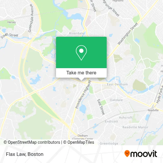
See Flax Law, Dedham, on the map
Public Transit to Flax Law in Dedham
Wondering how to get to Flax Law in Dedham? Moovit helps you find the best way to get to Flax Law with step-by-step directions from the nearest public transit station.
Moovit provides free maps and live directions to help you navigate through your city. View schedules, routes, timetables, and find out how long does it take to get to Flax Law in real time.
Looking for the nearest stop or station to Flax Law? Check out this list of stops closest to your destination: Washington St @ High St; 272 Washington St; Washington St Opp Eastbrook Rd; Dedham Mall @ South Side; Dedham Corporate Center; Readville.
Bus: 34E, 34, 35, 52.Train: PROVIDENCE/STOUGHTON, FOXBORO EVENT SERVICE, FRANKLIN/FOXBORO.
Want to see if there’s another route that gets you there at an earlier time? Moovit helps you find alternative routes or times. Get directions from and directions to Flax Law easily from the Moovit App or Website.
We make riding to Flax Law easy, which is why over 1.7 million users, including users in Dedham, trust Moovit as the best app for public transit. You don’t need to download an individual bus app or train app, Moovit is your all-in-one transit app that helps you find the best bus time or train time available.
For information on prices of bus, subway and train, costs and ride fares to Flax Law, please check the Moovit app.
Use the app to navigate to popular places including to the airport, hospital, stadium, grocery store, mall, coffee shop, school, college, and university.
Flax Law Address: 4 Kings Ct street in Dedham
- Lafountain & Wollman P.C.,
- Law Offices of Martin I. Flax,
- Purple Door Catering,
- Carol D Kimball Attorney at Law,
- Stil Studio,
- P.C. Hilane Jewelry,
- Msm Group,
- Dedham District Court,
- Terma Goods,
- Registry of Deeds,
- Acmeware,
- Humphrey H D Insurance Agency,
- A Murakami Saori MD,
- Cordaville Realty,
- Cuddy Michael F,
- Norfolk County Courthouse,
- 1800gotjunk,
- Weston & Sampson,
- Anthony S Travel Service,
- J Mac Builders
Places Near Flax Law (Dedham)
- Museum Of Science, Boston,
- Quincy Market, Boston,
- Wilbur Theatre, Boston,
- Wang Theater, Boston,
- Faneuil Hall, Boston,
- North End, Boston,
- House Of Blues, Boston,
- Boston Common, Boston,
- Seaport District, Boston,
- Prudential Center, Boston,
- Cheers, Boston,
- Boston Children's Hospital, Boston,
- Mgm Music Hall, Boston,
- Boston Medical Center, Boston,
- Castle Island, Boston,
- Isabella Stewart Gardner Museum, Boston,
- Boston Convention & Exhibition Center, Boston,
- Massachusetts General Hospital, Boston,
- Td Garden, Boston,
- Leader Bank Pavilion (Leader Bank Pavillion), Boston
How to get to popular places in Boston with public transit
Get around Dedham by public transit!
Traveling around Dedham has never been so easy. See step by step directions as you travel to any attraction, street or major public transit station. View bus and train schedules, arrival times, service alerts and detailed routes on a map, so you know exactly how to get to anywhere in Dedham.
When traveling to any destination around Dedham use Moovit's Live Directions with Get Off Notifications to know exactly where and how far to walk, how long to wait for your line, and how many stops are left. Moovit will alert you when it's time to get off — no need to constantly re-check whether yours is the next stop.
Wondering how to use public transit in Dedham or how to pay for public transit in Dedham? Moovit public transit app can help you navigate your way with public transit easily, and at minimum cost. It includes public transit fees, ticket prices, and costs. Looking for a map of Dedham public transit lines? Moovit public transit app shows all public transit maps in Dedham with all Bus, Train, Subway and Ferry routes and stops on an interactive map.
Boston has 4 transit type(s), including: Bus, Train, Subway and Ferry, operated by several transit agencies, including MBTA, Southeastern Regional Transit Authority, MetroWest Regional Transit Authority, Rhode Island Public Transit Authority, WRTA, Lowell Regional Transit Authority, Merrimack Valley Transit, Montachusett Regional Transit Authority, Cape Cod Regional Transit Authority, Brockton Area Transit Authority, Martha's Vineyard Transit Authority, the WAVE - Nantucket Regional Transit Authority, GATRA, Cape Ann Transportation Authority and Massport