See Fleetwood Station, Mount Vernon, Ny, on the map
Directions to Fleetwood Station (Mount Vernon, Ny) with public transportation
The following transit lines have routes that pass near Fleetwood Station
 Bus:
Bus: - Train:
- Subway:
How to get to Fleetwood Station by bus?
Click on the bus route to see step by step directions with maps, line arrival times and updated time schedules.
How to get to Fleetwood Station by train?
Click on the train route to see step by step directions with maps, line arrival times and updated time schedules.
How to get to Fleetwood Station by subway?
Click on the subway route to see step by step directions with maps, line arrival times and updated time schedules.
Train stations near Fleetwood Station in Mount Vernon, Ny
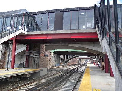
- Fleetwood ,4 min walk,
- Mount Vernon East ,28 min walk,
Bus stations near Fleetwood Station in Mount Vernon, Ny
- Bronxville Railroad Station West,26 min walk,
Bus lines to Fleetwood Station in Mount Vernon, Ny
- 26,The Bronx-Yonkers,
- 30,Yonkers - Bronxville - New Rochelle,
- 52,Mt Vernon - The Bronx - Bronxville,
What are the closest stations to Fleetwood Station?
The closest stations to Fleetwood Station are:
- Fleetwood is 297 yards away, 4 min walk.
- Bronxville Railroad Station West is 2153 yards away, 26 min walk.
- Mount Vernon East is 2380 yards away, 28 min walk.
Which bus lines stop near Fleetwood Station?
These bus lines stop near Fleetwood Station: 25, 52, 55.
Which train line stops near Fleetwood Station?
HARLEM
Which subway line stops near Fleetwood Station?
2
What’s the nearest train station to Fleetwood Station in Mount Vernon, Ny?
The nearest train station to Fleetwood Station in Mount Vernon, Ny is Fleetwood. It’s a 4 min walk away.
See Fleetwood Station, Mount Vernon, Ny, on the map
Public Transit to Fleetwood Station in Mount Vernon, Ny
Wondering how to get to Fleetwood Station in Mount Vernon, Ny, United States? Moovit helps you find the best way to get to Fleetwood Station with step-by-step directions from the nearest public transit station.
Moovit provides free maps and live directions to help you navigate through your city. View schedules, routes, timetables, and find out how long does it take to get to Fleetwood Station in real time.
Looking for the nearest stop or station to Fleetwood Station? Check out this list of stops closest to your destination: Fleetwood ; Bronxville Railroad Station West; Mount Vernon East .
Bus:Train:Subway:
Want to see if there’s another route that gets you there at an earlier time? Moovit helps you find alternative routes or times. Get directions from and directions to Fleetwood Station easily from the Moovit App or Website.
We make riding to Fleetwood Station easy, which is why over 1.5 million users, including users in Mount Vernon, Ny, trust Moovit as the best app for public transit. You don’t need to download an individual bus app or train app, Moovit is your all-in-one transit app that helps you find the best bus time or train time available.
For information on prices of bus, train and subway, costs and ride fares to Fleetwood Station, please check the Moovit app.
Use the app to navigate to popular places including to the airport, hospital, stadium, grocery store, mall, coffee shop, school, college, and university.
Location: Mount Vernon, Ny, New York - New Jersey
Attractions near Fleetwood Station
1 North MacQuesten Parkway,90,W Broad St W Broad St,Time Warner Cable,10 E 20 LLC,Qualitone Industries Inc,J & K Dry Cleaner,J & T Design Inc,A E M S Realty Corp,Mt Vernon Medical Care,Miro Art Interiors,Westchester Capoeira,689 Macquesten Pkwy N ,USA Locksmith,Cobra Locksmith & Key,Larue Locksmith,Terk Hearing & Air Ctr Inc,Locust Street Deli Inc,Locust St (locust broad),Locust Broad,Automec Locksmith CenterHow to get to popular attractions in Mount Vernon, Ny with public transit
Café Habana, Manhattan,Food Gallery 32, Manhattan,Top of The Standard, Manhattan,Brass Monkey, Manhattan,Ace Hotel Lobby Bar, Manhattan,Clinton St. Baking Co. & Restaurant, Manhattan,Gyu-Kaku Japanese BBQ, Manhattan,Woorijip, Manhattan,Grimaldi's Pizzeria,Jing Fong Restaurant 金豐大酒樓, Manhattan,Lombardi's Coal Oven Pizza, Manhattan,Ulysses Folk House, Manhattan,Sheep Meadow, Manhattan,MTA Subway - 42nd St / Bryant Park (B / D/F / M/7), Manhattan,The Dead Rabbit, Manhattan,The Meatball Shop,Mad Dog & Beans Mexican Cantina, Manhattan,Hair of the Dog, Manhattan,Wingate by Wyndham Manhattan Midtown, Manhattan,Great Lawn, ManhattanGet around Mount Vernon, Ny by public transit!
Traveling around Mount Vernon, Ny has never been so easy. See step by step directions as you travel to any attraction, street or major public transit station. View bus and train schedules, arrival times, service alerts and detailed routes on a map, so you know exactly how to get to anywhere in Mount Vernon, Ny.
When traveling to any destination around Mount Vernon, Ny use Moovit's Live Directions with Get Off Notifications to know exactly where and how far to walk, how long to wait for your line, and how many stops are left. Moovit will alert you when it's time to get off — no need to constantly re-check whether yours is the next stop.
Wondering how to use public transit in Mount Vernon, Ny or how to pay for public transit in Mount Vernon, Ny? Moovit public transit app can help you navigate your way with public transit easily, and at minimum cost. It includes public transit fees, ticket prices, and costs. Looking for a map of Mount Vernon, Ny public transit lines? Moovit public transit app shows all public transit maps in Mount Vernon, Ny with all bus, train or subway routes and stops on an interactive map.
Mount Vernon, Ny has 3 transit type(s), including: bus, train or subway, operated by several transit agencies, including MTA Subway, Metro-North Railroad, LIRR, PATH, Shore Line East, MTA Bus Company, MTA New York City Transit - Express routes, MTA Bus, NJ Transit, NYC Ferry, NICE bus, Bee-Line Bus, NJ Transit Rail, NJ Transit Rail and Norwalk Transit District