How to get to Flores Rodriguez Delcy Rosario by bus?
Click on the bus route to see step by step directions with maps, line arrival times and updated time schedules.
From Av El Derby 254 Santiago de Surco, Santiago D
44 minFrom Trocadero Club, Ventanilla
52 minFrom Puente Nuevo, El Agustin
35 minFrom ICPNA - Instituto Cultural Peruano Norteamericano, Santiago D
40 minFrom AV CAMINOS DEL INCA CUADRA 23 SURCO, Santiago D
46 minFrom av. fray bartolome de las casas, San Martin
39 minFrom Complejo Policial Cmdte. PNP Juan Benites Luna (Cuartel Los Cibeles del Rímac), Rimac
39 minFrom Parque Loma Amarilla - Surco, Santiago D
53 minFrom Estadio Miguel Grau, Ventanilla
33 minFrom Base Aérea Las Palmas, Santiago D
52 min
Bus stops near Flores Rodriguez Delcy Rosario in Magdalena
Bus lines to Flores Rodriguez Delcy Rosario in Magdalena
- 1010, Pte. Piedra - Magdalena - Pte. Piedra,VIEW
- 1012, Magdalena - Torreblanca (Carabayllo),VIEW
- 1024, Los Sauces - Cerro Candela,VIEW
- 1111, San Gabriel (Villa María Del Triunfo) - Universitaria (Lima),VIEW
- 1205, San Miguel - El Agustino,VIEW
- 1291, Ventanilla - Chorrillos,VIEW
- 1302, Minka (Callao) - Casablanca (San Juan De Lurigancho),VIEW
- 1475, La Paz (Callao) - Campoy (San Juan De Lurigancho),VIEW
- 1482, Chorrillos - S.M.P.,VIEW
- CR43, Ventanilla - Carabayllo,VIEW
- 404, Brasil (Magdalena Del Mar) - Wiesse (San Juan De Lurigancho),VIEW
- 1030, Canta Callao (San Martin De Porres) - San Diego (San Martin De Porres),VIEW
- 1065, Valdiviezo (Ate) - Ceres (Ate),VIEW
- 1084, Ceres (Ate) - La Campiña (Chorrillos),VIEW
- 1097, Av. Santa Rosa (San Juan De Lurigancho) - Las Palmas (Pachacamac) ,VIEW
- 1180, Pamplona Alta (San Juan De Miraflores) - Torre Blanca (Carabayllo),VIEW
- 1183, Carabayllo - Surco - Carabayllo,VIEW
- 1219, San Miguel - Ate,VIEW
- 1252, V.M.T. - San Miguel,VIEW
- 1269, Santa Rosa (Callao) - Las Gaviotas (Ate),VIEW
What are the closest stations to Flores Rodriguez Delcy Rosario?
The closest stations to Flores Rodriguez Delcy Rosario are:
- 28 De Julio is 21 meters away, 1 min walk.
- Javier Prado is 199 meters away, 3 min walk.
- Paradero 204 is 221 meters away, 3 min walk.
- Brasil is 288 meters away, 4 min walk.
- Daniel Alcides Carrión is 413 meters away, 6 min walk.
- Hospital Militar is 990 meters away, 13 min walk.
Which bus lines stop near Flores Rodriguez Delcy Rosario?
These bus lines stop near Flores Rodriguez Delcy Rosario: 1097, 1180, 1183, 1272, 1291, 1315, 204, OM19.
What’s the nearest bus station to Flores Rodriguez Delcy Rosario in Magdalena?
The nearest bus station to Flores Rodriguez Delcy Rosario in Magdalena is 28 De Julio. It’s a 1 min walk away.
What time is the first bus to Flores Rodriguez Delcy Rosario in Magdalena?
The 1180 is the first bus that goes to Flores Rodriguez Delcy Rosario in Magdalena. It stops nearby at 4:08 AM.
What time is the last bus to Flores Rodriguez Delcy Rosario in Magdalena?
The AED 02 is the last bus that goes to Flores Rodriguez Delcy Rosario in Magdalena. It stops nearby at 2:08 AM.
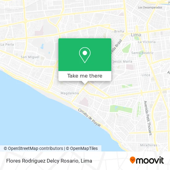
See Flores Rodriguez Delcy Rosario, Magdalena, on the map
Public Transit to Flores Rodriguez Delcy Rosario in Magdalena
Wondering how to get to Flores Rodriguez Delcy Rosario in Magdalena? Moovit helps you find the best way to get to Flores Rodriguez Delcy Rosario with step-by-step directions from the nearest public transit station.
Moovit provides free maps and live directions to help you navigate through your city. View schedules, routes, timetables, and find out how long does it take to get to Flores Rodriguez Delcy Rosario in real time.
Looking for the nearest stop or station to Flores Rodriguez Delcy Rosario? Check out this list of stops closest to your destination: 28 De Julio; Javier Prado; Paradero 204; Brasil; Daniel Alcides Carrión; Hospital Militar.
Bus: 1097, 1180, 1183, 1272, 1291, 1315, 204, OM19, 1010, 1012, 1024, 1111, 1205, 404, 1030, 1065, 1084, 1219 SX, 1182, 1293, 1473, 1163.
Want to see if there’s another route that gets you there at an earlier time? Moovit helps you find alternative routes or times. Get directions from and directions to Flores Rodriguez Delcy Rosario easily from the Moovit App or Website.
We make riding to Flores Rodriguez Delcy Rosario easy, which is why over 1.5 million users, including users in Magdalena, trust Moovit as the best app for public transit. You don’t need to download an individual bus app or train app, Moovit is your all-in-one transit app that helps you find the best bus time or train time available.
For information on prices of bus, costs and ride fares to Flores Rodriguez Delcy Rosario, please check the Moovit app.
Use the app to navigate to popular places including to the airport, hospital, stadium, grocery store, mall, coffee shop, school, college, and university.
Flores Rodriguez Delcy Rosario Address: Jirón 28 de Julio Oyague, 15086 Magdalena del Mar street in Magdalena
- Lizarzaburu Petrozzi Mitzi Geraldine,
- Avenida Brasil & Calle 28 de Julio,
- Correa Coz Oscar Lizardo,
- Av. Brasil cuadra 30,
- AV BRASIL 3068,
- Notaría Rocío Calmet,
- Avenida Brasil 3059,
- Av Brasil 2980,
- Banco de la Nación,
- Huamanga 165,
- Alcantara Rengifo Manuelaugusto,
- Av Brasil 3029 Magdalena del Mar,
- Av Brasil Cdra 30 a una cuadra y media de Javier Prado,
- Jr Huamanga 117,
- cuadra 29 de Avenida Brasil,
- Club de Ajedrez Magdalena,
- Condominio Bahia Del Sol Torre Flamengo,
- Don Italo,
- Innova Store,
- Av Brasil 2968 (1 Cdra Av La Marina)
Places Near Flores Rodriguez Delcy Rosario (Magdalena)
- Mall Del Sur,
- Av. Abancay, Lima,
- Parque Kennedy, Miraflores,
- Pontificia Universidad Católica del Perú - PUCP, San Miguel,
- av arequipa, Lima,
- Parque de las Leyendas, San Miguel,
- Plaza San Miguel, San Miguel,
- Real Plaza Puruchuco, Ate,
- Gamarra,
- Jockey Plaza, Santiago D,
- Av. Salaverry, Jesus Mari,
- Circuito Mágico Del Agua, Lima,
- Aeropuerto Internacional Jorge Chávez, Ventanilla,
- Av. La Marina, San Miguel,
- Barranco, Barranco,
- Miraflores, Miraflores,
- Larcomar, Miraflores,
- Paradero Av.Brasil,
- Centro Comercial Plaza Norte, Independen,
- Hospital Edgardo Rebagliati Martins, Jesus Mari
How to get to popular places in Lima with public transit
Get around Magdalena by public transit!
Traveling around Magdalena has never been so easy. See step by step directions as you travel to any attraction, street or major public transit station. View bus and train schedules, arrival times, service alerts and detailed routes on a map, so you know exactly how to get to anywhere in Magdalena.
When traveling to any destination around Magdalena use Moovit's Live Directions with Get Off Notifications to know exactly where and how far to walk, how long to wait for your line, and how many stops are left. Moovit will alert you when it's time to get off — no need to constantly re-check whether yours is the next stop.
Wondering how to use public transit in Magdalena or how to pay for public transit in Magdalena? Moovit public transit app can help you navigate your way with public transit easily, and at minimum cost. It includes public transit fees, ticket prices, and costs. Looking for a map of Magdalena public transit lines? Moovit public transit app shows all public transit maps in Magdalena with all Bus, Metro and Ferry routes and stops on an interactive map.
Lima has 3 transit type(s), including: Bus, Metro and Ferry, operated by several transit agencies, including Metro de Lima Línea 2 , Metro de Lima, Corredor Rojo, Metropolitano, Metropolitano - Alimentadores, Corredor Morado, Corredor Azul, Rutas Tradicionales, Transportes y Servicios La Esperanza S.A., Las Flores S.A., Virgen de la Asunción S.A., Consorcio HAM, Transportes y Service Canadá S.A., ETUL4SA and ETUCHISA