How to get to Innova Store by bus?
Click on the bus route to see step by step directions with maps, line arrival times and updated time schedules.
From Caminos del Inca Santiago de Surco, Santiago D
44 minFrom Hospital Nacional Daniel A. Carrión, Ventanilla
29 minFrom Base Aérea Las Palmas, Santiago D
51 minFrom Playa La Herradura, Chorrillos
60 minFrom Av Los Chancas de Andahuaylas 224 Santa Anita, Santa Anit
48 minFrom Estadio Alberto Gallardo, San Martin
25 minFrom Av El Polo Surco, Santiago D
53 minFrom Urb Mateo Pumacahua Santiago de Surco, Santiago D
53 minFrom VIDENA | Villa Deportiva Nacional · Puerta #.1, San Luis
35 minFrom Instituto Nacional De Ciencias Neurológicas (Ex Santo Toribio Mogrovejo), Lima
40 min
Bus stops near Innova Store in Magdalena
Bus lines to Innova Store in Magdalena
- 1024, Los Sauces - Cerro Candela,VIEW
- 1030, Canta Callao (San Martin De Porres) - San Diego (San Martin De Porres),VIEW
- 1065, Valdiviezo (Ate) - Ceres (Ate),VIEW
- 1084, Ceres (Ate) - La Campiña (Chorrillos),VIEW
- 1097, Av. Santa Rosa (San Juan De Lurigancho) - Las Palmas (Pachacamac) ,VIEW
- 1180, Pamplona Alta (San Juan De Miraflores) - Torre Blanca (Carabayllo),VIEW
- 1183, Carabayllo - Surco - Carabayllo,VIEW
- 1252, V.M.T. - San Miguel,VIEW
- 1269, Santa Rosa (Callao) - Las Gaviotas (Ate),VIEW
- 1462, Carabayllo - Universitaria - Brasil - Carabayllo,VIEW
- 404, Brasil (Magdalena Del Mar) - Wiesse (San Juan De Lurigancho),VIEW
- 1219, San Miguel - Ate,VIEW
- 1219 SX, Aeropuerto (Callao) - Galerías Brasil (Pueblo Libre),VIEW
- 204, Manchay (Pachacamac) - Faucett (San Miguel),VIEW
- 1182, San Juan de Miraflores - Carabayllo,VIEW
- 1272, Minka (Callao) - Santa Marta (Santa Anita),VIEW
- 1291, Ventanilla - Chorrillos,VIEW
- 1293, José Gálvez (Pachacamac) - Mi Perú (Ventanilla),VIEW
- 1315, Jose Galvez (Pachacamac) - Óvalo Centenario (Callao),VIEW
- 1473, S.J.L. - Magdalena,VIEW
What are the closest stations to Innova Store?
The closest stations to Innova Store are:
- Javier Prado is 22 meters away, 1 min walk.
- Brasil is 80 meters away, 2 min walk.
- Hospital Militar is 451 meters away, 6 min walk.
Which bus lines stop near Innova Store?
These bus lines stop near Innova Store: 1024, 1084, 1272, 1291, 1293, 1315, OM19.
What’s the nearest bus station to Innova Store in Magdalena?
The nearest bus station to Innova Store in Magdalena is Javier Prado. It’s a 1 min walk away.
What time is the first bus to Innova Store in Magdalena?
The 1180 is the first bus that goes to Innova Store in Magdalena. It stops nearby at 4:08 AM.
What time is the last bus to Innova Store in Magdalena?
The AED 02 is the last bus that goes to Innova Store in Magdalena. It stops nearby at 2:08 AM.
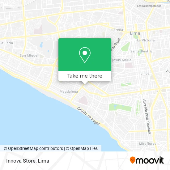
See Innova Store, Magdalena, on the map
Public Transit to Innova Store in Magdalena
Wondering how to get to Innova Store in Magdalena? Moovit helps you find the best way to get to Innova Store with step-by-step directions from the nearest public transit station.
Moovit provides free maps and live directions to help you navigate through your city. View schedules, routes, timetables, and find out how long does it take to get to Innova Store in real time.
Looking for the nearest stop or station to Innova Store? Check out this list of stops closest to your destination: Javier Prado; Brasil; Hospital Militar.
Bus: 1024, 1084, 1272, 1291, 1293, 1315, OM19, 1030, 1065, 1097, 404, 1219, 1219 SX, 204, 1182, 1163, IM47, 201, 206, 209.
Want to see if there’s another route that gets you there at an earlier time? Moovit helps you find alternative routes or times. Get directions from and directions to Innova Store easily from the Moovit App or Website.
We make riding to Innova Store easy, which is why over 1.5 million users, including users in Magdalena, trust Moovit as the best app for public transit. You don’t need to download an individual bus app or train app, Moovit is your all-in-one transit app that helps you find the best bus time or train time available.
For information on prices of bus, costs and ride fares to Innova Store, please check the Moovit app.
Use the app to navigate to popular places including to the airport, hospital, stadium, grocery store, mall, coffee shop, school, college, and university.
Innova Store Address: Jirón Larco Herrera 1353 Primavera, 15076 Magdalena del Mar street in Magdalena
- Jr Larco Herrera,
- Alcantara Rengifo Manuelaugusto,
- Av Brasil Cdra 30 a una cuadra y media de Javier Prado,
- Jr Larco Herrera 1368,
- Tomas Ramsey,
- Don Italo,
- Dentista-Zabalbeascoa Benavides Carlos,
- Nancy Lachy Perez,
- Clínica De Ojos Oprece,
- Av Brasil 3029 Magdalena del Mar,
- Avenida Brasil 3059,
- Avenida Brasil & Calle 28 de Julio,
- Gonzalez Falen Rory Alberto,
- Confecciones para Bebes y Niños-Children Planet Magdalena del Mar Lima,
- Ferias Agropecuarias Mistura,
- Banco de la Nación,
- cuadra 29 de Avenida Brasil,
- Flores Rodriguez Delcy Rosario,
- Instituto Superior Eurohispano,
- Lizarzaburu Petrozzi Mitzi Geraldine
Places Near Innova Store (Magdalena)
- Av. Salaverry, Jesus Mari,
- Aeropuerto Internacional Jorge Chávez, Ventanilla,
- Av. Abancay, Lima,
- Larcomar, Miraflores,
- Miraflores, Miraflores,
- Av. La Marina, San Miguel,
- Parque Kennedy, Miraflores,
- av arequipa, Lima,
- Gamarra,
- Hospital Edgardo Rebagliati Martins, Jesus Mari,
- Barranco, Barranco,
- Parque de las Leyendas, San Miguel,
- Mall Del Sur,
- Circuito Mágico Del Agua, Lima,
- Paradero Av.Brasil,
- Plaza San Miguel, San Miguel,
- Centro Comercial Plaza Norte, Independen,
- Pontificia Universidad Católica del Perú - PUCP, San Miguel,
- Jockey Plaza, Santiago D,
- Real Plaza Puruchuco, Ate
How to get to popular places in Lima with public transit
Get around Magdalena by public transit!
Traveling around Magdalena has never been so easy. See step by step directions as you travel to any attraction, street or major public transit station. View bus and train schedules, arrival times, service alerts and detailed routes on a map, so you know exactly how to get to anywhere in Magdalena.
When traveling to any destination around Magdalena use Moovit's Live Directions with Get Off Notifications to know exactly where and how far to walk, how long to wait for your line, and how many stops are left. Moovit will alert you when it's time to get off — no need to constantly re-check whether yours is the next stop.
Wondering how to use public transit in Magdalena or how to pay for public transit in Magdalena? Moovit public transit app can help you navigate your way with public transit easily, and at minimum cost. It includes public transit fees, ticket prices, and costs. Looking for a map of Magdalena public transit lines? Moovit public transit app shows all public transit maps in Magdalena with all Bus, Metro and Ferry routes and stops on an interactive map.
Lima has 3 transit type(s), including: Bus, Metro and Ferry, operated by several transit agencies, including Metro de Lima Línea 2 , Metro de Lima, Corredor Rojo, Metropolitano, Metropolitano - Alimentadores, Corredor Morado, Corredor Azul, Rutas Tradicionales, Transportes y Servicios La Esperanza S.A., Las Flores S.A., Virgen de la Asunción S.A., Consorcio HAM, Transportes y Service Canadá S.A., ETUL4SA and ETUCHISA