How to get to Florian by bus?
Click on the bus route to see step by step directions with maps, line arrival times and updated time schedules.
How to get to Florian by train?
Click on the train route to see step by step directions with maps, line arrival times and updated time schedules.
Bus stops near Florian in Fall River
- Bedford St And Eighth St, 1 min walk,VIEW
- Rodman St And S Main St, 3 min walk,VIEW
- Hartwell St And Brow St, 5 min walk,VIEW
- N Main St And Bank St, 6 min walk,VIEW
- Mechanics Cooperative Bank, 6 min walk,VIEW
- Transportation Center Fall River, 8 min walk,VIEW
- Pettine Transit Center (Fall River), 8 min walk,VIEW
Train station near Florian in Fall River
- Fall River Depot, 42 min walk,VIEW
Bus lines to Florian in Fall River
- 9, Fall River To New Bedford Express Via 195,VIEW
- 104, Robeson St Catholic Memorial,VIEW
- 108, Bcc & Durfee H.S.,VIEW
- 109, Bedford St,VIEW
- 199, Fall River To New Bedford Via Umass Dartmouth,VIEW
- 101, SRTA Fall River Terminal - Shove St and Broad St,VIEW
- 103, SRTA Fall River Terminal - Amity St and McMahon St,VIEW
- 107, Bay St Turn Around - SRTA Fall River Terminal,VIEW
- 105, Stafford Rd Via Southcoast Mkt Pl,VIEW
- 110, Terminal,VIEW
- 102, North Main St,VIEW
- 114, Fall River Terminal Via Route 6,VIEW
- PETER PAN, Providence (Bus Terminal) Ri,VIEW
- PETER PAN, Hyannis,VIEW
- 24L, Providence,VIEW
What are the closest stations to Florian?
The closest stations to Florian are:
- Bedford St And Eighth St is 59 yards away, 1 min walk.
- Rodman St And S Main St is 210 yards away, 3 min walk.
- Hartwell St And Brow St is 335 yards away, 5 min walk.
- N Main St And Bank St is 431 yards away, 6 min walk.
- Mechanics Cooperative Bank is 449 yards away, 6 min walk.
- Transportation Center Fall River is 583 yards away, 8 min walk.
- Pettine Transit Center (Fall River) is 592 yards away, 8 min walk.
- Fall River Depot is 3612 yards away, 42 min walk.
Which bus lines stop near Florian?
These bus lines stop near Florian: 102, 24L, 9, PETER PAN.
Which train line stops near Florian?
FALL RIVER/NEW BEDFORD (#1909 | Fall River)
What’s the nearest bus station to Florian in Fall River?
The nearest bus station to Florian in Fall River is Bedford St And Eighth St. It’s a 1 min walk away.
What time is the first train to Florian in Fall River?
The FALL RIVER/NEW BEDFORD is the first train that goes to Florian in Fall River. It stops nearby at 5:00 AM.
What time is the last train to Florian in Fall River?
The FALL RIVER/NEW BEDFORD is the last train that goes to Florian in Fall River. It stops nearby at 12:14 AM.
What time is the first bus to Florian in Fall River?
The 102 is the first bus that goes to Florian in Fall River. It stops nearby at 6:00 AM.
What time is the last bus to Florian in Fall River?
The 9 is the last bus that goes to Florian in Fall River. It stops nearby at 9:45 PM.
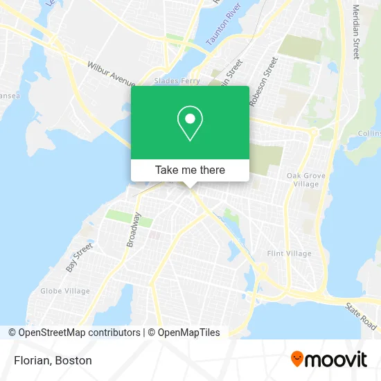
See Florian, Fall River, on the map
Public Transit to Florian in Fall River
Wondering how to get to Florian in Fall River? Moovit helps you find the best way to get to Florian with step-by-step directions from the nearest public transit station.
Moovit provides free maps and live directions to help you navigate through your city. View schedules, routes, timetables, and find out how long does it take to get to Florian in real time.
Looking for the nearest stop or station to Florian? Check out this list of stops closest to your destination: Bedford St And Eighth St; Rodman St And S Main St; Hartwell St And Brow St; N Main St And Bank St; Mechanics Cooperative Bank; Transportation Center Fall River; Pettine Transit Center (Fall River); Fall River Depot.
Bus: 102, 24L, 9, PETER PAN, 104, 108, 109, 199, 101, 103, 107, 105, 110, 114.Train: FALL RIVER/NEW BEDFORD.
Want to see if there’s another route that gets you there at an earlier time? Moovit helps you find alternative routes or times. Get directions from and directions to Florian easily from the Moovit App or Website.
We make riding to Florian easy, which is why over 1.7 million users, including users in Fall River, trust Moovit as the best app for public transit. You don’t need to download an individual bus app or train app, Moovit is your all-in-one transit app that helps you find the best bus time or train time available.
For information on prices of bus and train, costs and ride fares to Florian, please check the Moovit app.
Use the app to navigate to popular places including to the airport, hospital, stadium, grocery store, mall, coffee shop, school, college, and university.
Location: Fall River, Boston
- Cav Restaurant Fall River,
- St Luke's Hospital Outpatient,
- Entrance I-195 W,
- The Law Office of James M. Caramanica, P.C.,
- Deangelis Concrete,
- Fall River Downtown Farmers Market,
- A. J. Borden Building,
- Law Offices of Ronald J. Resmini,
- Greater Fall River Healthy Families,
- Pleasant View,
- D'Agostino Insurance,
- New England Title & Escrow Services,
- Standish Associates,
- Robin Durgin-King LSCSW,
- Plumbing Financing Plans Plumbers,
- Renaud Thomas W CPA PC,
- SPS New England,
- Sherrys Hair Obsession,
- Pamela Laliberte,
- Pop Culture - Cake Pops, Cookies and Other Confections
Places Near Florian (Fall River)
- Museum Of Science, Boston,
- House Of Blues, Boston,
- Cheers, Boston,
- Castle Island, Boston,
- Quincy Market, Boston,
- Boston Children's Hospital, Boston,
- Boston Convention & Exhibition Center, Boston,
- Boston Medical Center, Boston,
- Faneuil Hall, Boston,
- Isabella Stewart Gardner Museum, Boston,
- Boston Common, Boston,
- Massachusetts General Hospital, Boston,
- North End, Boston,
- Wilbur Theatre, Boston,
- Wang Theater, Boston,
- Seaport District, Boston,
- Prudential Center, Boston,
- Td Garden, Boston,
- Mgm Music Hall, Boston,
- Leader Bank Pavilion (Leader Bank Pavillion), Boston
How to get to popular places in Boston with public transit
Get around Fall River by public transit!
Traveling around Fall River has never been so easy. See step by step directions as you travel to any attraction, street or major public transit station. View bus and train schedules, arrival times, service alerts and detailed routes on a map, so you know exactly how to get to anywhere in Fall River.
When traveling to any destination around Fall River use Moovit's Live Directions with Get Off Notifications to know exactly where and how far to walk, how long to wait for your line, and how many stops are left. Moovit will alert you when it's time to get off — no need to constantly re-check whether yours is the next stop.
Wondering how to use public transit in Fall River or how to pay for public transit in Fall River? Moovit public transit app can help you navigate your way with public transit easily, and at minimum cost. It includes public transit fees, ticket prices, and costs. Looking for a map of Fall River public transit lines? Moovit public transit app shows all public transit maps in Fall River with all Bus, Train, Subway and Ferry routes and stops on an interactive map.
Boston has 4 transit type(s), including: Bus, Train, Subway and Ferry, operated by several transit agencies, including MBTA, Southeastern Regional Transit Authority, MetroWest Regional Transit Authority, Rhode Island Public Transit Authority, WRTA, Lowell Regional Transit Authority, Merrimack Valley Transit, Montachusett Regional Transit Authority, Cape Cod Regional Transit Authority, Brockton Area Transit Authority, Martha's Vineyard Transit Authority, the WAVE - Nantucket Regional Transit Authority, GATRA, Cape Ann Transportation Authority and Massport