Directions to Flowfactory (Boston) with public transportation
The following transit lines have routes that pass near Flowfactory
 Bus: 19, 23, 45, 14, 28.
- Train: FAIRMOUNT, FRANKLIN/FOXBORO, PROVIDENCE/STOUGHTON.
- Subway: ORANGE LINE, RED LINE.
How to get to Flowfactory by bus?
Click on the bus route to see step by step directions with maps, line arrival times and updated time schedules.
From Massachusetts Institute of Technology (MIT), Cambridge
46 minFrom South Boston Waterfront, Boston
54 minFrom Maverick Station, Boston
85 minFrom DoubleTree by Hilton Boston Logan Airport Chelsea, Chelsea
83 minFrom Homewood Suites by Hilton Boston Logan Airport Chelsea, Chelsea
84 minFrom FOUR POINTS BY SHERATON Boston Newton, Newton
62 minFrom Inman Square, Cambridge
74 minFrom Sommerville Theatre, Somerville
85 minFrom crown Colony Shuttle, Quincy
86 minFrom Massport Security Badge Office, Boston
51 min
How to get to Flowfactory by train?
Click on the train route to see step by step directions with maps, line arrival times and updated time schedules.
How to get to Flowfactory by subway?
Click on the subway route to see step by step directions with maps, line arrival times and updated time schedules.
From Massachusetts Institute of Technology (MIT), Cambridge
70 minFrom Massport Security Badge Office, Boston
61 minFrom South Boston Waterfront, Boston
66 minFrom Maverick Station, Boston
55 minFrom Inman Square, Cambridge
73 minFrom Sommerville Theatre, Somerville
67 minFrom crown Colony Shuttle, Quincy
78 min
Bus stops near Flowfactory in Boston
Train station near Flowfactory in Boston
- Four Corners/Geneva, 3 min walk,VIEW
Subway station near Flowfactory in Boston
- Jackson Square, 22 min walk,VIEW
Bus lines to Flowfactory in Boston
What are the closest stations to Flowfactory?
The closest stations to Flowfactory are:
- Blue Hill Ave @ Brunswick St is 67 yards away, 1 min walk.
- Four Corners/Geneva is 178 yards away, 3 min walk.
- Warren St @ Intervale St is 240 yards away, 3 min walk.
- Warren St @ Brunswick St is 267 yards away, 4 min walk.
- Jackson Square is 1801 yards away, 22 min walk.
Which bus lines stop near Flowfactory?
These bus lines stop near Flowfactory: 19, 23, 45.
Which train line stops near Flowfactory?
FAIRMOUNT (#1619 | Fairmount)
Which subway lines stop near Flowfactory?
These subway lines stop near Flowfactory: ORANGE LINE, RED LINE.
What’s the nearest subway station to Flowfactory in Boston?
The nearest subway station to Flowfactory in Boston is Jackson Square. It’s a 22 min walk away.
What’s the nearest train station to Flowfactory in Boston?
The nearest train station to Flowfactory in Boston is Four Corners/Geneva. It’s a 3 min walk away.
What’s the nearest bus station to Flowfactory in Boston?
The nearest bus station to Flowfactory in Boston is Blue Hill Ave @ Brunswick St. It’s a 1 min walk away.
What time is the first subway to Flowfactory in Boston?
The ORANGE LINE is the first subway that goes to Flowfactory in Boston. It stops nearby at 5:20 AM.
What time is the last subway to Flowfactory in Boston?
The ORANGE LINE is the last subway that goes to Flowfactory in Boston. It stops nearby at 1:52 AM.
What time is the first train to Flowfactory in Boston?
The FAIRMOUNT is the first train that goes to Flowfactory in Boston. It stops nearby at 4:47 AM.
What time is the last train to Flowfactory in Boston?
The FAIRMOUNT is the last train that goes to Flowfactory in Boston. It stops nearby at 12:00 AM.
What time is the first bus to Flowfactory in Boston?
The 28 is the first bus that goes to Flowfactory in Boston. It stops nearby at 3:17 AM.
What time is the last bus to Flowfactory in Boston?
The 23 is the last bus that goes to Flowfactory in Boston. It stops nearby at 2:33 AM.
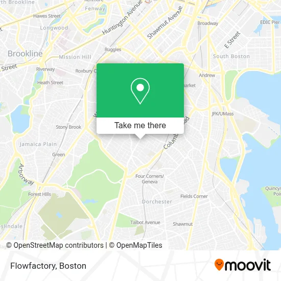
See Flowfactory, Boston, on the map
Public Transit to Flowfactory in Boston
Wondering how to get to Flowfactory in Boston? Moovit helps you find the best way to get to Flowfactory with step-by-step directions from the nearest public transit station.
Moovit provides free maps and live directions to help you navigate through your city. View schedules, routes, timetables, and find out how long does it take to get to Flowfactory in real time.
Looking for the nearest stop or station to Flowfactory? Check out this list of stops closest to your destination: Blue Hill Ave @ Brunswick St; Four Corners/Geneva; Warren St @ Intervale St; Warren St @ Brunswick St; Jackson Square.
Bus: 19, 23, 45, 14, 28, 10, 22.Train: FAIRMOUNT, FRANKLIN/FOXBORO, PROVIDENCE/STOUGHTON.Subway: ORANGE LINE, RED LINE.
Want to see if there’s another route that gets you there at an earlier time? Moovit helps you find alternative routes or times. Get directions from and directions to Flowfactory easily from the Moovit App or Website.
We make riding to Flowfactory easy, which is why over 1.7 million users, including users in Boston, trust Moovit as the best app for public transit. You don’t need to download an individual bus app or train app, Moovit is your all-in-one transit app that helps you find the best bus time or train time available.
For information on prices of bus, subway and train, costs and ride fares to Flowfactory, please check the Moovit app.
Use the app to navigate to popular places including to the airport, hospital, stadium, grocery store, mall, coffee shop, school, college, and university.
Flowfactory Address: 350 Blue Hill Ave street in Boston
- Gorgeous Lil Things,
- Future Chefs,
- Gentiles Record,
- Steven and Francines Locksmiths,
- Dorchester,
- Abcd,
- Commercial Property Management Company in Massachusetts,
- Online Roofing Contractors Boston,
- Charles Street Ame Church (The Historic Charles Street African Methodist Episcopal Church),
- Cac Mt. Joy Victory Center,
- Woods Real Estate,
- Pine Street Inn,
- Redefining Lighting,
- First Choice Market,
- Matrix Entertainment,
- Seven 86 Market,
- Blue Hill Ave & Georgia St,
- Zion Apostolic Church,
- Simpson Gumpertz,
- Redbox
Places Near Flowfactory (Boston)
- Prudential Center, Boston,
- Leader Bank Pavilion (Leader Bank Pavillion), Boston,
- Td Garden, Boston,
- Wang Theater, Boston,
- Massachusetts General Hospital, Boston,
- Isabella Stewart Gardner Museum, Boston,
- Museum Of Science, Boston,
- Boston Children's Hospital, Boston,
- Mgm Music Hall, Boston,
- Quincy Market, Boston,
- Wilbur Theatre, Boston,
- Boston Convention & Exhibition Center, Boston,
- North End, Boston,
- Cheers, Boston,
- Seaport District, Boston,
- Faneuil Hall, Boston,
- House Of Blues, Boston,
- Boston Medical Center, Boston,
- Boston Common, Boston,
- Castle Island, Boston
How to get to popular places in Boston with public transit
Get around Boston by public transit!
Traveling around Boston has never been so easy. See step by step directions as you travel to any attraction, street or major public transit station. View bus and train schedules, arrival times, service alerts and detailed routes on a map, so you know exactly how to get to anywhere in Boston.
When traveling to any destination around Boston use Moovit's Live Directions with Get Off Notifications to know exactly where and how far to walk, how long to wait for your line, and how many stops are left. Moovit will alert you when it's time to get off — no need to constantly re-check whether yours is the next stop.
Wondering how to use public transit in Boston or how to pay for public transit in Boston? Moovit public transit app can help you navigate your way with public transit easily, and at minimum cost. It includes public transit fees, ticket prices, and costs. Looking for a map of Boston public transit lines? Moovit public transit app shows all public transit maps in Boston with all Bus, Train, Subway and Ferry routes and stops on an interactive map.
Boston has 4 transit type(s), including: Bus, Train, Subway and Ferry, operated by several transit agencies, including MBTA, Southeastern Regional Transit Authority, MetroWest Regional Transit Authority, Rhode Island Public Transit Authority, WRTA, Lowell Regional Transit Authority, Merrimack Valley Transit, Montachusett Regional Transit Authority, Cape Cod Regional Transit Authority, Brockton Area Transit Authority, Martha's Vineyard Transit Authority, the WAVE - Nantucket Regional Transit Authority, GATRA, Cape Ann Transportation Authority and Massport