Directions to Fluidangle (Boston) with public transportation
The following transit lines have routes that pass near Fluidangle
 Bus: 1, 39, 43, BB, SL4.
- Train: FITCHBURG, FRAMINGHAM/WORCESTER, HAVERHILL, NEEDHAM, FOXBORO EVENT SERVICE.
- Subway: GREEN LINE E, ORANGE LINE, GREEN LINE B, GREEN LINE C, GREEN LINE D.
How to get to Fluidangle by bus?
Click on the bus route to see step by step directions with maps, line arrival times and updated time schedules.
From Skating Club Of Boston, Boston
44 minFrom Mount Auburn Hospital, Cambridge
45 minFrom Highland Ave Somerville MA, Somerville
57 minFrom Melrose Wakefield Hospital, Malden
116 minFrom Comfort Inn & Suites Logan International Airport, Revere
55 minFrom Arnold Arboretum, Boston
43 minFrom VA Hospital, Boston
58 minFrom West Roxbury VA Medical Center, Boston
59 minFrom Regent Theatre, Arlington
71 minFrom Malden, MA, Malden
76 min
How to get to Fluidangle by train?
Click on the train route to see step by step directions with maps, line arrival times and updated time schedules.
How to get to Fluidangle by subway?
Click on the subway route to see step by step directions with maps, line arrival times and updated time schedules.
From Malden, MA, Malden
43 minFrom Skating Club Of Boston, Boston
65 minFrom Mount Auburn Hospital, Cambridge
49 minFrom Highland Ave Somerville MA, Somerville
52 minFrom Melrose Wakefield Hospital, Malden
42 minFrom Comfort Inn & Suites Logan International Airport, Revere
53 minFrom Arnold Arboretum, Boston
37 min
Subway station near Fluidangle in Boston
- Copley, 1 min walk,VIEW
Bus stops near Fluidangle in Boston
Train station near Fluidangle in Boston
- Back Bay - South End, 5 min walk,VIEW
Bus lines to Fluidangle in Boston
- 43, Ruggles,VIEW
- 15, Ruggles - Fields Corner,VIEW
- SL4, South Station - Nubian,VIEW
- SL5, Downtown - Nubian,VIEW
- 10, Arlington Via South Bay Center,VIEW
- 1, Nubian,VIEW
- ORANGE LINE SHUTTLE, Ruggles - Copley,VIEW
- ORANGE LINE SHUTTLE, Forest Hills - Back Bay (Shuttle),VIEW
- ORANGE LINE SHUTTLE, Forest Hills - Copley,VIEW
- ORANGE LINE SHUTTLE, Forest Hills - Back Bay via Ruggles Busway (Shuttle),VIEW
- ORANGE LINE SHUTTLE, Ruggles - Back Bay,VIEW
- ORANGE LINE SHUTTLE, Jackson Square - Copley,VIEW
- ORANGE LINE SHUTTLE, Jackson Square - Back Bay,VIEW
- ORANGE LINE SHUTTLE, Forest Hills - Back Bay via Copley (Shuttle),VIEW
What are the closest stations to Fluidangle?
The closest stations to Fluidangle are:
- Copley is 11 yards away, 1 min walk.
- Tremont St @ Aguadilla St is 214 yards away, 3 min walk.
- Washington St @ W Newton St is 230 yards away, 3 min walk.
- 43 W Dedham St is 309 yards away, 4 min walk.
- Massachusetts Ave @ Tremont St is 317 yards away, 4 min walk.
- Massachusetts Ave Station - Shuttle is 354 yards away, 5 min walk.
- Back Bay - South End is 388 yards away, 5 min walk.
Which bus lines stop near Fluidangle?
These bus lines stop near Fluidangle: 1, 39, 43, BB, SL4, SL5.
Which train lines stop near Fluidangle?
These train lines stop near Fluidangle: FITCHBURG, FRAMINGHAM/WORCESTER, HAVERHILL, NEEDHAM.
Which subway lines stop near Fluidangle?
These subway lines stop near Fluidangle: GREEN LINE E, ORANGE LINE.
What’s the nearest subway station to Fluidangle in Boston?
The nearest subway station to Fluidangle in Boston is Copley. It’s a 1 min walk away.
What’s the nearest train station to Fluidangle in Boston?
The nearest train station to Fluidangle in Boston is Back Bay - South End. It’s a 5 min walk away.
What’s the nearest bus station to Fluidangle in Boston?
The nearest bus stations to Fluidangle in Boston are Tremont St @ Aguadilla St and Washington St @ W Newton St. The closest one is a 3 min walk away.
What time is the first subway to Fluidangle in Boston?
The GREEN LINE D is the first subway that goes to Fluidangle in Boston. It stops nearby at 5:05 AM.
What time is the last subway to Fluidangle in Boston?
The GREEN LINE D is the last subway that goes to Fluidangle in Boston. It stops nearby at 2:13 AM.
What time is the first train to Fluidangle in Boston?
The PROVIDENCE/STOUGHTON is the first train that goes to Fluidangle in Boston. It stops nearby at 4:25 AM.
What time is the last train to Fluidangle in Boston?
The LAKE SHORE LIMITED is the last train that goes to Fluidangle in Boston. It stops nearby at 8:26 PM.
What time is the first bus to Fluidangle in Boston?
The 1 is the first bus that goes to Fluidangle in Boston. It stops nearby at 4:45 AM.
What time is the last bus to Fluidangle in Boston?
The 1 is the last bus that goes to Fluidangle in Boston. It stops nearby at 2:36 AM.
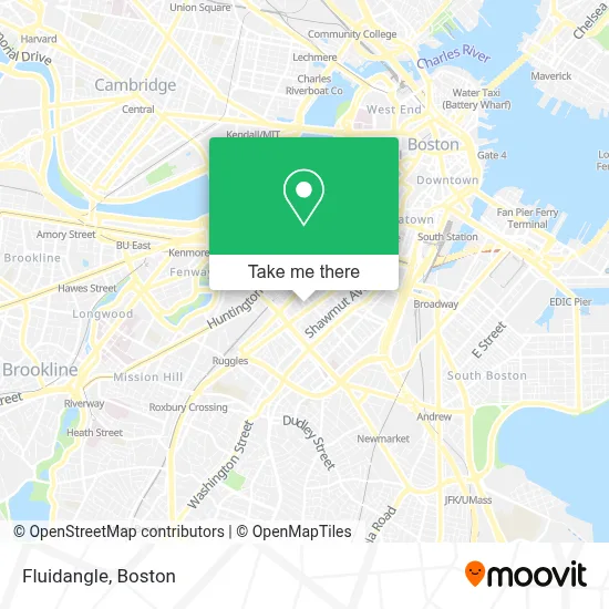
See Fluidangle, Boston, on the map
Public Transit to Fluidangle in Boston
Wondering how to get to Fluidangle in Boston? Moovit helps you find the best way to get to Fluidangle with step-by-step directions from the nearest public transit station.
Moovit provides free maps and live directions to help you navigate through your city. View schedules, routes, timetables, and find out how long does it take to get to Fluidangle in real time.
Looking for the nearest stop or station to Fluidangle? Check out this list of stops closest to your destination: Copley; Tremont St @ Aguadilla St; Washington St @ W Newton St; 43 W Dedham St; Massachusetts Ave @ Tremont St; Massachusetts Ave Station - Shuttle; Back Bay - South End.
Bus: 1, 39, 43, BB, SL4, SL5, 15, 10.Train: FITCHBURG, FRAMINGHAM/WORCESTER, HAVERHILL, NEEDHAM, FOXBORO EVENT SERVICE, FRANKLIN/FOXBORO, ORANGE LINE.Subway: GREEN LINE E, ORANGE LINE, GREEN LINE B, GREEN LINE C, GREEN LINE D.
Want to see if there’s another route that gets you there at an earlier time? Moovit helps you find alternative routes or times. Get directions from and directions to Fluidangle easily from the Moovit App or Website.
We make riding to Fluidangle easy, which is why over 1.7 million users, including users in Boston, trust Moovit as the best app for public transit. You don’t need to download an individual bus app or train app, Moovit is your all-in-one transit app that helps you find the best bus time or train time available.
For information on prices of bus, subway and train, costs and ride fares to Fluidangle, please check the Moovit app.
Use the app to navigate to popular places including to the airport, hospital, stadium, grocery store, mall, coffee shop, school, college, and university.
Fluidangle Address: 13 Rutland Sq street in Boston
- Encore,
- Tremont Street,
- Tremont St @ Worcester St (Tremont St @ W Springfield St),
- Jhcc,
- Heartbreak Hill Running Company,
- West Newton Apartments,
- 36 & 48 Rutland Street,
- Five Horses Tavern,
- Romper Room Childcare Center,
- GURL (Gay Urban Running League),
- Styles by Bianca B,
- Zaid al-Bender DDS,
- Benjamin Franklin Institute of Technology Polling Station,
- MetroPCS (Metro by T-Mobile),
- PLS Check Cashing Store,
- French Riviera,
- Whipped Urban Dessert Lab,
- The Mad Monkfish,
- SRV,
- Fanuel Hall, 2nd Fl
Places Near Fluidangle (Boston)
- Leader Bank Pavilion (Leader Bank Pavillion), Boston,
- Seaport District, Boston,
- North End, Boston,
- Mgm Music Hall, Boston,
- Isabella Stewart Gardner Museum, Boston,
- Boston Medical Center, Boston,
- Prudential Center, Boston,
- Museum Of Science, Boston,
- Castle Island, Boston,
- Boston Children's Hospital, Boston,
- Wilbur Theatre, Boston,
- Massachusetts General Hospital, Boston,
- Boston Convention & Exhibition Center, Boston,
- House Of Blues, Boston,
- Quincy Market, Boston,
- Cheers, Boston,
- Td Garden, Boston,
- Wang Theater, Boston,
- Boston Common, Boston,
- Faneuil Hall, Boston
How to get to popular places in Boston with public transit
Get around Boston by public transit!
Traveling around Boston has never been so easy. See step by step directions as you travel to any attraction, street or major public transit station. View bus and train schedules, arrival times, service alerts and detailed routes on a map, so you know exactly how to get to anywhere in Boston.
When traveling to any destination around Boston use Moovit's Live Directions with Get Off Notifications to know exactly where and how far to walk, how long to wait for your line, and how many stops are left. Moovit will alert you when it's time to get off — no need to constantly re-check whether yours is the next stop.
Wondering how to use public transit in Boston or how to pay for public transit in Boston? Moovit public transit app can help you navigate your way with public transit easily, and at minimum cost. It includes public transit fees, ticket prices, and costs. Looking for a map of Boston public transit lines? Moovit public transit app shows all public transit maps in Boston with all Bus, Train, Subway and Ferry routes and stops on an interactive map.
Boston has 4 transit type(s), including: Bus, Train, Subway and Ferry, operated by several transit agencies, including MBTA, Southeastern Regional Transit Authority, MetroWest Regional Transit Authority, Rhode Island Public Transit Authority, WRTA, Lowell Regional Transit Authority, Merrimack Valley Transit, Montachusett Regional Transit Authority, Cape Cod Regional Transit Authority, Brockton Area Transit Authority, Martha's Vineyard Transit Authority, the WAVE - Nantucket Regional Transit Authority, GATRA, Cape Ann Transportation Authority and Massport