Directions to Fly High Fitness by Benny Chadwick (Boston) with public transportation
The following transit lines have routes that pass near Fly High Fitness by Benny Chadwick
 Bus: 1, 57, 60, BB, 1 BU (CHARLES RIVER-MEDICAL CAMPUS).
- Train: FRAMINGHAM/WORCESTER, HAVERHILL, NEEDHAM, NEWBURYPORT/ROCKPORT.
- Subway: GREEN LINE B, GREEN LINE C, GREEN LINE D, GREEN LINE E.
How to get to Fly High Fitness by Benny Chadwick by bus?
Click on the bus route to see step by step directions with maps, line arrival times and updated time schedules.
From Homewood Suites by Hilton Boston Logan Airport Chelsea, Chelsea
80 minFrom Mount Ida College, Newton
78 minFrom West Roxbury, Boston
62 minFrom Qea, Quincy
107 minFrom Six Flags New England, Newton
56 minFrom The Mall At Chestnut Hill, Newton
58 minFrom Wollaston Beach, Quincy
120 minFrom FOUR POINTS BY SHERATON Boston Newton, Newton
47 minFrom Milton Academy, Milton
100 minFrom Melrose Wakefield Hospital, Malden
92 min
How to get to Fly High Fitness by Benny Chadwick by train?
Click on the train route to see step by step directions with maps, line arrival times and updated time schedules.
How to get to Fly High Fitness by Benny Chadwick by subway?
Click on the subway route to see step by step directions with maps, line arrival times and updated time schedules.
Bus stops near Fly High Fitness by Benny Chadwick in Boston
- Massachusetts Ave @ Beacon St, 1 min walk,VIEW
- Announcement #3 - Airport To Back Bay, 1 min walk,VIEW
- Danielsen Hall, 2 min walk,VIEW
- Ipswich St @ Boylston St, 3 min walk,VIEW
- Massachusetts Ave @ Newbury St, 5 min walk,VIEW
- Boylston St @ Massachusetts Ave, 5 min walk,VIEW
- Hynes Convention Center - Cambria St @ Boylston St, 5 min walk,VIEW
- Hynes - Commonwealth Ave @ Massachusetts Ave, 7 min walk,VIEW
- Hynes Convention Center - Commonwealth Ave @ Massachusetts Ave, 8 min walk,VIEW
Subway stations near Fly High Fitness by Benny Chadwick in Boston
Bus lines to Fly High Fitness by Benny Chadwick in Boston
- 1, Harvard,VIEW
- BB, Back Bay,VIEW
- 1 BU (CHARLES RIVER-MEDICAL CAMPUS), Comm Ave @ Buick St,VIEW
- 55, Arlington,VIEW
- GREEN LINE SHUTTLE, Park Street (Shuttle),VIEW
- 57, Watertown Via Kenmore,VIEW
- GREEN LINE B SHUTTLE, Back Bay (Shuttle),VIEW
- GREEN LINE C SHUTTLE, Saint Mary's Street (Shuttle),VIEW
- GREEN LINE B SHUTTLE, Babcock Street - Back Bay,VIEW
- GREEN LINE B SHUTTLE, Babcock Street - Copley,VIEW
- GREEN LINE B SHUTTLE, Boston College - Back Bay (Shuttle),VIEW
- GREEN LINE B SHUTTLE, Babcock Street - Back Bay via Copley (Shuttle),VIEW
- GREEN LINE B SHUTTLE, Kenmore - Back Bay via Copley (Shuttle),VIEW
- GREEN LINE D SHUTTLE, Brookline Hills - Back Bay (Shuttle),VIEW
- GREEN LINE SHUTTLE, Kenmore - Back Bay,VIEW
- GREEN LINE SHUTTLE, Kenmore (Shuttle),VIEW
What are the closest stations to Fly High Fitness by Benny Chadwick?
The closest stations to Fly High Fitness by Benny Chadwick are:
- Massachusetts Ave @ Beacon St is 37 yards away, 1 min walk.
- Announcement #3 - Airport To Back Bay is 50 yards away, 1 min walk.
- Danielsen Hall is 96 yards away, 2 min walk.
- Ipswich St @ Boylston St is 198 yards away, 3 min walk.
- Kenmore is 284 yards away, 4 min walk.
- Copley is 302 yards away, 4 min walk.
- Massachusetts Ave @ Newbury St is 379 yards away, 5 min walk.
- Boylston St @ Massachusetts Ave is 397 yards away, 5 min walk.
- Hynes Convention Center - Cambria St @ Boylston St is 402 yards away, 5 min walk.
- Hynes - Commonwealth Ave @ Massachusetts Ave is 558 yards away, 7 min walk.
- Hynes Convention Center - Commonwealth Ave @ Massachusetts Ave is 596 yards away, 8 min walk.
Which bus lines stop near Fly High Fitness by Benny Chadwick?
These bus lines stop near Fly High Fitness by Benny Chadwick: 1, 57, 60, BB.
Which train lines stop near Fly High Fitness by Benny Chadwick?
These train lines stop near Fly High Fitness by Benny Chadwick: FRAMINGHAM/WORCESTER, HAVERHILL, NEEDHAM, NEWBURYPORT/ROCKPORT.
Which subway lines stop near Fly High Fitness by Benny Chadwick?
These subway lines stop near Fly High Fitness by Benny Chadwick: GREEN LINE B, GREEN LINE C, GREEN LINE D.
What’s the nearest subway station to Fly High Fitness by Benny Chadwick in Boston?
The nearest subway stations to Fly High Fitness by Benny Chadwick in Boston are Kenmore and Copley. The closest one is a 4 min walk away.
What’s the nearest bus station to Fly High Fitness by Benny Chadwick in Boston?
The nearest bus stations to Fly High Fitness by Benny Chadwick in Boston are Massachusetts Ave @ Beacon St and Announcement #3 - Airport To Back Bay. The closest one is a 1 min walk away.
What time is the first subway to Fly High Fitness by Benny Chadwick in Boston?
The GREEN LINE D is the first subway that goes to Fly High Fitness by Benny Chadwick in Boston. It stops nearby at 5:00 AM.
What time is the last subway to Fly High Fitness by Benny Chadwick in Boston?
The GREEN LINE D is the last subway that goes to Fly High Fitness by Benny Chadwick in Boston. It stops nearby at 2:18 AM.
What time is the first bus to Fly High Fitness by Benny Chadwick in Boston?
The 1 is the first bus that goes to Fly High Fitness by Benny Chadwick in Boston. It stops nearby at 4:50 AM.
What time is the last bus to Fly High Fitness by Benny Chadwick in Boston?
The 1 is the last bus that goes to Fly High Fitness by Benny Chadwick in Boston. It stops nearby at 2:32 AM.
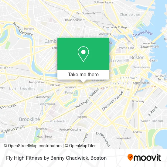
See Fly High Fitness by Benny Chadwick, Boston, on the map
Public Transit to Fly High Fitness by Benny Chadwick in Boston
Wondering how to get to Fly High Fitness by Benny Chadwick in Boston? Moovit helps you find the best way to get to Fly High Fitness by Benny Chadwick with step-by-step directions from the nearest public transit station.
Moovit provides free maps and live directions to help you navigate through your city. View schedules, routes, timetables, and find out how long does it take to get to Fly High Fitness by Benny Chadwick in real time.
Looking for the nearest stop or station to Fly High Fitness by Benny Chadwick? Check out this list of stops closest to your destination: Massachusetts Ave @ Beacon St; Announcement #3 - Airport To Back Bay; Danielsen Hall; Ipswich St @ Boylston St; Kenmore; Copley; Massachusetts Ave @ Newbury St; Boylston St @ Massachusetts Ave; Hynes Convention Center - Cambria St @ Boylston St; Hynes - Commonwealth Ave @ Massachusetts Ave; Hynes Convention Center - Commonwealth Ave @ Massachusetts Ave.
Bus: 1, 57, 60, BB, 1 BU (CHARLES RIVER-MEDICAL CAMPUS), 55.Train: FRAMINGHAM/WORCESTER, HAVERHILL, NEEDHAM, NEWBURYPORT/ROCKPORT.Subway: GREEN LINE B, GREEN LINE C, GREEN LINE D, GREEN LINE E.
Want to see if there’s another route that gets you there at an earlier time? Moovit helps you find alternative routes or times. Get directions from and directions to Fly High Fitness by Benny Chadwick easily from the Moovit App or Website.
We make riding to Fly High Fitness by Benny Chadwick easy, which is why over 1.7 million users, including users in Boston, trust Moovit as the best app for public transit. You don’t need to download an individual bus app or train app, Moovit is your all-in-one transit app that helps you find the best bus time or train time available.
For information on prices of bus, subway and train, costs and ride fares to Fly High Fitness by Benny Chadwick, please check the Moovit app.
Use the app to navigate to popular places including to the airport, hospital, stadium, grocery store, mall, coffee shop, school, college, and university.
Fly High Fitness by Benny Chadwick Address: 362 Commonwealth Ave street in Boston
- Wild Duck,
- DHL Express Servicepoint,
- Eliot Hotel,
- The Eliot Suite Hotel Boston,
- The Eliot Hotel,
- Talanian Design,
- Clio,
- Food for Thought Dining,
- Muji,
- Notary Active,
- Stemwave,
- Zelst,
- Rma Executive Search,
- Oxeia Biopharmaceuticals,
- Grace City Church,
- Sagefrog B2b Marketing Group,
- Bravesportzwear,
- Loc'd on the Vineyard,
- Copley Square Psychic,
- Veterinary CPA Accounting
Places Near Fly High Fitness by Benny Chadwick (Boston)
- Prudential Center, Boston,
- Mgm Music Hall, Boston,
- North End, Boston,
- Castle Island, Boston,
- Wang Theater, Boston,
- Boston Medical Center, Boston,
- Leader Bank Pavilion (Leader Bank Pavillion), Boston,
- House Of Blues, Boston,
- Cheers, Boston,
- Faneuil Hall, Boston,
- Museum Of Science, Boston,
- Quincy Market, Boston,
- Boston Children's Hospital, Boston,
- Massachusetts General Hospital, Boston,
- Td Garden, Boston,
- Boston Convention & Exhibition Center, Boston,
- Seaport District, Boston,
- Wilbur Theatre, Boston,
- Boston Common, Boston,
- Isabella Stewart Gardner Museum, Boston
How to get to popular places in Boston with public transit
Get around Boston by public transit!
Traveling around Boston has never been so easy. See step by step directions as you travel to any attraction, street or major public transit station. View bus and train schedules, arrival times, service alerts and detailed routes on a map, so you know exactly how to get to anywhere in Boston.
When traveling to any destination around Boston use Moovit's Live Directions with Get Off Notifications to know exactly where and how far to walk, how long to wait for your line, and how many stops are left. Moovit will alert you when it's time to get off — no need to constantly re-check whether yours is the next stop.
Wondering how to use public transit in Boston or how to pay for public transit in Boston? Moovit public transit app can help you navigate your way with public transit easily, and at minimum cost. It includes public transit fees, ticket prices, and costs. Looking for a map of Boston public transit lines? Moovit public transit app shows all public transit maps in Boston with all Bus, Train, Subway and Ferry routes and stops on an interactive map.
Boston has 4 transit type(s), including: Bus, Train, Subway and Ferry, operated by several transit agencies, including MBTA, Southeastern Regional Transit Authority, MetroWest Regional Transit Authority, Rhode Island Public Transit Authority, WRTA, Lowell Regional Transit Authority, Merrimack Valley Transit, Montachusett Regional Transit Authority, Cape Cod Regional Transit Authority, Brockton Area Transit Authority, Martha's Vineyard Transit Authority, the WAVE - Nantucket Regional Transit Authority, GATRA, Cape Ann Transportation Authority and Massport