Directions to Fly Parties (Boston) with public transportation
The following transit lines have routes that pass near Fly Parties
 Bus: 15, 16, 17, 19.
- Train: FAIRMOUNT, FRANKLIN/FOXBORO, PROVIDENCE/STOUGHTON.
- Subway: RED LINE.
How to get to Fly Parties by bus?
Click on the bus route to see step by step directions with maps, line arrival times and updated time schedules.
From The Institute Of Contemporary Art, Boston
66 minFrom Christian A Herter Park, Boston
81 minFrom Porter Square, Cambridge
90 minFrom Assembly Square Mall Shopping Center, Somerville
87 minFrom Quincy Market, Quincy
68 minFrom Central Square, Cambridge
47 minFrom Mount Auburn Hospital, Cambridge
81 minFrom Encore Boston Harbor, Everett
98 minFrom Newton, MA, Newton
70 minFrom Mount Auburn, Cambridge
77 min
How to get to Fly Parties by train?
Click on the train route to see step by step directions with maps, line arrival times and updated time schedules.
How to get to Fly Parties by subway?
Click on the subway route to see step by step directions with maps, line arrival times and updated time schedules.
From The Institute Of Contemporary Art, Boston
51 minFrom Porter Square, Cambridge
48 minFrom Assembly Square Mall Shopping Center, Somerville
56 minFrom Quincy Market, Quincy
44 minFrom Central Square, Cambridge
43 minFrom Mount Auburn Hospital, Cambridge
64 minFrom Encore Boston Harbor, Everett
69 minFrom Newton, MA, Newton
87 min
Bus stops near Fly Parties in Boston
Train stations near Fly Parties in Boston
- Four Corners/Geneva, 7 min walk,VIEW
Subway station near Fly Parties in Boston
- Shawmut, 14 min walk,VIEW
Bus lines to Fly Parties in Boston
What are the closest stations to Fly Parties?
The closest stations to Fly Parties are:
- Geneva Ave Opp Olney St is 267 yards away, 4 min walk.
- Bowdoin St @ Geneva Ave is 278 yards away, 4 min walk.
- Four Corners/Geneva is 563 yards away, 7 min walk.
- Columbia Rd @ Devon St is 638 yards away, 8 min walk.
- Shawmut is 1135 yards away, 14 min walk.
Which bus lines stop near Fly Parties?
These bus lines stop near Fly Parties: 15, 16, 17, 19.
Which train line stops near Fly Parties?
FAIRMOUNT (#1619 | Fairmount)
Which subway line stops near Fly Parties?
RED LINE (Ashmont/Braintree)
What’s the nearest subway station to Fly Parties in Boston?
The nearest subway station to Fly Parties in Boston is Shawmut. It’s a 14 min walk away.
What’s the nearest train station to Fly Parties in Boston?
The nearest train station to Fly Parties in Boston is Four Corners/Geneva. It’s a 7 min walk away.
What’s the nearest bus station to Fly Parties in Boston?
The nearest bus stations to Fly Parties in Boston are Geneva Ave Opp Olney St and Bowdoin St @ Geneva Ave. The closest one is a 4 min walk away.
What time is the first subway to Fly Parties in Boston?
The RED LINE is the first subway that goes to Fly Parties in Boston. It stops nearby at 5:16 AM.
What time is the last subway to Fly Parties in Boston?
The RED LINE is the last subway that goes to Fly Parties in Boston. It stops nearby at 2:03 AM.
What time is the first train to Fly Parties in Boston?
The FAIRMOUNT is the first train that goes to Fly Parties in Boston. It stops nearby at 4:41 AM.
What time is the last train to Fly Parties in Boston?
The FAIRMOUNT is the last train that goes to Fly Parties in Boston. It stops nearby at 12:00 AM.
What time is the first bus to Fly Parties in Boston?
The 15 is the first bus that goes to Fly Parties in Boston. It stops nearby at 3:31 AM.
What time is the last bus to Fly Parties in Boston?
The 16 is the last bus that goes to Fly Parties in Boston. It stops nearby at 1:44 AM.
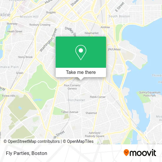
See Fly Parties, Boston, on the map
Public Transit to Fly Parties in Boston
Wondering how to get to Fly Parties in Boston? Moovit helps you find the best way to get to Fly Parties with step-by-step directions from the nearest public transit station.
Moovit provides free maps and live directions to help you navigate through your city. View schedules, routes, timetables, and find out how long does it take to get to Fly Parties in real time.
Looking for the nearest stop or station to Fly Parties? Check out this list of stops closest to your destination: Geneva Ave Opp Olney St; Bowdoin St @ Geneva Ave; Four Corners/Geneva; Columbia Rd @ Devon St; Shawmut.
Bus: 15, 16, 17, 19.Train: FAIRMOUNT, FRANKLIN/FOXBORO, PROVIDENCE/STOUGHTON.Subway: RED LINE.
Want to see if there’s another route that gets you there at an earlier time? Moovit helps you find alternative routes or times. Get directions from and directions to Fly Parties easily from the Moovit App or Website.
We make riding to Fly Parties easy, which is why over 1.7 million users, including users in Boston, trust Moovit as the best app for public transit. You don’t need to download an individual bus app or train app, Moovit is your all-in-one transit app that helps you find the best bus time or train time available.
For information on prices of bus, subway and train, costs and ride fares to Fly Parties, please check the Moovit app.
Use the app to navigate to popular places including to the airport, hospital, stadium, grocery store, mall, coffee shop, school, college, and university.
Location: Boston
- Susi M & Sons (Mario Susi & Son),
- Norton St,
- Bilh Pharmacy,
- Covid-19 Testing Site: Bowdoin Street Health Center,
- Adp Auto School ,
- Hawa's African Hair Braiding,
- Fresh Salon & Spa,
- Dollar Tree,
- Yawkey Center,
- Pete's Pizza and Seafood,
- Figueroa Mini Market,
- St Peter Parish (St Peter's Parish-Dorchester),
- Wings and Tingz Caters,
- Cohen Robt S Iwyr,
- The Guild,
- Bebe's African Hair Braiding Salon,
- China Kitchen,
- Kingdom Hall of Jehovah's Witnesses,
- Bf06 TRANSIT,
- Grove Hall
Places Near Fly Parties (Boston)
- Boston Medical Center, Boston,
- North End, Boston,
- Seaport District, Boston,
- House Of Blues, Boston,
- Cheers, Boston,
- Castle Island, Boston,
- Wang Theater, Boston,
- Isabella Stewart Gardner Museum, Boston,
- Quincy Market, Boston,
- Wilbur Theatre, Boston,
- Massachusetts General Hospital, Boston,
- Td Garden, Boston,
- Boston Children's Hospital, Boston,
- Leader Bank Pavilion (Leader Bank Pavillion), Boston,
- Faneuil Hall, Boston,
- Museum Of Science, Boston,
- Boston Convention & Exhibition Center, Boston,
- Boston Common, Boston,
- Prudential Center, Boston,
- Mgm Music Hall, Boston
How to get to popular places in Boston with public transit
Get around Boston by public transit!
Traveling around Boston has never been so easy. See step by step directions as you travel to any attraction, street or major public transit station. View bus and train schedules, arrival times, service alerts and detailed routes on a map, so you know exactly how to get to anywhere in Boston.
When traveling to any destination around Boston use Moovit's Live Directions with Get Off Notifications to know exactly where and how far to walk, how long to wait for your line, and how many stops are left. Moovit will alert you when it's time to get off — no need to constantly re-check whether yours is the next stop.
Wondering how to use public transit in Boston or how to pay for public transit in Boston? Moovit public transit app can help you navigate your way with public transit easily, and at minimum cost. It includes public transit fees, ticket prices, and costs. Looking for a map of Boston public transit lines? Moovit public transit app shows all public transit maps in Boston with all Bus, Train, Subway and Ferry routes and stops on an interactive map.
Boston has 4 transit type(s), including: Bus, Train, Subway and Ferry, operated by several transit agencies, including MBTA, Southeastern Regional Transit Authority, MetroWest Regional Transit Authority, Rhode Island Public Transit Authority, WRTA, Lowell Regional Transit Authority, Merrimack Valley Transit, Montachusett Regional Transit Authority, Cape Cod Regional Transit Authority, Brockton Area Transit Authority, Martha's Vineyard Transit Authority, the WAVE - Nantucket Regional Transit Authority, GATRA, Cape Ann Transportation Authority and Massport